Directions to Labelle Waste Systems (Haverhill) with public transportation
The following transit lines have routes that pass near Labelle Waste Systems
 Bus: 15.
- Train: HAVERHILL, DOWNEASTER.
How to get to Labelle Waste Systems by bus?
Click on the bus route to see step by step directions with maps, line arrival times and updated time schedules.
From Lawrence, Massachusetts, Lawrence
56 minFrom Phillips Academy Andover, Andover
105 minFrom Parque de las ardillas, Lawrence
54 minFrom Lawrence, MA, Lawrence
57 minFrom Andover, MA, Andover
99 minFrom Rockingham Mall Salem New Hampshire, Lawrence
57 minFrom QRD, Methuen Town
77 minFrom Methuen, Methuen Town
78 min
How to get to Labelle Waste Systems by train?
Click on the train route to see step by step directions with maps, line arrival times and updated time schedules.
Bus stop near Labelle Waste Systems in Haverhill
- Hilldale Avenue & Monument Street, 4 min walk,VIEW
Train stations near Labelle Waste Systems in Haverhill
- Haverhill, 6 min walk,VIEW
Bus lines to Labelle Waste Systems in Haverhill
- 15, Haverhill Commons,VIEW
What are the closest stations to Labelle Waste Systems?
The closest stations to Labelle Waste Systems are:
- Hilldale Avenue & Monument Street is 270 yards away, 4 min walk.
- Haverhill is 479 yards away, 6 min walk.
Which bus line stops near Labelle Waste Systems?
15 (Washington Square Transit Center)
Which train line stops near Labelle Waste Systems?
HAVERHILL (#223 | Haverhill)
What’s the nearest train station to Labelle Waste Systems in Haverhill?
The nearest train station to Labelle Waste Systems in Haverhill is Haverhill. It’s a 6 min walk away.
What’s the nearest bus station to Labelle Waste Systems in Haverhill?
The nearest bus station to Labelle Waste Systems in Haverhill is Hilldale Avenue & Monument Street. It’s a 4 min walk away.
What time is the first train to Labelle Waste Systems in Haverhill?
The HAVERHILL is the first train that goes to Labelle Waste Systems in Haverhill. It stops nearby at 5:27 AM.
What time is the last train to Labelle Waste Systems in Haverhill?
The HAVERHILL is the last train that goes to Labelle Waste Systems in Haverhill. It stops nearby at 12:53 AM.
What time is the first bus to Labelle Waste Systems in Haverhill?
The 15 is the first bus that goes to Labelle Waste Systems in Haverhill. It stops nearby at 5:50 AM.
What time is the last bus to Labelle Waste Systems in Haverhill?
The 15 is the last bus that goes to Labelle Waste Systems in Haverhill. It stops nearby at 7:02 PM.
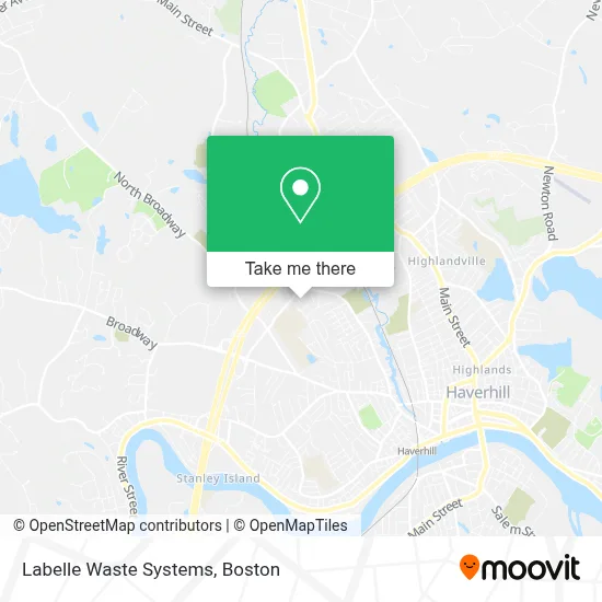
See Labelle Waste Systems, Haverhill, on the map
Public Transit to Labelle Waste Systems in Haverhill
Wondering how to get to Labelle Waste Systems in Haverhill? Moovit helps you find the best way to get to Labelle Waste Systems with step-by-step directions from the nearest public transit station.
Moovit provides free maps and live directions to help you navigate through your city. View schedules, routes, timetables, and find out how long does it take to get to Labelle Waste Systems in real time.
Looking for the nearest stop or station to Labelle Waste Systems? Check out this list of stops closest to your destination: Hilldale Avenue & Monument Street; Haverhill.
Bus: 15.Train: HAVERHILL, DOWNEASTER.
Want to see if there’s another route that gets you there at an earlier time? Moovit helps you find alternative routes or times. Get directions from and directions to Labelle Waste Systems easily from the Moovit App or Website.
We make riding to Labelle Waste Systems easy, which is why over 1.7 million users, including users in Haverhill, trust Moovit as the best app for public transit. You don’t need to download an individual bus app or train app, Moovit is your all-in-one transit app that helps you find the best bus time or train time available.
For information on prices of bus and train, costs and ride fares to Labelle Waste Systems, please check the Moovit app.
Use the app to navigate to popular places including to the airport, hospital, stadium, grocery store, mall, coffee shop, school, college, and university.
Labelle Waste Systems Address: 10 Boscawan Ave street in Haverhill
- Muscle Injuries & Overuse Physical Therapy,
- Solo Aquatics - Haverhill,
- Greater Lawrence Educational Collaborative,
- Stable Hands Therapeutic Massage,
- Haverhill Rehabilitation And Healthcare Center,
- Commonwealth Current North,
- Haverhill Bank,
- Trance Digital Marketing,
- Helen's Daycare,
- Prospect Cleaning Corporation,
- Haverhill City Cemetery,
- Diamond Auto Collision,
- Mrh Home Improvement,
- Shapex,
- Serenity Space,
- I-495 North Exit 51,
- Royale A Cabot Coach Builders Company,
- Capital One Atm,
- Cvs Pharmacy,
- Target
Places Near Labelle Waste Systems (Haverhill)
- Quincy Market, Boston,
- Museum Of Science, Boston,
- Cheers, Boston,
- North End, Boston,
- Castle Island, Boston,
- Seaport District, Boston,
- Wilbur Theatre, Boston,
- Td Garden, Boston,
- Mgm Music Hall, Boston,
- Isabella Stewart Gardner Museum, Boston,
- Boston Children's Hospital, Boston,
- Boston Medical Center, Boston,
- Wang Theater, Boston,
- House Of Blues, Boston,
- Prudential Center, Boston,
- Faneuil Hall, Boston,
- Leader Bank Pavilion (Leader Bank Pavillion), Boston,
- Boston Common, Boston,
- Massachusetts General Hospital, Boston,
- Boston Convention & Exhibition Center, Boston
How to get to popular places in Boston with public transit
Get around Haverhill by public transit!
Traveling around Haverhill has never been so easy. See step by step directions as you travel to any attraction, street or major public transit station. View bus and train schedules, arrival times, service alerts and detailed routes on a map, so you know exactly how to get to anywhere in Haverhill.
When traveling to any destination around Haverhill use Moovit's Live Directions with Get Off Notifications to know exactly where and how far to walk, how long to wait for your line, and how many stops are left. Moovit will alert you when it's time to get off — no need to constantly re-check whether yours is the next stop.
Wondering how to use public transit in Haverhill or how to pay for public transit in Haverhill? Moovit public transit app can help you navigate your way with public transit easily, and at minimum cost. It includes public transit fees, ticket prices, and costs. Looking for a map of Haverhill public transit lines? Moovit public transit app shows all public transit maps in Haverhill with all Bus, Train, Subway and Ferry routes and stops on an interactive map.
Boston has 4 transit type(s), including: Bus, Train, Subway and Ferry, operated by several transit agencies, including MBTA, Southeastern Regional Transit Authority, MetroWest Regional Transit Authority, Rhode Island Public Transit Authority, WRTA, Lowell Regional Transit Authority, Merrimack Valley Transit, Montachusett Regional Transit Authority, Cape Cod Regional Transit Authority, Brockton Area Transit Authority, Martha's Vineyard Transit Authority, the WAVE - Nantucket Regional Transit Authority, GATRA, Cape Ann Transportation Authority and Massport