See Labeuvrière on the map
Directions to Labeuvrière with public transportation
The following transit lines have routes that pass near Labeuvrière
 Bus:
Bus: - Train:
How to get to Labeuvrière by bus?
Click on the bus route to see step by step directions with maps, line arrival times and updated time schedules.
How to get to Labeuvrière by train?
Click on the train route to see step by step directions with maps, line arrival times and updated time schedules.
Bus stations near Labeuvrière
- Mairie,1 min walk,
- Salengro,5 min walk,
- Blum,5 min walk,
- Barriere,6 min walk,
- Cimetiere,9 min walk,
Train stations near Labeuvrière
- Fouquereuil,24 min walk,
- Vis À Marles,54 min walk,
Bus lines to Labeuvrière
- 20,Abreuvoir,
- 68,Mairie,
- 2501,Eglise,
- 2401,Ecole,
- 2402,Marles Les Mines-College Zola,
- 2502,Bethune/beuvry Etablissements Scolaires,
- 2500,Quinty,
What are the closest stations to Labeuvrière?
The closest stations to Labeuvrière are:
- Mairie is 36 meters away, 1 min walk.
- Salengro is 302 meters away, 5 min walk.
- Blum is 331 meters away, 5 min walk.
- Barriere is 420 meters away, 6 min walk.
- Cimetiere is 678 meters away, 9 min walk.
- Fouquereuil is 1826 meters away, 24 min walk.
- Vis À Marles is 4179 meters away, 54 min walk.
Which bus line stops near Labeuvrière?
B2
Which train line stops near Labeuvrière?
P52
What’s the nearest train station to Labeuvrière?
The nearest train station to Labeuvrière is Fouquereuil. It’s a 24 min walk away.
What’s the nearest bus stop to Labeuvrière?
The nearest bus stop to Labeuvrière is Mairie. It’s a 1 min walk away.
What time is the first train to Labeuvrière?
The K50 is the first train that goes to Labeuvrière. It stops nearby at 6:07 AM.
What time is the last train to Labeuvrière?
The K50 is the last train that goes to Labeuvrière. It stops nearby at 7:59 PM.
What time is the first bus to Labeuvrière?
The 2501 is the first bus that goes to Labeuvrière. It stops nearby at 7:15 AM.
What time is the last bus to Labeuvrière?
The 2502 is the last bus that goes to Labeuvrière. It stops nearby at 6:39 PM.
See Labeuvrière on the map
Public Transportation to Labeuvrière
Wondering how to get to Labeuvrière, France? Moovit helps you find the best way to get to Labeuvrière with step-by-step directions from the nearest public transit station.
Moovit provides free maps and live directions to help you navigate through your city. View schedules, routes, timetables, and find out how long does it take to get to Labeuvrière in real time.
Looking for the nearest stop or station to Labeuvrière? Check out this list of stops closest to your destination: Mairie; Salengro; Blum; Barriere; Cimetiere; Fouquereuil; Vis À Marles.
Bus:Train:
Want to see if there’s another route that gets you there at an earlier time? Moovit helps you find alternative routes or times. Get directions from and directions to Labeuvrière easily from the Moovit App or Website.
We make riding to Labeuvrière easy, which is why over 1.5 million users, including users in Lens, trust Moovit as the best app for public transit. You don’t need to download an individual bus app or train app, Moovit is your all-in-one transit app that helps you find the best bus time or train time available.
For information on prices of bus and train, costs and ride fares to Labeuvrière, please check the Moovit app.
Use the app to navigate to popular places including to the airport, hospital, stadium, grocery store, mall, coffee shop, school, college, and university.
Location: Lens
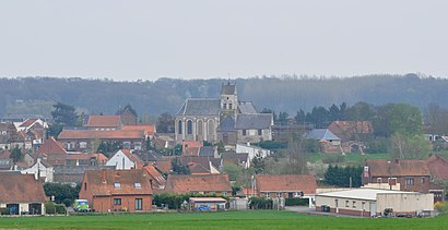
Labeuvrière (French pronunciation: [labœvʁijɛʁ]) is a commune in the Pas-de-Calais department in the Hauts-de-France region of France.Wiki
Popular routes to Labeuvrière
Popular routes from Labeuvrière
Attractions near Labeuvrière
Communaute d'Agglomeration de l'Artois Atelier de Maintenance,Amicale Laique,Labeuvrière,Vival,Capadora's,Salle Gaston Lecocq,Art Rénov,1,2,3 Autoservice,Auxil Services,Es Labeuvriere,Duquesne Geoffrey,Travaux Publics Location Canalisations,Rue Jules Ferry,Le Relax Lapugnoy,Randocar Maillet S.a.,Winsterstein Emmanuel,Ce Poney Club,Motrio,Isabelle Mess,CalinuitHow to get to popular attractions in Lens with public transit
Aldi, Calonne-Ricouart,Cinéville Henin Beaumont, Hénin-Beaumont,Parc D'Olhain, Maisnil-Lès-Ruitz,Decathlon, Hénin-Beaumont,Vimy, Vimy,Beuvry, Beuvry,Mission Locale Liévin, Liévin,Recup'Tri, Loison-Sous-Lens,Plateforme Multimodale Delta 3, Dourges,Faculté des Sciences Appliquées F.S.A, Béthune,Parc d'Olhain, Auchy-Les-Mines,Agence Voyages Baudart, Noyelles-Godault,Auchan, Noyelles-Godault,Castorama Hénin-Beaumont, Hénin-Beaumont,Les Jardins Du Louvre-Lens, Loos-En-Gohelle,Arena Stade Couvert De Liévin, Liévin,Centre Commercial E. Leclerc, Loison-Sous-Lens,Pharmacie Cora, Bruay-La-Buissière,Piscine De Harnes, Harnes,Ostricourt, OstricourtGet around Lens by public transit!
Traveling around Lens has never been so easy. See step by step directions as you travel to any attraction, street or major public transit station. View bus and train schedules, arrival times, service alerts and detailed routes on a map, so you know exactly how to get to anywhere in Lens.
When traveling to any destination around Lens use Moovit's Live Directions with Get Off Notifications to know exactly where and how far to walk, how long to wait for your line, and how many stops are left. Moovit will alert you when it's time to get off — no need to constantly re-check whether yours is the next stop.
Wondering how to use public transit in Lens or how to pay for public transit in Lens? Moovit public transit app can help you navigate your way with public transit easily, and at minimum cost. It includes public transit fees, ticket prices, and costs. Looking for a map of Lens public transit lines? Moovit public transit app shows all public transit maps in Lens with all bus or train routes and stops on an interactive map.
Lens has 2 transit type(s), including: bus or train, operated by several transit agencies, including Tadao, Tadao | Lignes Principales, Tadao | Navettes (Marchés / Centre-ville), Tadao | Lignes Bulles (BHNS) and SNCF VOYAGEURS