See Lachryma Montis, Sonoma, on the map
Directions to Lachryma Montis (Sonoma) with public transportation
The following transit lines have routes that pass near Lachryma Montis
 Bus:
Bus:
How to get to Lachryma Montis by bus?
Click on the bus route to see step by step directions with maps, line arrival times and updated time schedules.
Bus stations near Lachryma Montis in Sonoma
- Hwy. 12 & 3rd St. West,10 min walk,
Bus lines to Lachryma Montis in Sonoma
- 32,Sonoma Shuttle - North,
What are the closest stations to Lachryma Montis?
The closest stations to Lachryma Montis are:
- Hwy. 12 & 3rd St. West is 838 yards away, 10 min walk.
Which bus lines stop near Lachryma Montis?
These bus lines stop near Lachryma Montis: 30, 38, 40.
What’s the nearest bus stop to Lachryma Montis in Sonoma?
The nearest bus stop to Lachryma Montis in Sonoma is Hwy. 12 & 3rd St. West. It’s a 10 min walk away.
See Lachryma Montis, Sonoma, on the map
Public Transit to Lachryma Montis in Sonoma
Wondering how to get to Lachryma Montis in Sonoma, United States? Moovit helps you find the best way to get to Lachryma Montis with step-by-step directions from the nearest public transit station.
Moovit provides free maps and live directions to help you navigate through your city. View schedules, routes, timetables, and find out how long does it take to get to Lachryma Montis in real time.
Looking for the nearest stop or station to Lachryma Montis? Check out this list of stops closest to your destination: Hwy. 12 & 3rd St. West.
Bus:
Want to see if there’s another route that gets you there at an earlier time? Moovit helps you find alternative routes or times. Get directions from and directions to Lachryma Montis easily from the Moovit App or Website.
We make riding to Lachryma Montis easy, which is why over 1.5 million users, including users in Sonoma, trust Moovit as the best app for public transit. You don’t need to download an individual bus app or train app, Moovit is your all-in-one transit app that helps you find the best bus time or train time available.
For information on prices of bus, costs and ride fares to Lachryma Montis, please check the Moovit app.
Use the app to navigate to popular places including to the airport, hospital, stadium, grocery store, mall, coffee shop, school, college, and university.
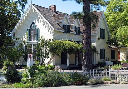
Lachryma Montis Address: Vallejo Home State Park street in Sonoma
Attractions near Lachryma Montis
General Vallejo's House,Vallejo Home State Historical Monument,Sonoma Bike Path,Sonoma State Historic Park,Sonoma State Historic Park,Peterson Field,Field Of Dreams/Jazz+,Field Of Dreams,Sonoma Ecology Center,Emergemcy Operations Center,Sonoma Valley Girls Softball Field of Dreams,Stone Field,City of Sonoma Police Department,Toscano Hotel,The Haven,Black Cat Caberet,Sonoma Dog Park,Sonoma Community Meeting Room,Montini Way,Annabelle's at Sonoma SquareHow to get to popular attractions in Sonoma with public transit
Safeway, Walnut Creek,Mountain View Caltrain Station,LinkedIn,Buena Vista Cafe, Russian Hill, Sf,Mountain View VTA Light Rail Station,I-80, Emeryville,Costco Wholesale, Antioch,Golden Gate Park, Golden Gate Park, Sf,The Castro, Castro/Upper Market,West Dublin / Pleasanton BART Station, Pleasanton,City of Dublin, Dublin,City of Pinole, Pinole,Genentech Inc, South San Francisco,Safeway Corporate Headquarters, Pleasanton,City of Cupertino, Cupertino,Sunnyvale, CA, Sunnyvale,Sonoma County Fairgrounds, Santa Rosa,Silicon Valley, Santa Clara,Westgate Shopping Center, San Jose,Concord BART Station, ConcordGet around Sonoma by public transit!
Traveling around Sonoma has never been so easy. See step by step directions as you travel to any attraction, street or major public transit station. View bus and train schedules, arrival times, service alerts and detailed routes on a map, so you know exactly how to get to anywhere in Sonoma.
When traveling to any destination around Sonoma use Moovit's Live Directions with Get Off Notifications to know exactly where and how far to walk, how long to wait for your line, and how many stops are left. Moovit will alert you when it's time to get off — no need to constantly re-check whether yours is the next stop.
Wondering how to use public transit in Sonoma or how to pay for public transit in Sonoma? Moovit public transit app can help you navigate your way with public transit easily, and at minimum cost. It includes public transit fees, ticket prices, and costs. Looking for a map of Sonoma public transit lines? Moovit public transit app shows all public transit maps in Sonoma with all bus routes and stops on an interactive map.
Sonoma has 1 transit type(s), including: bus, operated by several transit agencies, including BART, Bay Area Rapid Transit, Muni Metro, Caltrain, VTA, Capitol Corridor, Sonoma Marin Area Rail Transit, MUNI, VTA, SF Cable Car, AC Transit, Dumbarton Express, Golden Gate Transit, County Connection and SamTrans