See Lady Davis Institute for Medical Research, Montréal, on the map
Directions to Lady Davis Institute for Medical Research (Montréal) with public transportation
The following transit lines have routes that pass near Lady Davis Institute for Medical Research
 Bus:
Bus: - Metro:
How to get to Lady Davis Institute for Medical Research by bus?
Click on the bus route to see step by step directions with maps, line arrival times and updated time schedules.
How to get to Lady Davis Institute for Medical Research by metro?
Click on the metro route to see step by step directions with maps, line arrival times and updated time schedules.
Bus stations near Lady Davis Institute for Medical Research in Montréal
- Côte-Sainte-Catherine / Légaré,5 min walk,
- Van Horne / Lavoie,7 min walk,
- Côte-Des-Neiges / Côte-Sainte-Catherine,10 min walk,
Metro stations near Lady Davis Institute for Medical Research in Montréal
- Station Snowdon,8 min walk,
Bus lines to Lady Davis Institute for Medical Research in Montréal
- 129,Nord,
- 161,Est,
- 370,Ouest,
- 165,Nord,
- 369,Sud,
- 465,Nord,
What are the closest stations to Lady Davis Institute for Medical Research?
The closest stations to Lady Davis Institute for Medical Research are:
- Côte-Sainte-Catherine / Légaré is 330 meters away, 5 min walk.
- Van Horne / Lavoie is 476 meters away, 7 min walk.
- Station Snowdon is 559 meters away, 8 min walk.
- Côte-Des-Neiges / Côte-Sainte-Catherine is 752 meters away, 10 min walk.
Which bus lines stop near Lady Davis Institute for Medical Research?
These bus lines stop near Lady Davis Institute for Medical Research: 124, 129, 161, 165.
Which metro line stops near Lady Davis Institute for Medical Research?
LIGNE 2 - ORANGE
What’s the nearest metro station to Lady Davis Institute for Medical Research in Montréal?
The nearest metro station to Lady Davis Institute for Medical Research in Montréal is Station Snowdon. It’s a 8 min walk away.
What’s the nearest bus stop to Lady Davis Institute for Medical Research in Montréal?
The nearest bus stop to Lady Davis Institute for Medical Research in Montréal is Côte-Sainte-Catherine / Légaré. It’s a 5 min walk away.
What time is the first metro to Lady Davis Institute for Medical Research in Montréal?
The LIGNE 5 - BLEUE is the first metro that goes to Lady Davis Institute for Medical Research in Montréal. It stops nearby at 5:30 AM.
What time is the last metro to Lady Davis Institute for Medical Research in Montréal?
The LIGNE 2 - ORANGE is the last metro that goes to Lady Davis Institute for Medical Research in Montréal. It stops nearby at 1:16 AM.
What time is the first bus to Lady Davis Institute for Medical Research in Montréal?
The 370 is the first bus that goes to Lady Davis Institute for Medical Research in Montréal. It stops nearby at 3:04 AM.
What time is the last bus to Lady Davis Institute for Medical Research in Montréal?
The 370 is the last bus that goes to Lady Davis Institute for Medical Research in Montréal. It stops nearby at 3:06 AM.
How much is the metro fare to Lady Davis Institute for Medical Research?
The metro fare to Lady Davis Institute for Medical Research costs about $3.50.
How much is the bus fare to Lady Davis Institute for Medical Research?
The bus fare to Lady Davis Institute for Medical Research costs about $3.50.
See Lady Davis Institute for Medical Research, Montréal, on the map
Public Transit to Lady Davis Institute for Medical Research in Montréal
Wondering how to get to Lady Davis Institute for Medical Research in Montréal, Canada? Moovit helps you find the best way to get to Lady Davis Institute for Medical Research with step-by-step directions from the nearest public transit station.
Moovit provides free maps and live directions to help you navigate through your city. View schedules, routes, timetables, and find out how long does it take to get to Lady Davis Institute for Medical Research in real time.
Looking for the nearest stop or station to Lady Davis Institute for Medical Research? Check out this list of stops closest to your destination: Côte-Sainte-Catherine / Légaré; Van Horne / Lavoie; Station Snowdon; Côte-Des-Neiges / Côte-Sainte-Catherine.
Bus:Metro:
Want to see if there’s another route that gets you there at an earlier time? Moovit helps you find alternative routes or times. Get directions from and directions to Lady Davis Institute for Medical Research easily from the Moovit App or Website.
We make riding to Lady Davis Institute for Medical Research easy, which is why over 1.5 million users, including users in Montréal, trust Moovit as the best app for public transit. You don’t need to download an individual bus app or train app, Moovit is your all-in-one transit app that helps you find the best bus time or train time available.
For information on prices of metro and bus, costs and ride fares to Lady Davis Institute for Medical Research, please check the Moovit app.
Use the app to navigate to popular places including to the airport, hospital, stadium, grocery store, mall, coffee shop, school, college, and university.
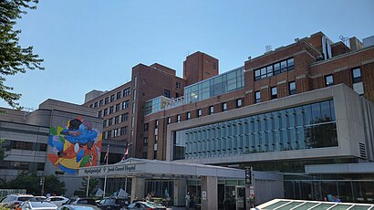
Lady Davis Institute for Medical Research Address: 3999 Chemin de la Cote-Ste-Catherine street in Montréal
Attractions near Lady Davis Institute for Medical Research
Hôpital Général Juif-Urgence,Coinamatic Canada,Sir Mortimer B. Davis Jewish General Hospital,Maido,5767 Rue Légaré,DLM,Pavillon E,Jewish General Hospital,Pavillon M,Rue Légaré,Hôpital Général Juif,Loop Dry,Saq23124 Edouard-Montp,Saint-Paul's Church,La Tour Vertu,Emarketfix,Pavillon G,Cercle De L'Amitié Ernest Avrith,Friendship Circle,Free Hebrew For JuniorsHow to get to popular attractions in Montréal with public transit
Apple Store, Montréal,Le Garde-Manger, Montréal,Secteur Fontainebleau, Blainville,STM Station Cartier,Métro Berri-Uqam, Montréal,Toi, Moi & Café, Montréal,Santos Tapas Bar, Montréal,Stereo Nightclub, Montréal,Beauharnois,Hampton Inn & Suites Montreal Dorval, Dorval,Collège Jean-De-Brébeuf, Montréal,Ye Olde Orchard Pub & Grill, Montréal,Carrefour Angrignon, Lasalle,STM Station Langelier, Montréal,Place Rosemère, Rosemère,Harvey's, Montréal,Avenue Monkland / Monkland Avenue, Montréal,Kanawake,Éts - Pavillon A, Montréal,Miami Deli, MontréalGet around Montréal by public transit!
Traveling around Montréal has never been so easy. See step by step directions as you travel to any attraction, street or major public transit station. View bus and train schedules, arrival times, service alerts and detailed routes on a map, so you know exactly how to get to anywhere in Montréal.
When traveling to any destination around Montréal use Moovit's Live Directions with Get Off Notifications to know exactly where and how far to walk, how long to wait for your line, and how many stops are left. Moovit will alert you when it's time to get off — no need to constantly re-check whether yours is the next stop.
Wondering how to use public transit in Montréal or how to pay for public transit in Montréal? Moovit public transit app can help you navigate your way with public transit easily, and at minimum cost. It includes public transit fees, ticket prices, and costs. Looking for a map of Montréal public transit lines? Moovit public transit app shows all public transit maps in Montréal with all metro or bus routes and stops on an interactive map.
Montréal has 2 transit type(s), including: metro or bus, operated by several transit agencies, including RTL, STM, STM, exo-Réseau de transport métropolitain, exo-Chambly-Richelieu-Carignan, exo-Haut-Saint-Laurent, exo-Laurentides, exo-La Presqu'île, CRT Lanaudière, exo-Le Richelain / Roussillon, exo-Sorel-Varennes, exo-Sud-Ouest, exo-Vallée du Richelieu, exo-L'Assomption and exo-Terrebonne-Mascouche