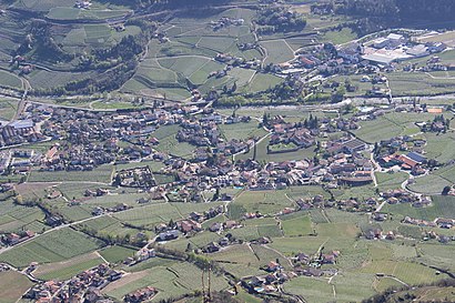
See Lagundo on the map
Directions to Lagundo with public transportation
The following transit lines have routes that pass near Lagundo
 Bus:
Bus: - Train:
How to get to Lagundo by bus?
Click on the bus route to see step by step directions with maps, line arrival times and updated time schedules.
How to get to Lagundo by train?
Click on the train route to see step by step directions with maps, line arrival times and updated time schedules.
Bus stations near Lagundo
- Lagundo, Stazione Di Lagundo/Algung Bahnhof,1 min walk,
- Lagundo C. Commerciale/Algung Einkaufszentrum,3 min walk,
- Centro Commerciale - Einkaufszentrum,3 min walk,
- Lagundo, Wiesenhof/Algund, Wiesenhof,3 min walk,
- - Wiesenhof,3 min walk,
Train stations near Lagundo
- Merano/Meran,23 min walk,
Bus lines to Lagundo
- 217,Foresta,
- 251,Stava Chiesa,
- 212 ME,Foresta - Forst,
- 213 ME,Parcheggio - Parkplatz,
- 235,Velloi,
- 237,Merano Terme,
- NIGHTS,Stazione Merano - Bhf Meran,
What are the closest stations to Lagundo?
The closest stations to Lagundo are:
- Lagundo, Stazione Di Lagundo/Algung Bahnhof is 21 meters away, 1 min walk.
- Lagundo C. Commerciale/Algung Einkaufszentrum is 154 meters away, 3 min walk.
- Centro Commerciale - Einkaufszentrum is 154 meters away, 3 min walk.
- Lagundo, Wiesenhof/Algund, Wiesenhof is 209 meters away, 3 min walk.
- - Wiesenhof is 209 meters away, 3 min walk.
- Merano/Meran is 1751 meters away, 23 min walk.
Which bus lines stop near Lagundo?
These bus lines stop near Lagundo: 212 ME, 213 ME, 217, 237.
Which train lines stop near Lagundo?
These train lines stop near Lagundo: 200, R.
What’s the nearest train station to Lagundo?
The nearest train station to Lagundo is Merano/Meran. It’s a 23 min walk away.
What’s the nearest bus stop to Lagundo?
The nearest bus stop to Lagundo is Lagundo, Stazione Di Lagundo/Algung Bahnhof. It’s a 1 min walk away.
What time is the first train to Lagundo?
The 200 is the first train that goes to Lagundo. It stops nearby at 6:00 AM.
What time is the last train to Lagundo?
The R is the last train that goes to Lagundo. It stops nearby at 10:44 PM.
What time is the first bus to Lagundo?
The 251 is the first bus that goes to Lagundo. It stops nearby at 5:32 AM.
What time is the last bus to Lagundo?
The 212 ME is the last bus that goes to Lagundo. It stops nearby at 9:22 PM.
See Lagundo on the map
Public Transportation to Lagundo
Wondering how to get to Lagundo, Italy? Moovit helps you find the best way to get to Lagundo with step-by-step directions from the nearest public transit station.
Moovit provides free maps and live directions to help you navigate through your city. View schedules, routes, timetables, and find out how long does it take to get to Lagundo in real time.
Looking for the nearest stop or station to Lagundo? Check out this list of stops closest to your destination: Lagundo, Stazione Di Lagundo/Algung Bahnhof; Lagundo C. Commerciale/Algung Einkaufszentrum; Centro Commerciale - Einkaufszentrum; Lagundo, Wiesenhof/Algund, Wiesenhof; - Wiesenhof; Merano/Meran.
Bus:Train:
Want to see if there’s another route that gets you there at an earlier time? Moovit helps you find alternative routes or times. Get directions from and directions to Lagundo easily from the Moovit App or Website.
We make riding to Lagundo easy, which is why over 1.5 million users, including users in Lagundo, trust Moovit as the best app for public transit. You don’t need to download an individual bus app or train app, Moovit is your all-in-one transit app that helps you find the best bus time or train time available.
For information on prices of bus and train, costs and ride fares to Lagundo, please check the Moovit app.
Use the app to navigate to popular places including to the airport, hospital, stadium, grocery store, mall, coffee shop, school, college, and university.
Lagundo Address: Bolzano, Trentino-Alto Adige street in Lagundo
Algund (German pronunciation: [alˈgʊnt]; Italian: Lagundo [laˈɡundo]) is a comune (municipality) in South Tyrol in northern Italy, located about 25 kilometres (16 mi) northwest of Bolzano.Wiki
Attractions near Lagundo
Rauch Juice Smoothie Bar,Loewen,Pizza Flash,Cava Enrico & Co,Iliad Corner,Maxi Mode Center,Poste Italiane,Giardineria Unterweger,Maxi Mode Center - Algo Center,Mpreis,Amadeus Trend Gmbh,Bluespirit,Algo Shopping Center,Grom,Terzer Tobacco e More,Volksbank,Teddy,Yamamay,Douglas 6180,Dogat LagundoHow to get to popular attractions in Lagundo with public transit
Cadino, Faedo,Bellamonte, Predazzo,Lagazuoi, Cortina D' Ampezzo,Stazione Merano Maia Bassa, Marlengo,Palazzo Fedrigotti, Rovereto,Piz Sorega, Badia,Castello di Arco, Arco,Cantine Ferrari, Trento,Malè, Malè,Sedico, Sedico,Carisolo, Carisolo,Tribunale Bolzano, Bolzano,L'Murin Apres Ski - Alta Badia Hotel La Perla, Corvara In Badia,S.Alessandro, Riva Del Garda,Piazza Di Centa, Trento,Lago di Auronzo di Cadore, Auronzo Di Cadore,Borca di Cadore, Borca Di Cadore,A22 - San Michele all'Adige, Mezzocorona,Venas Di Cadore, Valle Di Cadore,Mezzana, MezzanaGet around Lagundo by public transit!
Traveling around Lagundo has never been so easy. See step by step directions as you travel to any attraction, street or major public transit station. View bus and train schedules, arrival times, service alerts and detailed routes on a map, so you know exactly how to get to anywhere in Lagundo.
When traveling to any destination around Lagundo use Moovit's Live Directions with Get Off Notifications to know exactly where and how far to walk, how long to wait for your line, and how many stops are left. Moovit will alert you when it's time to get off — no need to constantly re-check whether yours is the next stop.
Wondering how to use public transit in Lagundo or how to pay for public transit in Lagundo? Moovit public transit app can help you navigate your way with public transit easily, and at minimum cost. It includes public transit fees, ticket prices, and costs. Looking for a map of Lagundo public transit lines? Moovit public transit app shows all public transit maps in Lagundo with all bus or train routes and stops on an interactive map.
Lagundo has 2 transit type(s), including: bus or train, operated by several transit agencies, including Trentino Trasporti (Urbano), Trentino Trasporti (Extraurbano), Trentino Trasporti, Dolomiti Bus S.p.A., SASA, Trenitalia, HOLZER BUS, AutoPostal, Paganella SkiArea, Simobil-Silbernagl, Servizi Turistici Alto Adige, TPL - FVG, Consorzio Altoadige Autonoleggiatori, Auto Rainer SRL and Servizi Turistici Alto Adige