How to get to Lakay Kreyol by bus?
Click on the bus route to see step by step directions with maps, line arrival times and updated time schedules.
From Staybridge Suites Boston-Quincy, Quincy
61 minFrom Academy Of the Pacific Rim Charter Public School, Boston
90 minFrom Lower Mills, Boston
24 minFrom Washington St, Boston
31 minFrom Granite Links Golf Club at Quarry Hills, Quincy
46 minFrom Best Western Adams Inn Quincy - Boston, Quincy
65 minFrom Brockton, MA, Brockton
37 minFrom Wollaston Beach, Quincy
102 minFrom Qea, Quincy
58 minFrom Quincy, MA, Quincy
49 min
Bus stop near Lakay Kreyol in Randolph
- N Main St @ Gordon St, 2 min walk,VIEW
What are the closest stations to Lakay Kreyol?
The closest stations to Lakay Kreyol are:
- N Main St @ Gordon St is 128 yards away, 2 min walk.
Which bus lines stop near Lakay Kreyol?
These bus lines stop near Lakay Kreyol: 12, 240.
What’s the nearest bus station to Lakay Kreyol in Randolph?
The nearest bus station to Lakay Kreyol in Randolph is N Main St @ Gordon St. It’s a 2 min walk away.
What time is the first bus to Lakay Kreyol in Randolph?
The 240 is the first bus that goes to Lakay Kreyol in Randolph. It stops nearby at 4:44 AM.
What time is the last bus to Lakay Kreyol in Randolph?
The 240 is the last bus that goes to Lakay Kreyol in Randolph. It stops nearby at 1:13 AM.
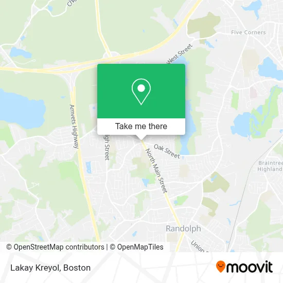
See Lakay Kreyol, Randolph, on the map
Public Transit to Lakay Kreyol in Randolph
Wondering how to get to Lakay Kreyol in Randolph? Moovit helps you find the best way to get to Lakay Kreyol with step-by-step directions from the nearest public transit station.
Moovit provides free maps and live directions to help you navigate through your city. View schedules, routes, timetables, and find out how long does it take to get to Lakay Kreyol in real time.
Looking for the nearest stop or station to Lakay Kreyol? Check out this list of stops closest to your destination: N Main St @ Gordon St.
Bus: 12, 240.
Want to see if there’s another route that gets you there at an earlier time? Moovit helps you find alternative routes or times. Get directions from and directions to Lakay Kreyol easily from the Moovit App or Website.
We make riding to Lakay Kreyol easy, which is why over 1.7 million users, including users in Randolph, trust Moovit as the best app for public transit. You don’t need to download an individual bus app or train app, Moovit is your all-in-one transit app that helps you find the best bus time or train time available.
For information on prices of bus and subway, costs and ride fares to Lakay Kreyol, please check the Moovit app.
Use the app to navigate to popular places including to the airport, hospital, stadium, grocery store, mall, coffee shop, school, college, and university.
Location: Randolph, Boston
- Randolph, Massachusetts,
- A&G Auto Care,
- Southern Baptist Convention,
- American Locksmith,
- GN Exteriors,
- Salon Bleu,
- Seven Star Car Services,
- Acupuncture Health for Life,
- Hai Lua Restaurant (Hai Lua Farmer Guy Supermarket),
- Hai Lua Farmer Guy Supermarket,
- Francis Crossing,
- North Randolph Fire Station,
- Boston Shufukai Kendo,
- Alexandra Beauty,
- US Gas,
- Delta Projects,
- Varzcare Clinic,
- Dr Olarewaju J Oladipo MD,
- Orchoville,
- Randolph Fleet Heating & Cooling Repair
Places Near Lakay Kreyol (Randolph)
- Wang Theater, Boston,
- Isabella Stewart Gardner Museum, Boston,
- Td Garden, Boston,
- Faneuil Hall, Boston,
- Seaport District, Boston,
- Boston Medical Center, Boston,
- North End, Boston,
- Wilbur Theatre, Boston,
- Mgm Music Hall, Boston,
- Castle Island, Boston,
- Quincy Market, Boston,
- Boston Children's Hospital, Boston,
- House Of Blues, Boston,
- Prudential Center, Boston,
- Boston Common, Boston,
- Boston Convention & Exhibition Center, Boston,
- Leader Bank Pavilion (Leader Bank Pavillion), Boston,
- Massachusetts General Hospital, Boston,
- Cheers, Boston,
- Museum Of Science, Boston
How to get to popular places in Boston with public transit
Get around Randolph by public transit!
Traveling around Randolph has never been so easy. See step by step directions as you travel to any attraction, street or major public transit station. View bus and train schedules, arrival times, service alerts and detailed routes on a map, so you know exactly how to get to anywhere in Randolph.
When traveling to any destination around Randolph use Moovit's Live Directions with Get Off Notifications to know exactly where and how far to walk, how long to wait for your line, and how many stops are left. Moovit will alert you when it's time to get off — no need to constantly re-check whether yours is the next stop.
Wondering how to use public transit in Randolph or how to pay for public transit in Randolph? Moovit public transit app can help you navigate your way with public transit easily, and at minimum cost. It includes public transit fees, ticket prices, and costs. Looking for a map of Randolph public transit lines? Moovit public transit app shows all public transit maps in Randolph with all Bus, Train, Subway and Ferry routes and stops on an interactive map.
Boston has 4 transit type(s), including: Bus, Train, Subway and Ferry, operated by several transit agencies, including MBTA, Southeastern Regional Transit Authority, MetroWest Regional Transit Authority, Rhode Island Public Transit Authority, WRTA, Lowell Regional Transit Authority, Merrimack Valley Transit, Montachusett Regional Transit Authority, Cape Cod Regional Transit Authority, Brockton Area Transit Authority, Martha's Vineyard Transit Authority, the WAVE - Nantucket Regional Transit Authority, GATRA, Cape Ann Transportation Authority and Massport