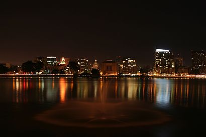
Directions to Lake Merritt (Oakland) with public transportation
The following transit lines have routes that pass near Lake Merritt
How to get to Lake Merritt by bus?
Click on the bus route to see step by step directions with maps, line arrival times and updated time schedules.
How to get to Lake Merritt by train?
Click on the train route to see step by step directions with maps, line arrival times and updated time schedules.
How to get to Lake Merritt by BART?
Click on the BART route to see step by step directions with maps, line arrival times and updated time schedules.
Bus stations near Lake Merritt in Oakland
- Lakeshore Av & Boden Way, 2 min walk,
- Macarthur Blvd & Van Buren Av, 5 min walk,
- Macarthur Blvd & Grand Av, 5 min walk,
- Grand Av & Macarthur Blvd, 5 min walk,
- Lake Park Av & Grand Av, 5 min walk,
- Lake Park Av & Lakeshore Av, 6 min walk,
Bart stations near Lake Merritt in Oakland
- Macarthur, 26 min walk,
- Lake Merritt, 42 min walk,
Train stations near Lake Merritt in Oakland
- Oakland Jack London Square, 60 min walk,
Bus lines to Lake Merritt in Oakland
- 29, Mandana Blvd. & Lakeshore Ave.,
- 57, Foothill Square,
- NX, Macarthur Blvd. & Millsbrae Ave.,
- 653, Montera Middle School,
- 657, Oakland Technical High School,
- 658, Macarthur Blvd. & Broadway,
- 12, Northwest Berkeley,
- 805, Oakland Airport,
- 688, Grand Lake District,
- NL, Eastmont Transit Center,
- 680, Bishop O'Dowd High School,
What are the closest stations to Lake Merritt?
The closest stations to Lake Merritt are:
- Lakeshore Av & Boden Way is 161 yards away, 2 min walk.
- Macarthur Blvd & Van Buren Av is 335 yards away, 5 min walk.
- Macarthur Blvd & Grand Av is 342 yards away, 5 min walk.
- Grand Av & Macarthur Blvd is 342 yards away, 5 min walk.
- Lake Park Av & Grand Av is 412 yards away, 5 min walk.
- Lake Park Av & Lakeshore Av is 464 yards away, 6 min walk.
- Macarthur is 2134 yards away, 26 min walk.
- Lake Merritt is 3512 yards away, 42 min walk.
- Oakland Jack London Square is 5028 yards away, 60 min walk.
Which bus lines stop near Lake Merritt?
These bus lines stop near Lake Merritt: 12, 57, NL.
Which train line stops near Lake Merritt?
CC
Which BART lines stop near Lake Merritt?
These BART lines stop near Lake Merritt: ORANGE, RED, YELLOW.
What’s the nearest BART station to Lake Merritt in Oakland?
The nearest BART station to Lake Merritt in Oakland is Macarthur. It’s a 26 min walk away.
What’s the nearest bus stop to Lake Merritt in Oakland?
The nearest bus stop to Lake Merritt in Oakland is Lakeshore Av & Boden Way. It’s a 2 min walk away.
What time is the first BART to Lake Merritt in Oakland?
The GREEN is the first BART that goes to Lake Merritt in Oakland. It stops nearby at 5:00 AM.
What time is the last BART to Lake Merritt in Oakland?
The ORANGE is the last BART that goes to Lake Merritt in Oakland. It stops nearby at 12:58 AM.
What time is the first train to Lake Merritt in Oakland?
The CC is the first train that goes to Lake Merritt in Oakland. It stops nearby at 5:42 AM.
What time is the last train to Lake Merritt in Oakland?
The COAST STARLIGHT is the last train that goes to Lake Merritt in Oakland. It stops nearby at 9:09 AM.
What time is the first bus to Lake Merritt in Oakland?
The 805 is the first bus that goes to Lake Merritt in Oakland. It stops nearby at 3:17 AM.
What time is the last bus to Lake Merritt in Oakland?
The AMTRAK THRUWAY CONNECTING SERVICE is the last bus that goes to Lake Merritt in Oakland. It stops nearby at 3:59 AM.
How much is the bus fare to Lake Merritt?
The bus fare to Lake Merritt costs about $1.80 - $6.40.
How much is the BART fare to Lake Merritt?
The BART fare to Lake Merritt costs about $2.15 - $8.65.
See Lake Merritt, Oakland, on the map
Public Transit to Lake Merritt in Oakland
Wondering how to get to Lake Merritt in Oakland, United States? Moovit helps you find the best way to get to Lake Merritt with step-by-step directions from the nearest public transit station.
Moovit provides free maps and live directions to help you navigate through your city. View schedules, routes, timetables, and find out how long does it take to get to Lake Merritt in real time.
Looking for the nearest stop or station to Lake Merritt? Check out this list of stops closest to your destination: Lakeshore Av & Boden Way; Macarthur Blvd & Van Buren Av; Macarthur Blvd & Grand Av; Grand Av & Macarthur Blvd; Lake Park Av & Grand Av; Lake Park Av & Lakeshore Av; Macarthur; Lake Merritt; Oakland Jack London Square.
Bus: 12, 57, NL, 29, 805.Train: CC, COAST STARLIGHT, SAN JOAQUINS.BART: ORANGE, RED, YELLOW, BLUE, GREEN.
Want to see if there’s another route that gets you there at an earlier time? Moovit helps you find alternative routes or times. Get directions from and directions to Lake Merritt easily from the Moovit App or Website.
We make riding to Lake Merritt easy, which is why over 1.5 million users, including users in Oakland, trust Moovit as the best app for public transit. You don’t need to download an individual bus app or train app, Moovit is your all-in-one transit app that helps you find the best bus time or train time available.
For information on prices of bus, BART and train, costs and ride fares to Lake Merritt, please check the Moovit app.
Get to Lake Merritt with public transit and pay for the ride in the Moovit app. In addition to all info you may need for your trip to Lake Merritt, including live directions, real-time arrivals and fare prices, you can also buy public transit passes for your rides. No need for cash or paper tickets to get to Lake Merritt - everything you need is accessible in the app with a click of the button.
Use the app to navigate to popular places including to the airport, hospital, stadium, grocery store, mall, coffee shop, school, college, and university.
Lake Merritt Address: 600 Grand Ave Oakland, CA 94610 street in Oakland
Attractions near Lake Merritt
Jason Rabineau, DC,Law Offices of Edward Casey Jr,Core Wellness Functional Medicine,UPS Access Point Location,Tuala Garcia-Zuazua, M.A.,Gold's Gym Oakland,Brighten, Jolene K,Urban Temple,Oakland Turkey Trot,Kuli Kuli,Jene Johnson,Miriam Drace,Kumespa,Cardea Services,Center of Joy,Crystal Crowley LMFT,Oral Health Solutions,The Working Body,Farmers Insurance - Susiani Tan,Sally BassHow to get to popular attractions in Oakland with public transit
Menlo Park Caltrain Station, Menlo Park,Costco Wholesale, Vallejo,ClubSport, Fremont,City of Fremont, Fremont,Apple Palo Alto, Palo Alto,Google - Quad Campus,San Ramon, San Ramon,City College Of San Francisco, San Francisco,Lagunitas Brewing Company, Petaluma,Netflix, Inc., Los Gatos,City of Pinole, Pinole,Googleplex - Charlie's Cafe,BJ's Restaurant and Brewhouse, Cupertino,Daly City BART, Daly City,De Anza College, Cupertino,City of Pleasanton, Pleasanton,Costco Gasoline, Sunnyvale,URL's Cafe at Yahoo!, Sunnyvale,440 Castro, Castro/Upper Market,Fentons Creamery & Restaurant, OaklandGet around San Francisco - San Jose, CA by public transit!
Traveling around San Francisco - San Jose, CA has never been so easy. See step by step directions as you travel to any attraction, street or major public transit station. View bus and train schedules, arrival times, service alerts and detailed routes on a map, so you know exactly how to get to anywhere in San Francisco - San Jose, CA.
When traveling to any destination around San Francisco - San Jose, CA use Moovit's Live Directions with Get Off Notifications to know exactly where and how far to walk, how long to wait for your line, and how many stops are left. Moovit will alert you when it's time to get off — no need to constantly re-check whether yours is the next stop.
Wondering how to use public transit in San Francisco - San Jose, CA or how to pay for public transit in San Francisco - San Jose, CA? Moovit public transit app can help you navigate your way with public transit easily, and at minimum cost. It includes public transit fees, ticket prices, and costs. Looking for a map of San Francisco - San Jose, CA public transit lines? Moovit public transit app shows all public transit maps in San Francisco - San Jose, CA with all Bus, Train, BART, Light Rail, Ferry and Cable Car routes and stops on an interactive map.
San Francisco - San Jose, CA has 6 transit type(s), including: Bus, Train, BART, Light Rail, Ferry and Cable Car, operated by several transit agencies, including BART, Bay Area Rapid Transit, Muni Metro, Caltrain, VTA, Capitol Corridor, Sonoma Marin Area Rail Transit, MUNI, SF Cable Car, AC Transit, Dumbarton Express, Golden Gate Transit, County Connection, SamTrans, SamTrans / City of Menlo Park