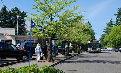
Directions to Lake Oswego Transit Center (Portland, OR) with public transportation
The following transit lines have routes that pass near Lake Oswego Transit Center
How to get to Lake Oswego Transit Center by bus?
Click on the bus route to see step by step directions with maps, line arrival times and updated time schedules.
Bus stations near Lake Oswego Transit Center in Portland, OR
- Lake Oswego Transit Center (South), 1 min walk,
Bus lines to Lake Oswego Transit Center in Portland, OR
- 35, Oregon City Transit Center (West),
- 37, Tualatin Park & Ride (North),
- 153, 8th Ave & 13th St (East),
- 78, Beaverton Transit Center (South),
What are the closest stations to Lake Oswego Transit Center?
The closest stations to Lake Oswego Transit Center are:
- Lake Oswego Transit Center (South) is 16 yards away, 1 min walk.
Which bus lines stop near Lake Oswego Transit Center?
These bus lines stop near Lake Oswego Transit Center: 35, 78.
What’s the nearest bus stop to Lake Oswego Transit Center in Portland, OR?
The nearest bus stop to Lake Oswego Transit Center in Portland, OR is Lake Oswego Transit Center (South). It’s a 1 min walk away.
See Lake Oswego Transit Center, Portland, OR, on the map
Public Transit to Lake Oswego Transit Center in Portland, OR
Wondering how to get to Lake Oswego Transit Center in Portland, OR, United States? Moovit helps you find the best way to get to Lake Oswego Transit Center with step-by-step directions from the nearest public transit station.
Moovit provides free maps and live directions to help you navigate through your city. View schedules, routes, timetables, and find out how long does it take to get to Lake Oswego Transit Center in real time.
Looking for the nearest stop or station to Lake Oswego Transit Center? Check out this list of stops closest to your destination: Lake Oswego Transit Center (South).
Bus: 35, 78, 37, 153.
Want to see if there’s another route that gets you there at an earlier time? Moovit helps you find alternative routes or times. Get directions from and directions to Lake Oswego Transit Center easily from the Moovit App or Website.
We make riding to Lake Oswego Transit Center easy, which is why over 1.5 million users, including users in Portland, OR, trust Moovit as the best app for public transit. You don’t need to download an individual bus app or train app, Moovit is your all-in-one transit app that helps you find the best bus time or train time available.
For information on prices of bus and light rail, costs and ride fares to Lake Oswego Transit Center, please check the Moovit app.
Use the app to navigate to popular places including to the airport, hospital, stadium, grocery store, mall, coffee shop, school, college, and university.
Location: Portland, OR
Attractions near Lake Oswego Transit Center
TriMet Lake Oswego Transit Center,Bus ID 8207,Lake Oswego TRANSIT Center,Safeway Pharmacy,Legacy Health - Lake Oswego,Bank Of America,Maher's,Maher's Pub,Ray's Factory Headlights,Safeway,401 A Avenue,Banner Bank,Lake Oswego,Zehtab Dental,Moore Tax Solutions,Lakin McCarthy Photography,Starbucks,Goodyear,Community Financial,Lake Oswego Fire Department Station 214How to get to popular attractions in Portland, OR with public transit
Moda Center, Portland,Paddy's Bar & Grill, Portland,TriMet SE Holgate Blvd MAX Station, Portland,The Alibi Restaurant & Lounge, Portland,NW Naito Parkway, Portland,Columbia Sportswear Trail's End Cafe,Kohl's Portland Gateway, Portland,Intel - RA3 Cafe, Hillsboro,PSU Urban Center, Portland,Bob's Red Mill Whole Grain Store, Milwaukie,C-TRAN 99th St Transit Center (Stop 110), Hazel Dell,Residence Inn Portland Airport at Cascade Station, Portland,Red Robin Gourmet Burgers, Beaverton,Nike - Pete Sampras Building, Beaverton,Fred Meyer Gas Station - Cornelius, Cornelius,TriMet Cascades MAX Station, Portland,Portland Marriott Downtown Waterfront, Portland,Washington Square Mall, Tigard,Hwy 99, Tigard,Mississippi Pizza Pub, PortlandGet around Portland, OR by public transit!
Traveling around Portland, OR has never been so easy. See step by step directions as you travel to any attraction, street or major public transit station. View bus and train schedules, arrival times, service alerts and detailed routes on a map, so you know exactly how to get to anywhere in Portland, OR.
When traveling to any destination around Portland, OR use Moovit's Live Directions with Get Off Notifications to know exactly where and how far to walk, how long to wait for your line, and how many stops are left. Moovit will alert you when it's time to get off — no need to constantly re-check whether yours is the next stop.
Wondering how to use public transit in Portland, OR or how to pay for public transit in Portland, OR? Moovit public transit app can help you navigate your way with public transit easily, and at minimum cost. It includes public transit fees, ticket prices, and costs. Looking for a map of Portland, OR public transit lines? Moovit public transit app shows all public transit maps in Portland, OR with all Bus, Train, Light Rail, Ferry, Streetcar and Gondola routes and stops on an interactive map.
Portland, OR has 6 transit type(s), including: Bus, Train, Light Rail, Ferry, Streetcar and Gondola, operated by several transit agencies, including Mount Adams Transportation Service, RiverCities Transit, TriMet , TriMet , TriMet, Portland Streetcar, Portland Aerial Tram, C-TRAN, Multnomah County Job Connector Shuttles, Washington Park Shuttle, SMART, Canby Area Transit, South Clackamas Transportation District, The Wave, Lincoln County Transit