Lampugnano M1 stop - Wednesday schedule
| Line | Direction | Time |
|---|---|---|
| Z301 | Lampugnano M1 | 05:23 |
| Z301 | Lampugnano M1 | 05:59 |
| Z301 | Lampugnano M1 | 06:30 |
| Z301 | Lampugnano M1 | 07:07 |
| Z301 | Lampugnano M1 | 07:41 |
| Z301 | Lampugnano M1 | 08:02 |
| Z301 | Lampugnano M1 | 08:28 |
| Z301 | Lampugnano M1 | 09:22 |
| Z301 | Lampugnano M1 | 13:53 |
| Z301 | Lampugnano M1 | 14:53 |
| Z301 | Lampugnano M1 | 15:53 |
| Z301 | Lampugnano M1 | 16:55 |
| Z301 | Lampugnano M1 | 17:27 |
| Z301 | Lampugnano M1 | 18:00 |
| Z301 | Lampugnano M1 | 18:30 |
| Z301 | Lampugnano M1 | 19:00 |
| Z301 | Lampugnano M1 | 19:29 |
Directions to Lampugnano M1 stop (Milano) with public transit
The following transit lines have routes that pass near Lampugnano M1
How to get to Lampugnano M1 stop by bus?
Click on the bus route to see step by step directions with maps, line arrival times and updated time schedules.
How to get to Lampugnano M1 stop by train?
Click on the train route to see step by step directions with maps, line arrival times and updated time schedules.
How to get to Lampugnano M1 stop by metro?
Click on the metro route to see step by step directions with maps, line arrival times and updated time schedules.
How to get to Lampugnano M1 stop by light rail?
Click on the light rail route to see step by step directions with maps, line arrival times and updated time schedules.
Bus stops near Lampugnano M1 stop in Milano
- Lampugnano M1, 2 min walk,
- Milano Lampugnano, (Stallo B5), 2 min walk,
- Milano - Autostazione Terminal Bus Di Lampugnano, 3 min walk,
- Via Terzaghi Via Sant'Elia, 8 min walk,
- Via Croce Via Sant'Elia, 8 min walk,
- Via Croce Via Uruguay, 9 min walk,
Metro stations near Lampugnano M1 station in Milano
- Lampugnano, 3 min walk,
Light Rail stations near Lampugnano M1 station in Milano
- V.le Certosa Via Tibullo, 18 min walk,
Bus lines to Lampugnano M1 stop in Milano
- Z301, Lampugnano M1,
- SAF, Verbania,
- 004, Torino - Autostazione Corso Bolzano,
- 903, Varallo - Stazione Ferroviaria,
- NM1, Lotto,
- 68, Via Bergognone,
- 560, Arese > L.go Boccioni,
- 40, Niguarda Parco Nord,
- 69, Molino Dorino M1 > S. Leonardo,
- Q68, Via Cechov,
What are the closest stations to Lampugnano M1?
The closest stations to Lampugnano M1 are:
- Lampugnano M1 is 88 meters away, 2 min walk.
- Milano Lampugnano, (Stallo B5) is 143 meters away, 2 min walk.
- Lampugnano is 157 meters away, 3 min walk.
- Milano - Autostazione Terminal Bus Di Lampugnano is 198 meters away, 3 min walk.
- Via Terzaghi Via Sant'Elia is 562 meters away, 8 min walk.
- Via Croce Via Sant'Elia is 580 meters away, 8 min walk.
- Via Croce Via Uruguay is 629 meters away, 9 min walk.
- V.le Certosa Via Tibullo is 1387 meters away, 18 min walk.
Which bus lines stop near Lampugnano M1?
These bus lines stop near Lampugnano M1: 68, 69, 78, Z301.
Which train lines stop near Lampugnano M1?
These train lines stop near Lampugnano M1: S5, S6.
Which metro line stops near Lampugnano M1?
M1 (Rho Fiera/Bisceglie)
Which light rail line stops near Lampugnano M1?
14 (Cim. Maggiore)
What’s the nearest light rail station to Lampugnano M1 in Milano?
The nearest light rail station to Lampugnano M1 in Milano is V.le Certosa Via Tibullo. It’s a 18 min walk away.
What’s the nearest metro station to Lampugnano M1 in Milano?
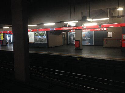
The nearest metro station to Lampugnano M1 in Milano is Lampugnano. It’s a 3 min walk away.
What’s the nearest bus stop to Lampugnano M1 in Milano?
The nearest bus stops to Lampugnano M1 in Milano are Lampugnano M1 and Milano Lampugnano, (Stallo B5). The closest one is a 2 min walk away.
What time is the first light rail to Lampugnano M1 in Milano?
The 14 is the first light rail that goes to Lampugnano M1 in Milano. It stops nearby at 5:41 AM.
What time is the last light rail to Lampugnano M1 in Milano?
The 14 is the last light rail that goes to Lampugnano M1 in Milano. It stops nearby at 2:04 AM.
What time is the first metro to Lampugnano M1 in Milano?
The M1 is the first metro that goes to Lampugnano M1 in Milano. It stops nearby at 5:44 AM.
What time is the last metro to Lampugnano M1 in Milano?
The M1 is the last metro that goes to Lampugnano M1 in Milano. It stops nearby at 12:48 AM.
What time is the first bus to Lampugnano M1 in Milano?
The NM1 is the first bus that goes to Lampugnano M1 in Milano. It stops nearby at 3:07 AM.
What time is the last bus to Lampugnano M1 in Milano?
The NM1 is the last bus that goes to Lampugnano M1 in Milano. It stops nearby at 3:26 AM.
See Lampugnano M1 stop, Milano, on the map
Public transit to Lampugnano M1 stop (ID: 19439) in Milano
Looking for directions to Lampugnano M1 in Milano, Italy?
Download the Moovit App to find the current schedule and step-by-step directions for Metro, Bus, Light Rail or Train routes that pass through Lampugnano M1.
Looking for the nearest stops closest to Lampugnano M1 ? Check out this list of closest stops to your destination: Lampugnano M1; Milano Lampugnano; Lampugnano; Milano - Autostazione Terminal Bus Di Lampugnano; Via Terzaghi Via Sant'Elia; Via Croce Via Sant'Elia; Via Croce Via Uruguay; V.le Certosa Via Tibullo.
Bus: 68, 69, 78, Z301, SAF, 004, 903, NM1, 560.Train: S5, S6.Metro: M1.Light Rail: 14.
We make riding on public transit to Lampugnano M1 easy, which is why over 1.5 million users, including users in Milano trust Moovit as the best app for public transit.
Use the app to navigate to popular places including to the airport, hospital, stadium, grocery store, mall, coffee shop, school, college, and university.
Lampugnano M1 stop’s code is 19439
The first line to this stop is Z301, at 05:23, and the last line is Z301 at 19:29.
11 Via Giulio Natta, Milano, Italy
This stop serves NET’s lines
Bus stops near Lampugnano M1 stop
Metro station near Lampugnano M1 station
Light Rail station near Lampugnano M1 station
Popular public transit stations in Milano
Get around Milano by public transit!
Traveling around Milano has never been so easy. See step by step directions as you travel to any attraction, street or major public transit station. View bus and train schedules, arrival times, service alerts and detailed routes on a map, so you know exactly how to get to anywhere in Milano.
When traveling to any destination around Milano use Moovit's Live Directions with Get Off Notifications to know exactly where and how far to walk, how long to wait for your line, and how many stops are left. Moovit will alert you when it's time to get off — no need to constantly re-check whether yours is the next stop.
Wondering how to use public transit in Milano or how to pay for public transit in Milano? Moovit public transit app can help you navigate your way with public transit easily, and at minimum cost. It includes public transit fees, ticket prices, and costs. Looking for a map of Milano public transit lines? Moovit public transit app shows all public transit maps in Milano with all Bus, Train, Metro, Light Rail, Ferry, Cable Car, Funicular and Gondola routes and stops on an interactive map.
Milan and Lombardy has 8 transit type(s), including: Bus, Train, Metro, Light Rail, Ferry, Cable Car, Funicular and Gondola, operated by several transit agencies, including ATM, Autoguidovie S.p.A., AirPullman, STAV, Autostradale S.r.l., Terravision, SAI, TiLo, Arriva Cremona, Trenord, Sun S.p.a., SAF Duemila, Arriva Bergamo, Linee Lecco and Trenitalia