How to get to Land Escapes by bus?
Click on the bus route to see step by step directions with maps, line arrival times and updated time schedules.
From Six Flags New England, Newton
85 minFrom Lechmere Station, Cambridge
46 minFrom Mass Eye And Ear, Boston
51 minFrom Melrose Wakefield Hospital, Malden
93 minFrom Brookline, MA, Brookline
71 minFrom The Castle, Boston
69 minFrom Sanofi-aventis, Cambridge
58 minFrom AC Hotel by Marriott Boston Cleveland Circle, Boston
67 minFrom Boston Children's Hospital at Waltham, Waltham
102 minFrom Charles W. Eliot Bridge, Boston
48 min
How to get to Land Escapes by train?
Click on the train route to see step by step directions with maps, line arrival times and updated time schedules.
Bus stops near Land Escapes in Arlington
Train stations near Land Escapes in Arlington
Subway station near Land Escapes in Arlington
- Alewife, 60 min walk,VIEW
What are the closest stations to Land Escapes?
The closest stations to Land Escapes are:
- Park Ave @ Oakland Ave is 443 yards away, 6 min walk.
- Massachusetts Ave @ Hobbs Ct is 596 yards away, 7 min walk.
- West Medford is 3618 yards away, 42 min walk.
- Alewife is 5125 yards away, 60 min walk.
- Belmont is 5167 yards away, 60 min walk.
Which bus line stops near Land Escapes?
77 (Arlington Heights)
Which train line stops near Land Escapes?
FITCHBURG (#409 | Wachusett)
What’s the nearest bus station to Land Escapes in Arlington?
The nearest bus station to Land Escapes in Arlington is Park Ave @ Oakland Ave. It’s a 6 min walk away.
What time is the first subway to Land Escapes in Arlington?
The RED LINE is the first subway that goes to Land Escapes in Arlington. It stops nearby at 5:15 AM.
What time is the last subway to Land Escapes in Arlington?
The RED LINE is the last subway that goes to Land Escapes in Arlington. It stops nearby at 2:06 AM.
What time is the first train to Land Escapes in Arlington?
The LOWELL is the first train that goes to Land Escapes in Arlington. It stops nearby at 5:31 AM.
What time is the last train to Land Escapes in Arlington?
The LOWELL is the last train that goes to Land Escapes in Arlington. It stops nearby at 12:20 AM.
What time is the first bus to Land Escapes in Arlington?
The 77 is the first bus that goes to Land Escapes in Arlington. It stops nearby at 4:49 AM.
What time is the last bus to Land Escapes in Arlington?
The 77 is the last bus that goes to Land Escapes in Arlington. It stops nearby at 1:28 AM.
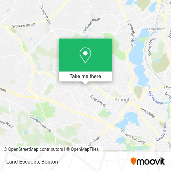
See Land Escapes, Arlington, on the map
Public Transit to Land Escapes in Arlington
Wondering how to get to Land Escapes in Arlington? Moovit helps you find the best way to get to Land Escapes with step-by-step directions from the nearest public transit station.
Moovit provides free maps and live directions to help you navigate through your city. View schedules, routes, timetables, and find out how long does it take to get to Land Escapes in real time.
Looking for the nearest stop or station to Land Escapes? Check out this list of stops closest to your destination: Park Ave @ Oakland Ave; Massachusetts Ave @ Hobbs Ct; West Medford; Alewife; Belmont.
Bus: 77, 62.Train: FITCHBURG, LOWELL.Subway: RED LINE.
Want to see if there’s another route that gets you there at an earlier time? Moovit helps you find alternative routes or times. Get directions from and directions to Land Escapes easily from the Moovit App or Website.
We make riding to Land Escapes easy, which is why over 1.7 million users, including users in Arlington, trust Moovit as the best app for public transit. You don’t need to download an individual bus app or train app, Moovit is your all-in-one transit app that helps you find the best bus time or train time available.
For information on prices of bus, subway and train, costs and ride fares to Land Escapes, please check the Moovit app.
Use the app to navigate to popular places including to the airport, hospital, stadium, grocery store, mall, coffee shop, school, college, and university.
Land Escapes Address: 11 Harvard St street in Arlington
- DUNKIN',
- Jitterbugs,
- MBTA Bus Stop - Appleton St,
- Mls Property Information Network, Inc.,
- Leader Bank,
- Ottoson Middle School Art Room,
- Keller Williams Realty,
- Arlington Heights,
- Vande Waters Collision Center,
- Mls Property Information Network, Inc.,
- Road Warrior Moving,
- David Whitney,
- Master Pies Pizza,
- Watermill Place Condominium Trust,
- Diana Ronell Dr,
- Arlington Heights Chriopractc Office,
- Living Peace Professional Organizing,
- Forced Exposure,
- Personal Safety,
- Rovinelli H Paul
Places Near Land Escapes (Arlington)
- Faneuil Hall, Boston,
- Castle Island, Boston,
- Boston Common, Boston,
- Museum Of Science, Boston,
- Isabella Stewart Gardner Museum, Boston,
- Cheers, Boston,
- House Of Blues, Boston,
- North End, Boston,
- Wang Theater, Boston,
- Wilbur Theatre, Boston,
- Boston Medical Center, Boston,
- Boston Convention & Exhibition Center, Boston,
- Quincy Market, Boston,
- Leader Bank Pavilion (Leader Bank Pavillion), Boston,
- Prudential Center, Boston,
- Seaport District, Boston,
- Mgm Music Hall, Boston,
- Massachusetts General Hospital, Boston,
- Td Garden, Boston,
- Boston Children's Hospital, Boston
How to get to popular places in Boston with public transit
Get around Arlington by public transit!
Traveling around Arlington has never been so easy. See step by step directions as you travel to any attraction, street or major public transit station. View bus and train schedules, arrival times, service alerts and detailed routes on a map, so you know exactly how to get to anywhere in Arlington.
When traveling to any destination around Arlington use Moovit's Live Directions with Get Off Notifications to know exactly where and how far to walk, how long to wait for your line, and how many stops are left. Moovit will alert you when it's time to get off — no need to constantly re-check whether yours is the next stop.
Wondering how to use public transit in Arlington or how to pay for public transit in Arlington? Moovit public transit app can help you navigate your way with public transit easily, and at minimum cost. It includes public transit fees, ticket prices, and costs. Looking for a map of Arlington public transit lines? Moovit public transit app shows all public transit maps in Arlington with all Bus, Train, Subway and Ferry routes and stops on an interactive map.
Boston has 4 transit type(s), including: Bus, Train, Subway and Ferry, operated by several transit agencies, including MBTA, Southeastern Regional Transit Authority, MetroWest Regional Transit Authority, Rhode Island Public Transit Authority, WRTA, Lowell Regional Transit Authority, Merrimack Valley Transit, Montachusett Regional Transit Authority, Cape Cod Regional Transit Authority, Brockton Area Transit Authority, Martha's Vineyard Transit Authority, the WAVE - Nantucket Regional Transit Authority, GATRA, Cape Ann Transportation Authority and Massport