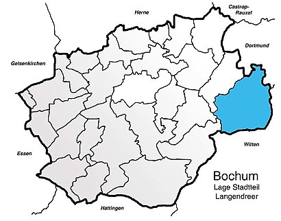
See Langendreer, Bochum, on the map
Directions to Langendreer (Bochum) with public transportation
The following transit lines have routes that pass near Langendreer
 Light Rail:
Which light rail line stops near Langendreer?
302
See Langendreer, Bochum, on the map
Public Transit to Langendreer in Bochum
Wondering how to get to Langendreer in Bochum, Germany? Moovit helps you find the best way to get to Langendreer with step-by-step directions from the nearest public transit station.
Moovit provides free maps and live directions to help you navigate through your city. View schedules, routes, timetables, and find out how long does it take to get to Langendreer in real time.
Light Rail:
Want to see if there’s another route that gets you there at an earlier time? Moovit helps you find alternative routes or times. Get directions from and directions to Langendreer easily from the Moovit App or Website.
We make riding to Langendreer easy, which is why over 1.5 million users, including users in Bochum, trust Moovit as the best app for public transit. You don’t need to download an individual bus app or train app, Moovit is your all-in-one transit app that helps you find the best bus time or train time available.
For information on prices of train, bus and light rail, costs and ride fares to Langendreer, please check the Moovit app.
Use the app to navigate to popular places including to the airport, hospital, stadium, grocery store, mall, coffee shop, school, college, and university.
Location: Bochum, NRW (North Rhine-Westphalia)
Attractions near Langendreer
Kinder-Jugendarztpraxis Dr. De La Motte,Lessing Schule,Lessing Gymnasium,Ottilienstraße 12,Schmidtmeier,Langendreer Amt,H stiftstraße,Stadtbücherei Langendreer,Stadt Bochum Stadtbücherei , Zweigbücherei Langendreer,Atmende Säule,Bezirksmusikschule Bochum-Ost,Standesamt-Außenstelle Langendreer,Carl-von-Ossietzky-Platz 1,Bürgerbüro Langendreer,Brillen Haarmann,Spielplatz Langendreer Amt,Eiscafe Sicilia,Blattwerk Der ! Blumenladen,Rechtsanwalt & Notar Erich Eisel,Netto Marken-DiscountHow to get to popular attractions in Bochum with public transit
Breitscheid, Ratingen,Rheinterrasse, Düsseldorf,Furth (Neuss), Neuss,Lindenthaler Tierpark, Köln,Westfalia Werkzeugcompany GmbH & Co Kg, Hagen,Königswinter, Königswinter,Marten, Dortmund,RWTH Sporthalle Königshügel, Aachen,Remagen, Remagen,Technologiepark Köln, Köln,Längste Theke der Welt, Düsseldorf,Luegallee, Düsseldorf,ALDI SÜD, Bonn,RWTH Aachen University, Aachen,Burscheid, Burscheid,RWTH Kármán, Aachen,Fronhofer Galeria, Bonn,Niederkassel, Düsseldorf,H+ Hotel Köln Brühl, Brühl,TBWA\ Düsseldorf, DüsseldorfGet around Bochum by public transit!
Traveling around Bochum has never been so easy. See step by step directions as you travel to any attraction, street or major public transit station. View bus and train schedules, arrival times, service alerts and detailed routes on a map, so you know exactly how to get to anywhere in Bochum.
When traveling to any destination around Bochum use Moovit's Live Directions with Get Off Notifications to know exactly where and how far to walk, how long to wait for your line, and how many stops are left. Moovit will alert you when it's time to get off — no need to constantly re-check whether yours is the next stop.
Wondering how to use public transit in Bochum or how to pay for public transit in Bochum? Moovit public transit app can help you navigate your way with public transit easily, and at minimum cost. It includes public transit fees, ticket prices, and costs. Looking for a map of Bochum public transit lines? Moovit public transit app shows all public transit maps in Bochum with all train, bus or light rail routes and stops on an interactive map.
Bochum has 3 transit type(s), including: train, bus or light rail, operated by several transit agencies, including KVB Kölner Verkehrs-Betriebe AG, Straßenbahn, Rheinbahn, DSW U-Bahn, DVG AG, KVB Kölner Verkehrs-Betriebe AG, S-Bahn, bvo, Rheinbahn, NWL, BOGESTRA U-Bahn, DVG AG, NordWestBahn, DVG AG and DB