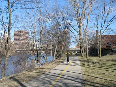
Directions to Lansing River Trail with public transportation
The following transit lines have routes that pass near Lansing River Trail
How to get to Lansing River Trail by bus?
Click on the bus route to see step by step directions with maps, line arrival times and updated time schedules.
Bus stations near Lansing River Trail
- Ebd Perkins Before Leslie, 26 min walk,
Bus lines to Lansing River Trail
- 07, 7 Aurelius - Miller,
What are the closest stations to Lansing River Trail?
The closest stations to Lansing River Trail are:
- Ebd Perkins Before Leslie is 2108 yards away, 26 min walk.
Which bus lines stop near Lansing River Trail?
These bus lines stop near Lansing River Trail: 07, 08.
See Lansing River Trail on the map
Public Transportation to Lansing River Trail
Wondering how to get to Lansing River Trail, United States? Moovit helps you find the best way to get to Lansing River Trail with step-by-step directions from the nearest public transit station.
Moovit provides free maps and live directions to help you navigate through your city. View schedules, routes, timetables, and find out how long does it take to get to Lansing River Trail in real time.
Looking for the nearest stop or station to Lansing River Trail? Check out this list of stops closest to your destination: Ebd Perkins Before Leslie.
Bus: 07, 08.
Want to see if there’s another route that gets you there at an earlier time? Moovit helps you find alternative routes or times. Get directions from and directions to Lansing River Trail easily from the Moovit App or Website.
We make riding to Lansing River Trail easy, which is why over 1.5 million users, including users in Lansing, trust Moovit as the best app for public transit. You don’t need to download an individual bus app or train app, Moovit is your all-in-one transit app that helps you find the best bus time or train time available.
For information on prices of bus, costs and ride fares to Lansing River Trail, please check the Moovit app.
Use the app to navigate to popular places including to the airport, hospital, stadium, grocery store, mall, coffee shop, school, college, and university.
Lansing River Trail Address: Old Town Downtown street in Lansing
Attractions near Lansing River Trail
Potter Park Zoo,Bald Eagle,River Otters,Artic Fox,Wolf,Raven,Pony Rides,Shubel Park,Sycamore Creek,Mr Quick Pick,Walsh Park,Fenner Nature Center,Potter Park,Mount Hope Elementary School,Holmes Street School,Barnum & Tenny Service Center,Sycamore Park,Hager Fox Electric,Hometown Floor and More,Triola'sHow to get to popular attractions in Lansing with public transit
Quality Dairy Bakery, Lansing,McDonald Contracting, Okemos,Patrick H Noud MD, Lansing,Brennan Law Library and Center for Research and Study, Lansing,James G Zito Dr, Lansing,Brody Hall Msu, East Lansing,J S Real Estate, Lansing,The Word of Life Romanian Church of Lansing,TACO BELL, East Lansing,Affordable Door, Lansing,A Gaydos & Leckie,Msu Roost, East Lansing,The North Face, Waverly,Michigan State Cafeteria, East Lansing,Haslett Coin Laundry, Haslett,Midway Early Childhood Center, Holt,Old Town, Michigan, Lansing,Resilient Physical Therapy, East Lansing,Leone Law Associates, Okemos,Mdot Park & Ride, MasonGet around Lansing by public transit!
Traveling around Lansing has never been so easy. See step by step directions as you travel to any attraction, street or major public transit station. View bus and train schedules, arrival times, service alerts and detailed routes on a map, so you know exactly how to get to anywhere in Lansing.
When traveling to any destination around Lansing use Moovit's Live Directions with Get Off Notifications to know exactly where and how far to walk, how long to wait for your line, and how many stops are left. Moovit will alert you when it's time to get off — no need to constantly re-check whether yours is the next stop.
Wondering how to use public transit in Lansing or how to pay for public transit in Lansing? Moovit public transit app can help you navigate your way with public transit easily, and at minimum cost. It includes public transit fees, ticket prices, and costs. Looking for a map of Lansing public transit lines? Moovit public transit app shows all public transit maps in Lansing with all Bus and Light Rail routes and stops on an interactive map.
Lansing has 2 transit type(s), including: Bus and Light Rail, operated by several transit agencies, including Capital Area Transportation Authority, Greyhound-us