Directions to Laramerchi (Boston) with public transportation
The following transit lines have routes that pass near Laramerchi
 Bus: 1, 43, SL4, SL5, 8.
- Train: FITCHBURG, NEEDHAM, FRANKLIN/FOXBORO, ORANGE LINE, PROVIDENCE/STOUGHTON.
- Subway: GREEN LINE E, ORANGE LINE.
How to get to Laramerchi by bus?
Click on the bus route to see step by step directions with maps, line arrival times and updated time schedules.
From The Schrafft Center, Boston
52 minFrom Arnold Arboretum, Boston
37 minFrom 7F Everett Street, Revere
59 minFrom Uscis Biometrics Office, Revere
58 minFrom VA Hospital, Boston
56 minFrom Malden Catholic High School, Malden
83 minFrom Medford Square, Medford
72 minFrom Harvard Museum Of Natural History, Cambridge
41 minFrom West Roxbury VA Medical Center, Boston
53 minFrom Boston College, Boston
70 min
How to get to Laramerchi by train?
Click on the train route to see step by step directions with maps, line arrival times and updated time schedules.
How to get to Laramerchi by subway?
Click on the subway route to see step by step directions with maps, line arrival times and updated time schedules.
Subway station near Laramerchi in Boston
- Northeastern University, 2 min walk,VIEW
Bus stops near Laramerchi in Boston
Train station near Laramerchi in Boston
- Ruggles, 4 min walk,VIEW
Bus lines to Laramerchi in Boston
What are the closest stations to Laramerchi?
The closest stations to Laramerchi are:
- Northeastern University is 147 yards away, 2 min walk.
- Tremont St @ Worcester St is 168 yards away, 3 min walk.
- Ruggles is 257 yards away, 4 min walk.
- Massachusetts Ave @ Tremont St is 302 yards away, 4 min walk.
- Washington St @ Lenox St is 344 yards away, 5 min walk.
Which bus lines stop near Laramerchi?
These bus lines stop near Laramerchi: 1, 43, SL4, SL5.
Which train lines stop near Laramerchi?
These train lines stop near Laramerchi: FITCHBURG, NEEDHAM.
Which subway lines stop near Laramerchi?
These subway lines stop near Laramerchi: GREEN LINE E, ORANGE LINE.
What’s the nearest subway station to Laramerchi in Boston?
The nearest subway station to Laramerchi in Boston is Northeastern University. It’s a 2 min walk away.
What’s the nearest train station to Laramerchi in Boston?
The nearest train station to Laramerchi in Boston is Ruggles. It’s a 4 min walk away.
What’s the nearest bus station to Laramerchi in Boston?
The nearest bus station to Laramerchi in Boston is Tremont St @ Worcester St. It’s a 3 min walk away.
What time is the first subway to Laramerchi in Boston?
The GREEN LINE E is the first subway that goes to Laramerchi in Boston. It stops nearby at 5:16 AM.
What time is the last subway to Laramerchi in Boston?
The GREEN LINE E is the last subway that goes to Laramerchi in Boston. It stops nearby at 2:10 AM.
What time is the first train to Laramerchi in Boston?
The PROVIDENCE/STOUGHTON is the first train that goes to Laramerchi in Boston. It stops nearby at 4:28 AM.
What time is the last train to Laramerchi in Boston?
The PROVIDENCE/STOUGHTON is the last train that goes to Laramerchi in Boston. It stops nearby at 12:34 AM.
What time is the first bus to Laramerchi in Boston?
The 1 is the first bus that goes to Laramerchi in Boston. It stops nearby at 4:43 AM.
What time is the last bus to Laramerchi in Boston?
The 1 is the last bus that goes to Laramerchi in Boston. It stops nearby at 2:38 AM.
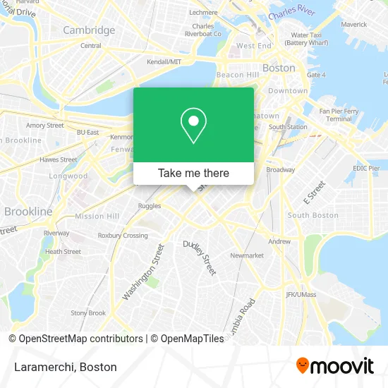
See Laramerchi, Boston, on the map
Public Transit to Laramerchi in Boston
Wondering how to get to Laramerchi in Boston? Moovit helps you find the best way to get to Laramerchi with step-by-step directions from the nearest public transit station.
Moovit provides free maps and live directions to help you navigate through your city. View schedules, routes, timetables, and find out how long does it take to get to Laramerchi in real time.
Looking for the nearest stop or station to Laramerchi? Check out this list of stops closest to your destination: Northeastern University; Tremont St @ Worcester St; Ruggles; Massachusetts Ave @ Tremont St; Washington St @ Lenox St.
Bus: 1, 43, SL4, SL5, 8, 15.Train: FITCHBURG, NEEDHAM, FRANKLIN/FOXBORO, ORANGE LINE, PROVIDENCE/STOUGHTON.Subway: GREEN LINE E, ORANGE LINE.
Want to see if there’s another route that gets you there at an earlier time? Moovit helps you find alternative routes or times. Get directions from and directions to Laramerchi easily from the Moovit App or Website.
We make riding to Laramerchi easy, which is why over 1.7 million users, including users in Boston, trust Moovit as the best app for public transit. You don’t need to download an individual bus app or train app, Moovit is your all-in-one transit app that helps you find the best bus time or train time available.
For information on prices of bus, subway and train, costs and ride fares to Laramerchi, please check the Moovit app.
Use the app to navigate to popular places including to the airport, hospital, stadium, grocery store, mall, coffee shop, school, college, and university.
Laramerchi Address: 537 Shawmut Ave street in Boston
- Northampton,
- Chester Park (Massachusetts Ave),
- E Springfield St & Washington St,
- Rosie's Place,
- Boston Housing Authority Developments,
- Church Of St. Augustine & St. Martin,
- Washington St Electrical,
- Mike's City Diner (Mikes City Diner),
- The Mad Monkfish,
- Little Donkey,
- Mida,
- MetroPCS (Metro by T-Mobile),
- Zaid al-Bender DDS,
- Rosie's Place Inc,
- Anita Kurl,
- Ilona,
- Fanuel Hall, 2nd Fl,
- PLS Check Cashing Store,
- Concord Street Elderly,
- Michael L. Bivins Basketball Court
Places Near Laramerchi (Boston)
- North End, Boston,
- Wang Theater, Boston,
- Massachusetts General Hospital, Boston,
- Quincy Market, Boston,
- Boston Medical Center, Boston,
- Wilbur Theatre, Boston,
- Faneuil Hall, Boston,
- Museum Of Science, Boston,
- Boston Common, Boston,
- House Of Blues, Boston,
- Isabella Stewart Gardner Museum, Boston,
- Boston Convention & Exhibition Center, Boston,
- Prudential Center, Boston,
- Castle Island, Boston,
- Mgm Music Hall, Boston,
- Boston Children's Hospital, Boston,
- Td Garden, Boston,
- Cheers, Boston,
- Seaport District, Boston,
- Leader Bank Pavilion (Leader Bank Pavillion), Boston
How to get to popular places in Boston with public transit
Get around Boston by public transit!
Traveling around Boston has never been so easy. See step by step directions as you travel to any attraction, street or major public transit station. View bus and train schedules, arrival times, service alerts and detailed routes on a map, so you know exactly how to get to anywhere in Boston.
When traveling to any destination around Boston use Moovit's Live Directions with Get Off Notifications to know exactly where and how far to walk, how long to wait for your line, and how many stops are left. Moovit will alert you when it's time to get off — no need to constantly re-check whether yours is the next stop.
Wondering how to use public transit in Boston or how to pay for public transit in Boston? Moovit public transit app can help you navigate your way with public transit easily, and at minimum cost. It includes public transit fees, ticket prices, and costs. Looking for a map of Boston public transit lines? Moovit public transit app shows all public transit maps in Boston with all Bus, Train, Subway and Ferry routes and stops on an interactive map.
Boston has 4 transit type(s), including: Bus, Train, Subway and Ferry, operated by several transit agencies, including MBTA, Southeastern Regional Transit Authority, MetroWest Regional Transit Authority, Rhode Island Public Transit Authority, WRTA, Lowell Regional Transit Authority, Merrimack Valley Transit, Montachusett Regional Transit Authority, Cape Cod Regional Transit Authority, Brockton Area Transit Authority, Martha's Vineyard Transit Authority, the WAVE - Nantucket Regional Transit Authority, GATRA, Cape Ann Transportation Authority and Massport