Directions to Larp Adventure Program (Arlington) with public transportation
The following transit lines have routes that pass near Larp Adventure Program
 Bus: 350, 77, 83, 87.
- Train: LOWELL, FITCHBURG.
- Subway: RED LINE, GREEN LINE B, GREEN LINE C, GREEN LINE E.
How to get to Larp Adventure Program by bus?
Click on the bus route to see step by step directions with maps, line arrival times and updated time schedules.
From Paradise Rock Club & Lounge, Boston
56 minFrom Prudential Tower, Boston
52 minFrom Embassy Suites by Hilton Boston Waltham, Waltham
153 minFrom Agganis Arena, Boston
57 minFrom The Liberty Hotel, Boston
61 minFrom The Middle East Restaurant, Cambridge
36 minFrom Burlington, Ma, Burlington
35 minFrom Roxbury, Boston
81 minFrom O'Bryant High School, Boston
77 minFrom SoWa Vintage Market, Boston
64 min
How to get to Larp Adventure Program by train?
Click on the train route to see step by step directions with maps, line arrival times and updated time schedules.
How to get to Larp Adventure Program by subway?
Click on the subway route to see step by step directions with maps, line arrival times and updated time schedules.
From Paradise Rock Club & Lounge, Boston
79 minFrom Prudential Tower, Boston
69 minFrom Agganis Arena, Boston
80 minFrom The Liberty Hotel, Boston
49 minFrom The Middle East Restaurant, Cambridge
44 minFrom Roxbury, Boston
74 minFrom O'Bryant High School, Boston
74 minFrom SoWa Vintage Market, Boston
65 min
Bus stops near Larp Adventure Program in Arlington
Subway stations near Larp Adventure Program in Arlington
Train stations near Larp Adventure Program in Arlington
Bus lines to Larp Adventure Program in Arlington
What are the closest stations to Larp Adventure Program?
The closest stations to Larp Adventure Program are:
- Massachusetts Ave @ Wyman St is 478 yards away, 6 min walk.
- Broadway @ Franklin St is 504 yards away, 7 min walk.
- Davis Sq. is 1489 yards away, 18 min walk.
- Medford/Tufts Station is 1704 yards away, 21 min walk.
- West Medford is 2332 yards away, 28 min walk.
- Belmont is 3924 yards away, 46 min walk.
Which bus lines stop near Larp Adventure Program?
These bus lines stop near Larp Adventure Program: 350, 77, 83, 87.
Which train line stops near Larp Adventure Program?
LOWELL (#323 | Lowell)
Which subway line stops near Larp Adventure Program?
RED LINE (Alewife)
What’s the nearest subway station to Larp Adventure Program in Arlington?
The nearest subway station to Larp Adventure Program in Arlington is Davis Sq.. It’s a 18 min walk away.
What’s the nearest train station to Larp Adventure Program in Arlington?
The nearest train station to Larp Adventure Program in Arlington is West Medford. It’s a 28 min walk away.
What’s the nearest bus station to Larp Adventure Program in Arlington?
The nearest bus station to Larp Adventure Program in Arlington is Massachusetts Ave @ Wyman St. It’s a 6 min walk away.
What time is the first subway to Larp Adventure Program in Arlington?
The GREEN LINE E is the first subway that goes to Larp Adventure Program in Arlington. It stops nearby at 4:57 AM.
What time is the last subway to Larp Adventure Program in Arlington?
The GREEN LINE E is the last subway that goes to Larp Adventure Program in Arlington. It stops nearby at 2:41 AM.
What time is the first train to Larp Adventure Program in Arlington?
The LOWELL is the first train that goes to Larp Adventure Program in Arlington. It stops nearby at 5:31 AM.
What time is the last train to Larp Adventure Program in Arlington?
The LOWELL is the last train that goes to Larp Adventure Program in Arlington. It stops nearby at 12:20 AM.
What time is the first bus to Larp Adventure Program in Arlington?
The 77 is the first bus that goes to Larp Adventure Program in Arlington. It stops nearby at 4:55 AM.
What time is the last bus to Larp Adventure Program in Arlington?
The 87 is the last bus that goes to Larp Adventure Program in Arlington. It stops nearby at 1:43 AM.
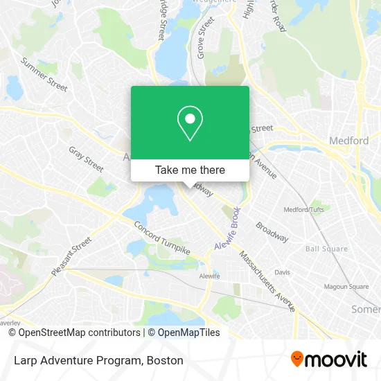
See Larp Adventure Program, Arlington, on the map
Public Transit to Larp Adventure Program in Arlington
Wondering how to get to Larp Adventure Program in Arlington? Moovit helps you find the best way to get to Larp Adventure Program with step-by-step directions from the nearest public transit station.
Moovit provides free maps and live directions to help you navigate through your city. View schedules, routes, timetables, and find out how long does it take to get to Larp Adventure Program in real time.
Looking for the nearest stop or station to Larp Adventure Program? Check out this list of stops closest to your destination: Massachusetts Ave @ Wyman St; Broadway @ Franklin St; Davis Sq.; Medford/Tufts Station; West Medford; Belmont.
Bus: 350, 77, 83, 87.Train: LOWELL, FITCHBURG.Subway: RED LINE, GREEN LINE B, GREEN LINE C, GREEN LINE E.
Want to see if there’s another route that gets you there at an earlier time? Moovit helps you find alternative routes or times. Get directions from and directions to Larp Adventure Program easily from the Moovit App or Website.
We make riding to Larp Adventure Program easy, which is why over 1.7 million users, including users in Arlington, trust Moovit as the best app for public transit. You don’t need to download an individual bus app or train app, Moovit is your all-in-one transit app that helps you find the best bus time or train time available.
For information on prices of bus, subway and train, costs and ride fares to Larp Adventure Program, please check the Moovit app.
Use the app to navigate to popular places including to the airport, hospital, stadium, grocery store, mall, coffee shop, school, college, and university.
Larp Adventure Program Address: PO BOX 5482 street in Arlington
- Decilio Financial Advisors,
- Arlington Dance Place,
- Brightview Arlington Addiction Treatment Center,
- Donatella Hairstylist,
- Farah Beauty Salon,
- Door to Door Locksmith,
- Thrapsano,
- Arlington Periodontal,
- Prose Restaurant,
- Friends of the Fox Thrift,
- Journeywomen Psychotherapy,
- Eco Massage,
- Danny Miller Massage Therapist,
- DUNKIN',
- Arlington Aveto Parts,
- Stephen Joseph Ma LMHC,
- Arlington Center,
- Rebbart,
- Arlington Properties,
- East Arlington, MA
Places Near Larp Adventure Program (Arlington)
- Castle Island, Boston,
- Isabella Stewart Gardner Museum, Boston,
- Cheers, Boston,
- Seaport District, Boston,
- House Of Blues, Boston,
- Wilbur Theatre, Boston,
- Td Garden, Boston,
- Wang Theater, Boston,
- Boston Children's Hospital, Boston,
- Prudential Center, Boston,
- Faneuil Hall, Boston,
- Museum Of Science, Boston,
- Mgm Music Hall, Boston,
- Leader Bank Pavilion (Leader Bank Pavillion), Boston,
- Massachusetts General Hospital, Boston,
- Boston Convention & Exhibition Center, Boston,
- Boston Common, Boston,
- Boston Medical Center, Boston,
- North End, Boston,
- Quincy Market, Boston
How to get to popular places in Boston with public transit
Get around Arlington by public transit!
Traveling around Arlington has never been so easy. See step by step directions as you travel to any attraction, street or major public transit station. View bus and train schedules, arrival times, service alerts and detailed routes on a map, so you know exactly how to get to anywhere in Arlington.
When traveling to any destination around Arlington use Moovit's Live Directions with Get Off Notifications to know exactly where and how far to walk, how long to wait for your line, and how many stops are left. Moovit will alert you when it's time to get off — no need to constantly re-check whether yours is the next stop.
Wondering how to use public transit in Arlington or how to pay for public transit in Arlington? Moovit public transit app can help you navigate your way with public transit easily, and at minimum cost. It includes public transit fees, ticket prices, and costs. Looking for a map of Arlington public transit lines? Moovit public transit app shows all public transit maps in Arlington with all Bus, Train, Subway and Ferry routes and stops on an interactive map.
Boston has 4 transit type(s), including: Bus, Train, Subway and Ferry, operated by several transit agencies, including MBTA, Southeastern Regional Transit Authority, MetroWest Regional Transit Authority, Rhode Island Public Transit Authority, WRTA, Lowell Regional Transit Authority, Merrimack Valley Transit, Montachusett Regional Transit Authority, Cape Cod Regional Transit Authority, Brockton Area Transit Authority, Martha's Vineyard Transit Authority, the WAVE - Nantucket Regional Transit Authority, GATRA, Cape Ann Transportation Authority and Massport