Directions to Laurel Park Arts (Boston) with public transportation
The following transit lines have routes that pass near Laurel Park Arts
 Bus: 31.
- Train: VALLEY FLYER, VERMONTER.
How to get to Laurel Park Arts by bus?
Click on the bus route to see step by step directions with maps, line arrival times and updated time schedules.
Bus stop near Laurel Park Arts in Boston
- N King St at Rockridge Community, 17 min walk,VIEW
Train station near Laurel Park Arts in Boston
- Northampton, 56 min walk,VIEW
Bus lines to Laurel Park Arts in Boston
- 31, Jwo Transit Center,VIEW
What are the closest stations to Laurel Park Arts?
The closest stations to Laurel Park Arts are:
- N King St at Rockridge Community is 1461 yards away, 17 min walk.
- Northampton is 4751 yards away, 56 min walk.
Which bus line stops near Laurel Park Arts?
31 (Jwo Transit Center)
What time is the first train to Laurel Park Arts in Boston?
The VALLEY FLYER is the first train that goes to Laurel Park Arts in Boston. It stops nearby at 6:30 AM.
What time is the last train to Laurel Park Arts in Boston?
The VALLEY FLYER is the last train that goes to Laurel Park Arts in Boston. It stops nearby at 10:07 PM.
What time is the first bus to Laurel Park Arts in Boston?
The 31 is the first bus that goes to Laurel Park Arts in Boston. It stops nearby at 5:33 AM.
What time is the last bus to Laurel Park Arts in Boston?
The 31 is the last bus that goes to Laurel Park Arts in Boston. It stops nearby at 7:01 PM.
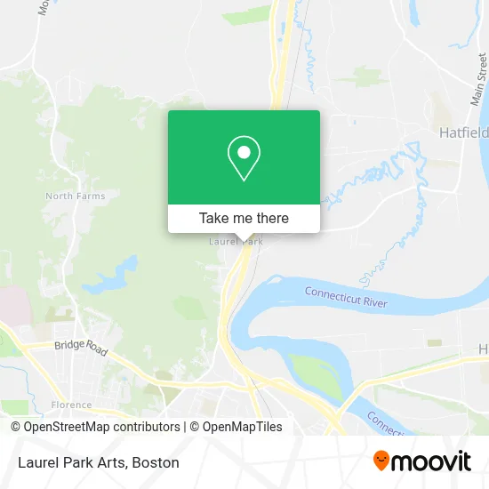
See Laurel Park Arts, Boston, on the map
Public Transit to Laurel Park Arts in Boston
Wondering how to get to Laurel Park Arts in Boston? Moovit helps you find the best way to get to Laurel Park Arts with step-by-step directions from the nearest public transit station.
Moovit provides free maps and live directions to help you navigate through your city. View schedules, routes, timetables, and find out how long does it take to get to Laurel Park Arts in real time.
Looking for the nearest stop or station to Laurel Park Arts? Check out this list of stops closest to your destination: N King St at Rockridge Community; Northampton.
Bus: 31.Train: VALLEY FLYER, VERMONTER.
Want to see if there’s another route that gets you there at an earlier time? Moovit helps you find alternative routes or times. Get directions from and directions to Laurel Park Arts easily from the Moovit App or Website.
We make riding to Laurel Park Arts easy, which is why over 1.7 million users, including users in Boston, trust Moovit as the best app for public transit. You don’t need to download an individual bus app or train app, Moovit is your all-in-one transit app that helps you find the best bus time or train time available.
For information on prices of bus, costs and ride fares to Laurel Park Arts, please check the Moovit app.
Use the app to navigate to popular places including to the airport, hospital, stadium, grocery store, mall, coffee shop, school, college, and university.
Laurel Park Arts Address: 2 Laurel Park street in Boston
- Pioneer Spine & Sports MDCN,
- Massachusetts State Police Northampton,
- Holy Trinity Cemetery,
- Comm of Mass Highway,
- Massdot District 2 Headquarters,
- Hebrew Cemetery,
- Canary Island,
- Fields Center,
- Mechanic Auto Plus Auto Repair,
- Hampshire Othopedics & Sports Medecine, Inc.,
- Hardigg Custom Services,
- Audiology Services 132,
- Ten West Plaza,
- Institute of Human Solutions,
- Scottish Inns Hatfield,
- Stiebel Eltron,
- Hatfield Village,
- Mineral Hills Winery,
- Pangaea Sushi,
- River Valley Co-Op
Places Near Laurel Park Arts (Boston)
- Leader Bank Pavilion (Leader Bank Pavillion), Boston,
- Quincy Market, Boston,
- House Of Blues, Boston,
- Boston Medical Center, Boston,
- Cheers, Boston,
- Castle Island, Boston,
- Prudential Center, Boston,
- Boston Convention & Exhibition Center, Boston,
- North End, Boston,
- Isabella Stewart Gardner Museum, Boston,
- Massachusetts General Hospital, Boston,
- Wang Theater, Boston,
- Wilbur Theatre, Boston,
- Faneuil Hall, Boston,
- Seaport District, Boston,
- Mgm Music Hall, Boston,
- Td Garden, Boston,
- Boston Children's Hospital, Boston,
- Museum Of Science, Boston,
- Boston Common, Boston
How to get to popular places in Boston with public transit
Get around Boston by public transit!
Traveling around Boston has never been so easy. See step by step directions as you travel to any attraction, street or major public transit station. View bus and train schedules, arrival times, service alerts and detailed routes on a map, so you know exactly how to get to anywhere in Boston.
When traveling to any destination around Boston use Moovit's Live Directions with Get Off Notifications to know exactly where and how far to walk, how long to wait for your line, and how many stops are left. Moovit will alert you when it's time to get off — no need to constantly re-check whether yours is the next stop.
Wondering how to use public transit in Boston or how to pay for public transit in Boston? Moovit public transit app can help you navigate your way with public transit easily, and at minimum cost. It includes public transit fees, ticket prices, and costs. Looking for a map of Boston public transit lines? Moovit public transit app shows all public transit maps in Boston with all Bus, Train, Subway and Ferry routes and stops on an interactive map.
Boston has 4 transit type(s), including: Bus, Train, Subway and Ferry, operated by several transit agencies, including MBTA, Southeastern Regional Transit Authority, MetroWest Regional Transit Authority, Rhode Island Public Transit Authority, WRTA, Lowell Regional Transit Authority, Merrimack Valley Transit, Montachusett Regional Transit Authority, Cape Cod Regional Transit Authority, Brockton Area Transit Authority, Martha's Vineyard Transit Authority, the WAVE - Nantucket Regional Transit Authority, GATRA, Cape Ann Transportation Authority and Massport