Directions to Laurel Wellness (Watertown Town) with public transportation
The following transit lines have routes that pass near Laurel Wellness
 Bus: 71, 73.
- Train: FITCHBURG, FRAMINGHAM/WORCESTER.
- Subway: RED LINE, GREEN LINE B.
How to get to Laurel Wellness by bus?
Click on the bus route to see step by step directions with maps, line arrival times and updated time schedules.
From Bos17 - Amazon, Boston
65 minFrom Hampton Inn Boston Seaport District (Hampton Inn-Hampton Inn Boston), Boston
73 minFrom Hampton Inn Boston, Boston
58 minFrom Carson Beach, Boston
91 minFrom Homewood Suites by Hilton Boston Logan Airport Chelsea, Chelsea
86 minFrom Hyatt Place Boston Seaport District, Boston
69 minFrom Courtyard South Boston (COURTYARD by Marriott), Boston
79 minFrom Cheers Beacon Hill, Boston
49 minFrom Homewood Suites-Boston Seaport District, Boston
72 minFrom Massachusetts State House, Boston
57 min
How to get to Laurel Wellness by train?
Click on the train route to see step by step directions with maps, line arrival times and updated time schedules.
From Bos17 - Amazon, Boston
64 minFrom Hampton Inn Boston Seaport District (Hampton Inn-Hampton Inn Boston), Boston
78 minFrom Hampton Inn Boston, Boston
104 minFrom Carson Beach, Boston
92 minFrom Homewood Suites by Hilton Boston Logan Airport Chelsea, Chelsea
119 minFrom Hyatt Place Boston Seaport District, Boston
80 minFrom Courtyard South Boston (COURTYARD by Marriott), Boston
103 minFrom Cheers Beacon Hill, Boston
67 minFrom Homewood Suites-Boston Seaport District, Boston
78 minFrom Massachusetts State House, Boston
69 min
How to get to Laurel Wellness by subway?
Click on the subway route to see step by step directions with maps, line arrival times and updated time schedules.
From Bos17 - Amazon, Boston
67 minFrom Hampton Inn Boston Seaport District (Hampton Inn-Hampton Inn Boston), Boston
83 minFrom Hampton Inn Boston, Boston
82 minFrom Carson Beach, Boston
82 minFrom Courtyard South Boston (COURTYARD by Marriott), Boston
74 minFrom Cheers Beacon Hill, Boston
65 minFrom Homewood Suites-Boston Seaport District, Boston
83 minFrom Massachusetts State House, Boston
60 min
Bus stops near Laurel Wellness in Watertown Town
Subway stations near Laurel Wellness in Watertown Town
What are the closest stations to Laurel Wellness?
The closest stations to Laurel Wellness are:
- Belmont St @ Cushing St is 97 yards away, 2 min walk.
- Mt Auburn St @ Homer Ave is 396 yards away, 5 min walk.
- Warren Street is 1118 yards away, 14 min walk.
- Harvard Square is 3816 yards away, 45 min walk.
Which bus line stops near Laurel Wellness?
71 (Watertown Square)
Which train lines stop near Laurel Wellness?
These train lines stop near Laurel Wellness: FITCHBURG, FRAMINGHAM/WORCESTER.
Which subway line stops near Laurel Wellness?
RED LINE (Alewife)
What’s the nearest subway station to Laurel Wellness in Watertown Town?
The nearest subway station to Laurel Wellness in Watertown Town is Warren Street. It’s a 14 min walk away.
What’s the nearest bus station to Laurel Wellness in Watertown Town?
The nearest bus station to Laurel Wellness in Watertown Town is Belmont St @ Cushing St. It’s a 2 min walk away.
What time is the first subway to Laurel Wellness in Watertown Town?
The GREEN LINE B is the first subway that goes to Laurel Wellness in Watertown Town. It stops nearby at 5:12 AM.
What time is the last subway to Laurel Wellness in Watertown Town?
The GREEN LINE B is the last subway that goes to Laurel Wellness in Watertown Town. It stops nearby at 2:28 AM.
What time is the first bus to Laurel Wellness in Watertown Town?
The 73 is the first bus that goes to Laurel Wellness in Watertown Town. It stops nearby at 4:52 AM.
What time is the last bus to Laurel Wellness in Watertown Town?
The 71 is the last bus that goes to Laurel Wellness in Watertown Town. It stops nearby at 1:20 AM.
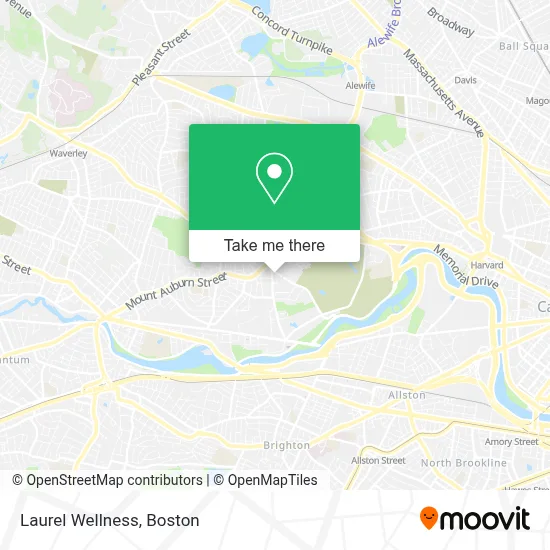
See Laurel Wellness, Watertown Town, on the map
Public Transit to Laurel Wellness in Watertown Town
Wondering how to get to Laurel Wellness in Watertown Town? Moovit helps you find the best way to get to Laurel Wellness with step-by-step directions from the nearest public transit station.
Moovit provides free maps and live directions to help you navigate through your city. View schedules, routes, timetables, and find out how long does it take to get to Laurel Wellness in real time.
Looking for the nearest stop or station to Laurel Wellness? Check out this list of stops closest to your destination: Belmont St @ Cushing St; Mt Auburn St @ Homer Ave; Warren Street; Harvard Square.
Bus: 71, 73.Train: FITCHBURG, FRAMINGHAM/WORCESTER.Subway: RED LINE, GREEN LINE B.
Want to see if there’s another route that gets you there at an earlier time? Moovit helps you find alternative routes or times. Get directions from and directions to Laurel Wellness easily from the Moovit App or Website.
We make riding to Laurel Wellness easy, which is why over 1.7 million users, including users in Watertown Town, trust Moovit as the best app for public transit. You don’t need to download an individual bus app or train app, Moovit is your all-in-one transit app that helps you find the best bus time or train time available.
For information on prices of bus, subway and train, costs and ride fares to Laurel Wellness, please check the Moovit app.
Use the app to navigate to popular places including to the airport, hospital, stadium, grocery store, mall, coffee shop, school, college, and university.
Laurel Wellness Address: 1 Grove St street in Watertown Town
- Watertown Lock & Safe,
- Geovision,
- The Family Institute of Cambridge,
- Daniel Bromberg Founder,
- Jen Schoonover,
- Lyndra Therapeutics,
- Phoenix Mechanical,
- MBTA Route 71 Bus Stop | Mt. Auburn St. & Bigelow Ave.,
- Swing Dance Depot,
- Sevan Bakery,
- Red Lentil,
- Watertown-Cambridge Greenway,
- St Stephens Armenian Apostolic,
- St. Stephen's Armenian Apostolic Church (Watertown, Ma),
- Nichols Locksmith Service,
- United Rentals,
- Arsenal Dog Run,
- Armenian Relief Society of Eastern USA,
- Inquire Rehearsal Dinners,
- Public Conversations Project
Places Near Laurel Wellness (Watertown Town)
- Faneuil Hall, Boston,
- Boston Convention & Exhibition Center, Boston,
- Isabella Stewart Gardner Museum, Boston,
- Leader Bank Pavilion (Leader Bank Pavillion), Boston,
- Wilbur Theatre, Boston,
- Massachusetts General Hospital, Boston,
- Castle Island, Boston,
- Museum Of Science, Boston,
- Quincy Market, Boston,
- Boston Medical Center, Boston,
- Wang Theater, Boston,
- Boston Common, Boston,
- House Of Blues, Boston,
- Seaport District, Boston,
- Boston Children's Hospital, Boston,
- North End, Boston,
- Cheers, Boston,
- Prudential Center, Boston,
- Mgm Music Hall, Boston,
- Td Garden, Boston
How to get to popular places in Boston with public transit
Get around Watertown Town by public transit!
Traveling around Watertown Town has never been so easy. See step by step directions as you travel to any attraction, street or major public transit station. View bus and train schedules, arrival times, service alerts and detailed routes on a map, so you know exactly how to get to anywhere in Watertown Town.
When traveling to any destination around Watertown Town use Moovit's Live Directions with Get Off Notifications to know exactly where and how far to walk, how long to wait for your line, and how many stops are left. Moovit will alert you when it's time to get off — no need to constantly re-check whether yours is the next stop.
Wondering how to use public transit in Watertown Town or how to pay for public transit in Watertown Town? Moovit public transit app can help you navigate your way with public transit easily, and at minimum cost. It includes public transit fees, ticket prices, and costs. Looking for a map of Watertown Town public transit lines? Moovit public transit app shows all public transit maps in Watertown Town with all Bus, Train, Subway and Ferry routes and stops on an interactive map.
Boston has 4 transit type(s), including: Bus, Train, Subway and Ferry, operated by several transit agencies, including MBTA, Southeastern Regional Transit Authority, MetroWest Regional Transit Authority, Rhode Island Public Transit Authority, WRTA, Lowell Regional Transit Authority, Merrimack Valley Transit, Montachusett Regional Transit Authority, Cape Cod Regional Transit Authority, Brockton Area Transit Authority, Martha's Vineyard Transit Authority, the WAVE - Nantucket Regional Transit Authority, GATRA, Cape Ann Transportation Authority and Massport