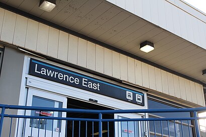
Directions to Lawrence East (Toronto) with public transportation
The following transit lines have routes that pass near Lawrence East
How to get to Lawrence East by bus?
Click on the bus route to see step by step directions with maps, line arrival times and updated time schedules.
How to get to Lawrence East by train?
Click on the train route to see step by step directions with maps, line arrival times and updated time schedules.
How to get to Lawrence East by subway?
Click on the subway route to see step by step directions with maps, line arrival times and updated time schedules.
Bus stations near Lawrence East in Toronto
- 2239 Lawrence Ave East, 9 min walk,
- Lawrence Ave East at Brockley Dr East Side, 10 min walk,
- Midland Ave at Stansbury Cres, 20 min walk,
Bus lines to Lawrence East in Toronto
- 54A, Starspray Loop at Lawrence Ave East,
- 54B, Kingston Rd at Collinsgrove Rd,
- 354, Starspray Loop at Lawrence Ave East,
- 154, University Of Toronto Scarborough,
- 57, Kennedy Station - Platform B,
What are the closest stations to Lawrence East?
The closest stations to Lawrence East are:
- 2239 Lawrence Ave East is 671 meters away, 9 min walk.
- Lawrence Ave East at Brockley Dr East Side is 731 meters away, 10 min walk.
- Midland Ave at Stansbury Cres is 1487 meters away, 20 min walk.
Which bus line stops near Lawrence East?
54
Which train line stops near Lawrence East?
ST
Which subway lines stop near Lawrence East?
These subway lines stop near Lawrence East: 2, 3.
What’s the nearest bus stop to Lawrence East in Toronto?
The nearest bus stop to Lawrence East in Toronto is 2239 Lawrence Ave East. It’s a 9 min walk away.
See Lawrence East, Toronto, on the map
Public Transit to Lawrence East in Toronto
Wondering how to get to Lawrence East in Toronto, Canada? Moovit helps you find the best way to get to Lawrence East with step-by-step directions from the nearest public transit station.
Moovit provides free maps and live directions to help you navigate through your city. View schedules, routes, timetables, and find out how long does it take to get to Lawrence East in real time.
Looking for the nearest stop or station to Lawrence East? Check out this list of stops closest to your destination: 2239 Lawrence Ave East; Lawrence Ave East at Brockley Dr East Side; Midland Ave at Stansbury Cres.
Bus: 54, 54A, 54B, 354, 154, 57.Train: ST.Subway: 2, 3.
Want to see if there’s another route that gets you there at an earlier time? Moovit helps you find alternative routes or times. Get directions from and directions to Lawrence East easily from the Moovit App or Website.
We make riding to Lawrence East easy, which is why over 1.5 million users, including users in Toronto, trust Moovit as the best app for public transit. You don’t need to download an individual bus app or train app, Moovit is your all-in-one transit app that helps you find the best bus time or train time available.
For information on prices of subway, bus and train, costs and ride fares to Lawrence East, please check the Moovit app.
Use the app to navigate to popular places including to the airport, hospital, stadium, grocery store, mall, coffee shop, school, college, and university.
Lawrence East Address: Lawrence Avenue East street in Toronto
Attractions near Lawrence East
Lawrence East RT Station,Toronto Police - Bail & Parole Enforcement,ReBoot,Reboot Canada,ABCO Group,M1P 2R7,129 Mike Myers Drive,Abco Group Office Furniture Showroom,Arsandco Park,CMB Auto Repairs,Advance Furniture Liquidators,100 Prudential Drive,M1P 4Z3,Fairstone, formerly CitiFinancial®,Hellenic Home for the Aged,Lawrence-Kennedy Parkette,1470 midland avenue,2568 Lawrence Ave E,GoodLife Fitness Scarborough Kennedy and Lawrence,Lawrence & KennedyHow to get to popular attractions in Toronto with public transit
Great Blue Heron Charity Casino, Toronto,Exhibition Place, Toronto,Hillcrest Mall, Richmond Hill,Maple Leaf Square, Toronto,Promenade Mall, Vaughan,Tim Hortons Field, Hamilton,Flamboro Casino, Hamilton,Bradford, Ontario, Bradford West Gwillimbury,Real Sports Bar & Grill, Toronto,COURTYARD-Toronto Downtown, Toronto,Scarborough Town Centre, Toronto,333 Bay St, Toronto,Cineplex Cinemas Yonge-Dundas, Toronto,George Brown St. James Campus, Toronto,Kitchener, Ontario, Kitchener,Toronto Christmas Market, Toronto,Hwy 400 at Hwy 7, Vaughan,HSR Bus Schedules & Fares, Hamilton,Dufferin St & St Clair Ave, Toronto,East York, TorontoGet around Toronto by public transit!
Traveling around Toronto has never been so easy. See step by step directions as you travel to any attraction, street or major public transit station. View bus and train schedules, arrival times, service alerts and detailed routes on a map, so you know exactly how to get to anywhere in Toronto.
When traveling to any destination around Toronto use Moovit's Live Directions with Get Off Notifications to know exactly where and how far to walk, how long to wait for your line, and how many stops are left. Moovit will alert you when it's time to get off — no need to constantly re-check whether yours is the next stop.
Wondering how to use public transit in Toronto or how to pay for public transit in Toronto? Moovit public transit app can help you navigate your way with public transit easily, and at minimum cost. It includes public transit fees, ticket prices, and costs. Looking for a map of Toronto public transit lines? Moovit public transit app shows all public transit maps in Toronto with all Bus, Train, Subway, Streetcar and Ferry routes and stops on an interactive map.
Toronto has 5 transit type(s), including: Bus, Train, Subway, Streetcar and Ferry, operated by several transit agencies, including TTC, TTC Streetcar, Toronto Subway, GO Transit Bus, GO Transit, Amtrak, York Region Transit, Grand River Transit, Guelph Transit, grt, Hamilton Street Railway, MiWay, Brampton Transit, Burlington Transit, Oakville Transit