See Leadership and Public Service High School, Manhattan, on the map
Directions to Leadership and Public Service High School (Manhattan) with public transportation
The following transit lines have routes that pass near Leadership and Public Service High School
 Bus:
Bus: - Train:
- Subway:
How to get to Leadership and Public Service High School by bus?
Click on the bus route to see step by step directions with maps, line arrival times and updated time schedules.
How to get to Leadership and Public Service High School by train?
Click on the train route to see step by step directions with maps, line arrival times and updated time schedules.
How to get to Leadership and Public Service High School by subway?
Click on the subway route to see step by step directions with maps, line arrival times and updated time schedules.
Bus stations near Leadership and Public Service High School in Manhattan
- Trinity Pl/Rector St,2 min walk,
Subway stations near Leadership and Public Service High School in Manhattan
- Rector St [N,R],4 min walk,
- Cortlandt St [1,2,3,A,C,E,N,R,W],4 min walk,
Bus lines to Leadership and Public Service High School in Manhattan
- BM1,Mill Basin - Downtown/Midtown,
- SIM1,Eltingville - Lower Manhattan Express,
- SIM1C,Eltingville - Manhattan Express,
- BM2,Canarsie/Spring Creek - Downtown/Midtown,
- SIM2,Tottenville - Lower Manhattan Express,
- BM3,Sheepshead Bay - Downtown/Midtown,
- SIM3C,Pt. Richmond - Manhattan Express,
- BM4,Gerritsen Beach - Downtown/Midtown,
- SIM4,Eltingville - Lower Manhattan Express,
- SIM4C,Huguenot - Manhattan Express,
- SIM4X,S.I. Mall - Lower Manhattan Express,
- SIM15,Eltingville - Lower Manhattan Express,
- X27,Bay Ridge - Manhattan Express,
- X28,Sea Gate / Bensonhurst - Manhattan Express,
- SIM32,Travis - Lower Manhattan Express,
- SIM33C,Mariners Harbor - Greenwich Village Express,
- SIM34,Mariners Harbor - Lower Manhattan Express,
- M55,W 44 St - South Ferry,
What are the closest stations to Leadership and Public Service High School?
The closest stations to Leadership and Public Service High School are:
- Trinity Pl/Rector St is 108 yards away, 2 min walk.
- Rector St [N,R] is 224 yards away, 4 min walk.
- Cortlandt St [1,2,3,A,C,E,N,R,W] is 227 yards away, 4 min walk.
Which bus lines stop near Leadership and Public Service High School?
These bus lines stop near Leadership and Public Service High School: BXM18, QM25, QM7.
Which train line stops near Leadership and Public Service High School?
PATH
Which subway lines stop near Leadership and Public Service High School?
These subway lines stop near Leadership and Public Service High School: 5, A, E, R, W.
What’s the nearest subway station to Leadership and Public Service High School in Manhattan?
The nearest subway stations to Leadership and Public Service High School in Manhattan are Rector St [N,R] and Cortlandt St [1,2,3,A,C,E,N,R,W]. The closest one is a 4 min walk away.
What’s the nearest bus stop to Leadership and Public Service High School in Manhattan?
The nearest bus stop to Leadership and Public Service High School in Manhattan is Trinity Pl/Rector St. It’s a 2 min walk away.
See Leadership and Public Service High School, Manhattan, on the map
Public Transit to Leadership and Public Service High School in Manhattan
Wondering how to get to Leadership and Public Service High School in Manhattan, United States? Moovit helps you find the best way to get to Leadership and Public Service High School with step-by-step directions from the nearest public transit station.
Moovit provides free maps and live directions to help you navigate through your city. View schedules, routes, timetables, and find out how long does it take to get to Leadership and Public Service High School in real time.
Looking for the nearest stop or station to Leadership and Public Service High School? Check out this list of stops closest to your destination: Trinity Pl/Rector St; Rector St [N,R]; Cortlandt St [1,2,3,A,C,E,N,R,W].
Bus:Train:Subway:
Want to see if there’s another route that gets you there at an earlier time? Moovit helps you find alternative routes or times. Get directions from and directions to Leadership and Public Service High School easily from the Moovit App or Website.
We make riding to Leadership and Public Service High School easy, which is why over 1.5 million users, including users in Manhattan, trust Moovit as the best app for public transit. You don’t need to download an individual bus app or train app, Moovit is your all-in-one transit app that helps you find the best bus time or train time available.
For information on prices of bus, subway and train, costs and ride fares to Leadership and Public Service High School, please check the Moovit app.
Use the app to navigate to popular places including to the airport, hospital, stadium, grocery store, mall, coffee shop, school, college, and university.
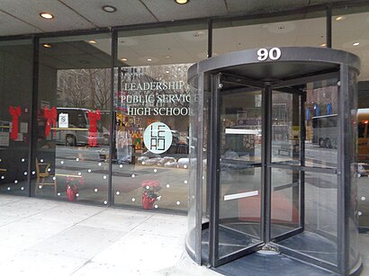
Leadership and Public Service High School Address: Trinity Place street in Manhattan
Attractions near Leadership and Public Service High School
Five Star Shoe Repair Corporation,Afternoon Express Restaurant,American Stock Exchange Building,125 Greenwich Street,Economics and Finance High School,High School Of Economics and Finance,Nichols Hall,Thames Street,100 Trinity Place,Thames St & Trinity Pl,Trinity Pl / Emeric Harvey Pl,Trinity Pl / Thames,Trinity and Thames,High School of Economics & Finance ,Exhange Dental Group,133 Greenwich Street,Courtyard by Marriott New York Downtown Manhattan / World Trade Center Area,Alpha North America,Acumen Fund Inc,Kerner & KernerHow to get to popular attractions in Manhattan with public transit
Food Gallery 32, Manhattan,LIRR - Huntington Station, Huntington Station, Ny,Virgin America Ticket Counter, Elizabeth, Nj,Spring Lounge, Manhattan,New Jersey Turnpike - Newark, Newark, Nj,Upper West Side, Manhattan,The Dutch, Manhattan,Peter Luger Steak House,LIRR - Babylon Station, Babylon, Ny,Stamford, CT, Stamford, Ct,Boat Basin Cafe, Manhattan,Harrah's Resort Hotel & Casino, Atlantic City, Nj,The Park, Manhattan,Ulysses Folk House, Manhattan,SoHo, Manhattan,Jing Fong Restaurant 金豐大酒樓, Manhattan,The Grey Dog, Manhattan,The Meatball Shop,Tom & Jerry's, Manhattan,Secaucus, NJ, Secaucus, NjGet around Manhattan by public transit!
Traveling around Manhattan has never been so easy. See step by step directions as you travel to any attraction, street or major public transit station. View bus and train schedules, arrival times, service alerts and detailed routes on a map, so you know exactly how to get to anywhere in Manhattan.
When traveling to any destination around Manhattan use Moovit's Live Directions with Get Off Notifications to know exactly where and how far to walk, how long to wait for your line, and how many stops are left. Moovit will alert you when it's time to get off — no need to constantly re-check whether yours is the next stop.
Wondering how to use public transit in Manhattan or how to pay for public transit in Manhattan? Moovit public transit app can help you navigate your way with public transit easily, and at minimum cost. It includes public transit fees, ticket prices, and costs. Looking for a map of Manhattan public transit lines? Moovit public transit app shows all public transit maps in Manhattan with all bus, subway or train routes and stops on an interactive map.
Manhattan has 3 transit type(s), including: bus, subway or train, operated by several transit agencies, including MTA Subway, Metro-North Railroad, LIRR, PATH, Shore Line East, MTA Bus Company, MTA New York City Transit - Express routes, MTA Bus, NJ Transit, NYC Ferry, NICE bus, Bee-Line Bus, NJ Transit Rail, NJ Transit Rail and Norwalk Transit District