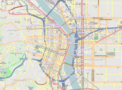
See Leland 1, Portland, OR, on the map
Directions to Leland 1 (Portland, OR) with public transportation
The following transit lines have routes that pass near Leland 1
 Bus:
Bus: - Light Rail:
- Streetcar:
How to get to Leland 1 by bus?
Click on the bus route to see step by step directions with maps, line arrival times and updated time schedules.
Bus stations near Leland 1 in Portland, OR
- 300 Block Sw Lincoln (East),2 min walk,
- 2200 Block Sw 1st (North),4 min walk,
Light Rail stations near Leland 1 in Portland, OR
- Lincoln/SW 3rd,2 min walk,
Bus lines to Leland 1 in Portland, OR
- ORANGE,SE Jackson & 21st (East),
- FX2,Cleveland Ave Park & Ride (East),
- 9,Gresham Central Transit Center (East),
- 17,SE Holgate & 122nd (East),
- 19,Flavel & I-205 Overpass (East),
- 35,N Portsmouth & Willamette (South),
What are the closest stations to Leland 1?
The closest stations to Leland 1 are:
- 300 Block Sw Lincoln (East) is 128 yards away, 2 min walk.
- Lincoln/SW 3rd is 155 yards away, 2 min walk.
- 2200 Block Sw 1st (North) is 229 yards away, 4 min walk.
Which bus lines stop near Leland 1?
These bus lines stop near Leland 1: 17, 35, 54, 9.
Which light rail line stops near Leland 1?
MAX ORANGE LINE
Which Streetcar line stops near Leland 1?
PORTLAND STREETCAR - NS LINE
What’s the nearest light rail station to Leland 1 in Portland, OR?
The nearest light rail station to Leland 1 in Portland, OR is Lincoln/SW 3rd. It’s a 2 min walk away.
What’s the nearest bus stop to Leland 1 in Portland, OR?
The nearest bus stop to Leland 1 in Portland, OR is 300 Block Sw Lincoln (East). It’s a 2 min walk away.
See Leland 1, Portland, OR, on the map
Public Transit to Leland 1 in Portland, OR
Wondering how to get to Leland 1 in Portland, OR, United States? Moovit helps you find the best way to get to Leland 1 with step-by-step directions from the nearest public transit station.
Moovit provides free maps and live directions to help you navigate through your city. View schedules, routes, timetables, and find out how long does it take to get to Leland 1 in real time.
Looking for the nearest stop or station to Leland 1? Check out this list of stops closest to your destination: 300 Block Sw Lincoln (East); Lincoln/SW 3rd; 2200 Block Sw 1st (North).
Bus:Light Rail:Streetcar:
Want to see if there’s another route that gets you there at an earlier time? Moovit helps you find alternative routes or times. Get directions from and directions to Leland 1 easily from the Moovit App or Website.
We make riding to Leland 1 easy, which is why over 1.5 million users, including users in Portland, OR, trust Moovit as the best app for public transit. You don’t need to download an individual bus app or train app, Moovit is your all-in-one transit app that helps you find the best bus time or train time available.
For information on prices of bus, light rail and Streetcar, costs and ride fares to Leland 1, please check the Moovit app.
Use the app to navigate to popular places including to the airport, hospital, stadium, grocery store, mall, coffee shop, school, college, and university.
Location: Portland, OR
Leland I, sometimes stylized as Leland 1 or Leland #1, is an outdoor 1975 sculpture by Lee Kelly and Bonnie Bronson, installed in Portland, Oregon, United States.Wiki
Attractions near Leland 1
Pittock Mansion And Acres,Oregon Holocaust Memorial,Adelle Apartments,Park Lane Inn & Suites,Jim Fisher Volvo,Pittock Mansion,Pay To Park,Westover Dental,23hoyt,Lucky Brand,Loyal B. Stearns Memorial,Washington Mutual,Uptown Shopping Center,Chase Bank,Usps,Zupan's,Limo,World Cup Coffee & Tea,Starbucks,Macleay ParkHow to get to popular attractions in Portland, OR with public transit
La Quinta Inn & Suites Portland Airport, Portland,Slappy Cakes, Portland,The Grotto, Portland,Lincoln High School, Portland,TriMet E 172nd Ave MAX Station, Gresham,Pok Pok Noi, Portland,Washington Square Mall, Tigard,Fred Meyer, Raleigh Hills,Portland Union Station, Portland,WinCo Foods, Gresham,Broadway Saloon Bar and Grill, Beaverton,Kohl's Portland Gateway, Portland,TriMet SE Fuller Rd MAX Station,McMenamins East Vancouver Pub, Vancouver,Columbia Sportswear Trail's End Cafe,Asian Food Center 百佳超市, Beaverton,TriMet E 148th Ave MAX Station, Portland,Lloyd Center / Northeast 11th Avenue, Portland,Portland Marriott Downtown Waterfront, Portland,Hwy 26 at Cornelius Pass Rd, HillsboroGet around Portland, OR by public transit!
Traveling around Portland, OR has never been so easy. See step by step directions as you travel to any attraction, street or major public transit station. View bus and train schedules, arrival times, service alerts and detailed routes on a map, so you know exactly how to get to anywhere in Portland, OR.
When traveling to any destination around Portland, OR use Moovit's Live Directions with Get Off Notifications to know exactly where and how far to walk, how long to wait for your line, and how many stops are left. Moovit will alert you when it's time to get off — no need to constantly re-check whether yours is the next stop.
Wondering how to use public transit in Portland, OR or how to pay for public transit in Portland, OR? Moovit public transit app can help you navigate your way with public transit easily, and at minimum cost. It includes public transit fees, ticket prices, and costs. Looking for a map of Portland, OR public transit lines? Moovit public transit app shows all public transit maps in Portland, OR with all bus, light rail or Streetcar routes and stops on an interactive map.
Portland, OR has 3 transit type(s), including: bus, light rail or Streetcar, operated by several transit agencies, including Mount Adams Transportation Service, RiverCities Transit, TriMet , TriMet , TriMet, Portland Streetcar, Portland Aerial Tram, C-TRAN, Multnomah County Job Connector Shuttles, Washington Park Shuttle, SMART, Canby Area Transit, South Clackamas Transportation District, The Wave and Lincoln County Transit