Directions to Leuchtturm Olhörn (Nordfriesland) with public transportation
The following transit lines have routes that pass near Leuchtturm Olhörn
Bus stations near Leuchtturm Olhörn in Nordfriesland
- Wyk Badestraße/Südstrand, 8 min walk,
- Wyk Bade-/Waldstraße, 9 min walk,
- Wyk Friesenmuseum, 15 min walk,
Ferry stations near Leuchtturm Olhörn in Nordfriesland
- Wyk Auf Föhr, 45 min walk,
Bus lines to Leuchtturm Olhörn in Nordfriesland
- 1, Wyk Hafen,
- 2, Süderende Kirche,
- 3, Wyk Hafen,
- 11, Wyk Hafen,
- 22, Wyk Hafen,
- 2, Wyk Hafen,
- 11, Wyk Mitte,
- 4, Wyk Hafen,
- X2, Wyk Gewerbegebiet - Wyk Mitte,
- 22, Wyk Hafen - Wyk Hafen,
- X2, Wyk Mitte,
What are the closest stations to Leuchtturm Olhörn?
The closest stations to Leuchtturm Olhörn are:
- Wyk Badestraße/Südstrand is 598 meters away, 8 min walk.
- Wyk Bade-/Waldstraße is 659 meters away, 9 min walk.
- Wyk Friesenmuseum is 1125 meters away, 15 min walk.
- Wyk Auf Föhr is 3477 meters away, 45 min walk.
Which ferry line stops near Leuchtturm Olhörn?
SCH
What’s the nearest bus stop to Leuchtturm Olhörn in Nordfriesland?
The nearest bus stop to Leuchtturm Olhörn in Nordfriesland is Wyk Badestraße/Südstrand. It’s a 8 min walk away.
What time is the first bus to Leuchtturm Olhörn in Nordfriesland?
The 1 is the first bus that goes to Leuchtturm Olhörn in Nordfriesland. It stops nearby at 7:52 AM.
What time is the last bus to Leuchtturm Olhörn in Nordfriesland?
The 2 is the last bus that goes to Leuchtturm Olhörn in Nordfriesland. It stops nearby at 8:34 PM.
What time is the first ferry to Leuchtturm Olhörn in Nordfriesland?
The SCH is the first ferry that goes to Leuchtturm Olhörn in Nordfriesland. It stops nearby at 6:00 AM.
What time is the last ferry to Leuchtturm Olhörn in Nordfriesland?
The SCH is the last ferry that goes to Leuchtturm Olhörn in Nordfriesland. It stops nearby at 9:00 PM.
See Leuchtturm Olhörn, Nordfriesland, on the map
Public Transit to Leuchtturm Olhörn in Nordfriesland
Wondering how to get to Leuchtturm Olhörn in Nordfriesland, Germany? Moovit helps you find the best way to get to Leuchtturm Olhörn with step-by-step directions from the nearest public transit station.
Moovit provides free maps and live directions to help you navigate through your city. View schedules, routes, timetables, and find out how long does it take to get to Leuchtturm Olhörn in real time.
Looking for the nearest stop or station to Leuchtturm Olhörn? Check out this list of stops closest to your destination: Wyk Badestraße/Südstrand; Wyk Bade-/Waldstraße; Wyk Friesenmuseum; Wyk Auf Föhr.
Bus: 1, 2, 3, 11, 22, 1, 2, 3, 11, 4, 4, X2, 22.Ferry: SCH.
Want to see if there’s another route that gets you there at an earlier time? Moovit helps you find alternative routes or times. Get directions from and directions to Leuchtturm Olhörn easily from the Moovit App or Website.
We make riding to Leuchtturm Olhörn easy, which is why over 1.5 million users, including users in Nordfriesland, trust Moovit as the best app for public transit. You don’t need to download an individual bus app or train app, Moovit is your all-in-one transit app that helps you find the best bus time or train time available.
For information on prices of train, ferry and bus, costs and ride fares to Leuchtturm Olhörn, please check the Moovit app.
Use the app to navigate to popular places including to the airport, hospital, stadium, grocery store, mall, coffee shop, school, college, and university.
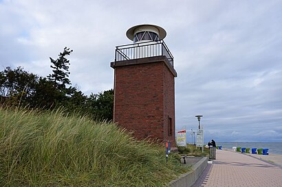
Leuchtturm Olhörn Address: Stockmannsweg street in Nordfriesland
Attractions near Leuchtturm Olhörn
Strandkrabbe,Lütje Hörn,Lüttmarschhalle,Haus Pidder Lyng,Strandkorbvermietung Wyk Station 2,Kalipsopreuß,Öffentliche Toilette Im Aquaföhr,Am Wellenbad,Ferienhäuser Bi de Hörn,Appartementvermietung Graf Luckner,Föhr Haus,Mehr Foehr,Ferienhäuser,Parkplatz Graf Luckner,Helen Prasser,Haus Brigg,Haus Kogge,Windsurfing Föhr,Kinderheim Haus Tanneck,Dlrg Wasserrettungsstation Wyk - Turm 2How to get to popular attractions in Nordfriesland with public transit
Bacardi, Hamburg-Nord,REWE CENTER, Schleswig-Holstein,Schmidts Tivoli, Hamburg-Mitte,ZOB Bad Oldesloe, Schleswig-Holstein,H BAB Auffahrt Stellingen, Eimsbüttel,H Haldesdorfer Straße, Wandsbek,H4 Hotel Hamburg Bergedorf, Bergedorf,Blohm+Voss Shipyards, Hamburg-Mitte,Groß Flottbek, Altona,Hamburg Airport Arrivals, Hamburg-Nord,Mümmelmannsberg, Hamburg-Mitte,Airbus Haus 25, Hamburg-Mitte,Ono by Steffen Henssler, Hamburg-Nord,Schleuse Geesthacht, Schleswig-Holstein,Schulauer Fährhaus & Willkomm Höft, Schleswig-Holstein,Strandkiosk (Ahoi), Altona,City Nord, Hamburg-Nord,Stormarnschule, Schleswig-Holstein,Othmarschen, Altona,S+U Ohlsdorf, Hamburg-NordGet around Hamburg & Schleswig-Holstein by public transit!
Traveling around Hamburg & Schleswig-Holstein has never been so easy. See step by step directions as you travel to any attraction, street or major public transit station. View bus and train schedules, arrival times, service alerts and detailed routes on a map, so you know exactly how to get to anywhere in Hamburg & Schleswig-Holstein.
When traveling to any destination around Hamburg & Schleswig-Holstein use Moovit's Live Directions with Get Off Notifications to know exactly where and how far to walk, how long to wait for your line, and how many stops are left. Moovit will alert you when it's time to get off — no need to constantly re-check whether yours is the next stop.
Wondering how to use public transit in Hamburg & Schleswig-Holstein or how to pay for public transit in Hamburg & Schleswig-Holstein? Moovit public transit app can help you navigate your way with public transit easily, and at minimum cost. It includes public transit fees, ticket prices, and costs. Looking for a map of Hamburg & Schleswig-Holstein public transit lines? Moovit public transit app shows all public transit maps in Hamburg & Schleswig-Holstein with all Bus, Train, Subway, Light Rail, Ferry and S-Bahn routes and stops on an interactive map.
Hamburg & Schleswig-Holstein has 6 transit type(s), including: Bus, Train, Subway, Light Rail, Ferry and S-Bahn, operated by several transit agencies, including Hamburger Verkehrsverbund (hvv), Hamburger Hochbahn AG, Deutsche Bahn AG, Verkehrsbetriebe Schleswig-Flensburg GmbH, Metronom, SchnellBusse, cantus Verkehrsgesellschaft, Nahreisezug, Nordbahn Eisenbahngesellschaft, CeBus GmbH & Co. KG, Schlepp- und Fährgesellschaft Kiel mbh (SFK), NordWestBahn, AKN, Kieler Verkehrsgesellschaft mbH, erixx