How to get to Light House by bus?
Click on the bus route to see step by step directions with maps, line arrival times and updated time schedules.
From Baneshwar Temple, Pune & Velhe
49 minFrom Giga Space, Pune & Velhe
48 minFrom Airtel office kharadi pune, Pune & Velhe
38 minFrom TCS Commerzone It Park, Pune & Velhe
36 minFrom Four Points by Sheraton, Pune & Velhe
49 minFrom Baner Pashan Link road, Pune & Velhe
60 minFrom Mulshi Dam, Paud
46 minFrom Shiv Srushti, Pune & Velhe
44 minFrom Vimannagar, Pune & Velhe
52 minFrom Cummins India Ltd., Pune & Velhe
39 min
How to get to Light House by metro?
Click on the metro route to see step by step directions with maps, line arrival times and updated time schedules.
Bus stops near Light House in Pune & Velhe
Metro stations near Light House in Pune & Velhe
Bus lines to Light House in Pune & Velhe
- 11, Marketyard - Pimplegurav,VIEW
- 12, Lokshahir Hon.Annabhau Sathe Bus Stand Upper Depot - Shivajinagar,VIEW
- 13, Lokshahir Hon.Annabhau Sathe Bus Stand Upper Depot - Shivajinagar,VIEW
- 19, Swargate - Yewalewadi,VIEW
- 22, Swargate - Vadachiwadi,VIEW
- 24, Katraj - MH Board Samtanagar,VIEW
- 26, Shivajinagar - Dhankawadi,VIEW
- 27, Bharati Vidyapeeth - Shivajinagar,VIEW
- 30, Marketyard - Ghotawade Phata,VIEW
- 38, Dhankawadi - Na.Ta.Wadi,VIEW
- 41, Lokshahir Hon.Annabhau Sathe Bus Stand Upper Depot - Sangvi Gaon,VIEW
- 42, Gujarwadi Phata Pmt Bus Stand - Nigdi Bhakti Shakti Terminal,VIEW
- 66, Thakarwadi - Marketyard,VIEW
- 68, Lokshahir Hon.Annabhau Sathe Bus Stand Upper Depot - Sutardara,VIEW
- 69, Marketyard - Ghotawade Gaon,VIEW
- 70, Marketyard - Mulshi Gaon,VIEW
- 71, Kothrud Depot ⟲ Kothrud Depot Via Sukhsagar Nagar (Circular),VIEW
- 72, Sukhsagarnagar - NDA Gate No.10,VIEW
- 78, Marketyard - NDA Gate No.10,VIEW
- 90, Katraj - Gokhale Nagar,VIEW
What are the closest stations to Light House?
The closest stations to Light House are:
- Lakshminarayan is 292 meters away, 4 min walk.
- Swargate is 303 meters away, 5 min walk.
- Laxminarayan Talkies is 319 meters away, 5 min walk.
- Parvati Darshan is 361 meters away, 5 min walk.
- Deccan Gymkhana is 2847 meters away, 37 min walk.
Which bus lines stop near Light House?
These bus lines stop near Light House: 233, 235, 236, 298, 30, 322, 72.
Which metro line stops near Light House?
PURPLE (Towards Swargate)
What’s the nearest metro station to Light House in Pune & Velhe?
The nearest metro station to Light House in Pune & Velhe is Swargate. It’s a 5 min walk away.
What’s the nearest bus station to Light House in Pune & Velhe?
The nearest bus station to Light House in Pune & Velhe is Lakshminarayan. It’s a 4 min walk away.
What time is the first metro to Light House in Pune & Velhe?
The PURPLE is the first metro that goes to Light House in Pune & Velhe. It stops nearby at 6:00 AM.
What time is the last metro to Light House in Pune & Velhe?
The PURPLE is the last metro that goes to Light House in Pune & Velhe. It stops nearby at 11:33 PM.
What time is the first bus to Light House in Pune & Velhe?
The RATRANI 2 is the first bus that goes to Light House in Pune & Velhe. It stops nearby at 3:00 AM.
What time is the last bus to Light House in Pune & Velhe?
The RATRANI 2 is the last bus that goes to Light House in Pune & Velhe. It stops nearby at 3:00 AM.
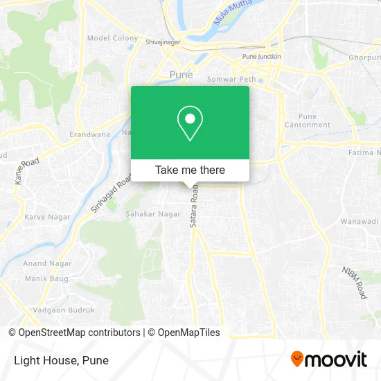
See Light House, Pune & Velhe, on the map
Public Transit to Light House in Pune & Velhe
Wondering how to get to Light House in Pune & Velhe? Moovit helps you find the best way to get to Light House with step-by-step directions from the nearest public transit station.
Moovit provides free maps and live directions to help you navigate through your city. View schedules, routes, timetables, and find out how long does it take to get to Light House in real time.
Looking for the nearest stop or station to Light House? Check out this list of stops closest to your destination: Lakshminarayan; Swargate; Laxminarayan Talkies; Parvati Darshan; Deccan Gymkhana.
Bus: 233, 235, 236, 298, 30, 322, 72, 11, 12, 13, 19, 22, 15, 17, 50, 52, 96, 216A, 2, 3, 4, 5, 6.Metro: PURPLE, AQUA.
Want to see if there’s another route that gets you there at an earlier time? Moovit helps you find alternative routes or times. Get directions from and directions to Light House easily from the Moovit App or Website.
We make riding to Light House easy, which is why over 1.5 million users, including users in Pune & Velhe, trust Moovit as the best app for public transit. You don’t need to download an individual bus app or train app, Moovit is your all-in-one transit app that helps you find the best bus time or train time available.
For information on prices of bus and metro, costs and ride fares to Light House, please check the Moovit app.
Use the app to navigate to popular places including to the airport, hospital, stadium, grocery store, mall, coffee shop, school, college, and university.
Light House Address: पुणे 411009 MH street in Pune & Velhe
- Mahabaleshwar, India,
- The Institute of Company Secretaries of India(ICSI),
- Mukund Nagar,
- Panchami,
- Cghs Polyclinic, Mukund Nagar,
- Pentagon,
- Mitra Mandal Colony,
- Art Housing Finance-India,
- Vaira Digital School,
- Nucleonics Traffic Equipmentts,
- swargate parking,
- Nagarsevak Late Arun Vishnupant Zagade Vahantal,
- Swargate bus Station,
- Kalubai Mandir,
- 7 Wonders Park,
- City International School,
- Yashwantrao Chavan Udyan Seven Wonders,
- Swargate Pmpml Bus Stand,
- Pridex Medicare,
- A1 Pizza Amul Kacchi Dabeli
Places Near Light House (Pune & Velhe)
- M G Road, Pune & Velhe,
- Tulshibaug, Pune & Velhe,
- Fc Road, Pune & Velhe,
- BAPS Shri Swaminarayan Mandir, Pune & Velhe,
- Dagdusheth Halwai Ganpati Mandir, Pune & Velhe,
- Vishwakarma Institute Of Technology (Vit), Pune & Velhe,
- ISKCON Pune, Pune & Velhe,
- Senapati Bapat Road, Pune & Velhe,
- Ion Digital Zone, Pune & Velhe,
- Chaturshringi Temple, Pune & Velhe,
- Swaminarayan Mandir, Pune & Velhe,
- ISKCON Nvcc Temple, Pune & Velhe,
- Cognizant Deccan Campus (CDC), Paud,
- Sarasbaug, Pune & Velhe,
- Laxmi Road, Pune & Velhe,
- Dagadusheth Halwai Ganapati Temple, Pune & Velhe,
- Symbiosis Lavale Bus Stop, Pune & Velhe,
- Pune Okayama Friendship Garden, Pune & Velhe,
- Westend Mall, Pune & Velhe,
- Pvr Icon - Pavilion Mall, Pune & Velhe
How to get to popular places in Pune with public transit
Get around Pune & Velhe by public transit!
Traveling around Pune & Velhe has never been so easy. See step by step directions as you travel to any attraction, street or major public transit station. View bus and train schedules, arrival times, service alerts and detailed routes on a map, so you know exactly how to get to anywhere in Pune & Velhe.
When traveling to any destination around Pune & Velhe use Moovit's Live Directions with Get Off Notifications to know exactly where and how far to walk, how long to wait for your line, and how many stops are left. Moovit will alert you when it's time to get off — no need to constantly re-check whether yours is the next stop.
Wondering how to use public transit in Pune & Velhe or how to pay for public transit in Pune & Velhe? Moovit public transit app can help you navigate your way with public transit easily, and at minimum cost. It includes public transit fees, ticket prices, and costs. Looking for a map of Pune & Velhe public transit lines? Moovit public transit app shows all public transit maps in Pune & Velhe with all Bus, Train and Metro routes and stops on an interactive map.
Pune has 3 transit type(s), including: Bus, Train and Metro, operated by several transit agencies, including Pune Metro (Maha Metro), PMPML, PMPML Night Bus Service (Ratrani) and Central Railways (Indian Railways)