Directions to Lighttackleanglers (Boston) with public transportation
The following transit lines have routes that pass near Lighttackleanglers
 Bus: 716, PROVIDENCE/STOUGHTON LINE SHUTTLE.
- Train: PROVIDENCE/STOUGHTON.
How to get to Lighttackleanglers by bus?
Click on the bus route to see step by step directions with maps, line arrival times and updated time schedules.
From Brockton, MA, Brockton
99 minFrom Good Samaritan Medical Center, Brockton
84 minFrom Dedham District Court, Dedham
98 minFrom Academy Of the Pacific Rim Charter Public School, Boston
82 minFrom Costco, Dedham
113 minFrom Georgetown, Massachusetts, Boston
72 minFrom Legacy Place, Dedham
111 minFrom Encompass Health Rehabilitation Hospital of Braintree, Braintree Town
141 minFrom Curry College, Milton
40 min
How to get to Lighttackleanglers by train?
Click on the train route to see step by step directions with maps, line arrival times and updated time schedules.
Bus stops near Lighttackleanglers in Boston
Train station near Lighttackleanglers in Boston
- Stoughton, 14 min walk,VIEW
Bus lines to Lighttackleanglers in Boston
What are the closest stations to Lighttackleanglers?
The closest stations to Lighttackleanglers are:
- Washington St Opp Canton Center Station - Bus Shuttle is 224 yards away, 3 min walk.
- Washington St Opp Canton Center Station is 224 yards away, 3 min walk.
- Stoughton is 1101 yards away, 14 min walk.
Which bus line stops near Lighttackleanglers?
716 (Mattapan)
Which train line stops near Lighttackleanglers?
PROVIDENCE/STOUGHTON (#831 | Providence)
What’s the nearest train station to Lighttackleanglers in Boston?
The nearest train station to Lighttackleanglers in Boston is Stoughton. It’s a 14 min walk away.
What’s the nearest bus station to Lighttackleanglers in Boston?
The nearest bus stations to Lighttackleanglers in Boston are Washington St Opp Canton Center Station - Bus Shuttle and Washington St Opp Canton Center Station. The closest one is a 3 min walk away.
What time is the first train to Lighttackleanglers in Boston?
The PROVIDENCE/STOUGHTON is the first train that goes to Lighttackleanglers in Boston. It stops nearby at 4:45 AM.
What time is the last train to Lighttackleanglers in Boston?
The PROVIDENCE/STOUGHTON is the last train that goes to Lighttackleanglers in Boston. It stops nearby at 12:25 AM.
What time is the first bus to Lighttackleanglers in Boston?
The PROVIDENCE/STOUGHTON LINE SHUTTLE is the first bus that goes to Lighttackleanglers in Boston. It stops nearby at 4:46 AM.
What time is the last bus to Lighttackleanglers in Boston?
The PROVIDENCE/STOUGHTON LINE SHUTTLE is the last bus that goes to Lighttackleanglers in Boston. It stops nearby at 12:37 AM.
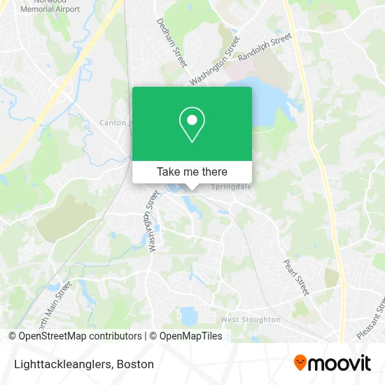
See Lighttackleanglers, Boston, on the map
Public Transit to Lighttackleanglers in Boston
Wondering how to get to Lighttackleanglers in Boston? Moovit helps you find the best way to get to Lighttackleanglers with step-by-step directions from the nearest public transit station.
Moovit provides free maps and live directions to help you navigate through your city. View schedules, routes, timetables, and find out how long does it take to get to Lighttackleanglers in real time.
Looking for the nearest stop or station to Lighttackleanglers? Check out this list of stops closest to your destination: Washington St Opp Canton Center Station - Bus Shuttle; Washington St Opp Canton Center Station; Stoughton.
Bus: 716, PROVIDENCE/STOUGHTON LINE SHUTTLE.Train: PROVIDENCE/STOUGHTON.
Want to see if there’s another route that gets you there at an earlier time? Moovit helps you find alternative routes or times. Get directions from and directions to Lighttackleanglers easily from the Moovit App or Website.
We make riding to Lighttackleanglers easy, which is why over 1.7 million users, including users in Boston, trust Moovit as the best app for public transit. You don’t need to download an individual bus app or train app, Moovit is your all-in-one transit app that helps you find the best bus time or train time available.
For information on prices of bus and train, costs and ride fares to Lighttackleanglers, please check the Moovit app.
Use the app to navigate to popular places including to the airport, hospital, stadium, grocery store, mall, coffee shop, school, college, and university.
Lighttackleanglers Address: 222 Bolivar St street in Boston
- Bosch Factory Certified Appliance Repair,
- Jack Conway Realtors - Canton Office,
- John Dolan Flooring, Kitchen and Bath,
- La Fitness,
- Waterfall Hills,
- Community Communications,
- Playa Bowls,
- Dime Aesthetics,
- Gather,
- Mimi's Bistro & Bakery,
- A Roberts Kenneth CPA,
- Canton Post Office,
- Emerging Markets Alternatives, LLC,
- USPS,
- American Auto Match,
- Advisors Living,
- The Law Office of Robert E. Burr Jr.,
- McDaid Insurance Agency,
- Stylists at Six Thirty,
- Mortgages at Canton Co-Operative Bank
Places Near Lighttackleanglers (Boston)
- Cheers, Boston,
- Boston Convention & Exhibition Center, Boston,
- Castle Island, Boston,
- Isabella Stewart Gardner Museum, Boston,
- Massachusetts General Hospital, Boston,
- Seaport District, Boston,
- Td Garden, Boston,
- North End, Boston,
- Prudential Center, Boston,
- Boston Common, Boston,
- Faneuil Hall, Boston,
- Museum Of Science, Boston,
- Leader Bank Pavilion (Leader Bank Pavillion), Boston,
- Wilbur Theatre, Boston,
- Quincy Market, Boston,
- Wang Theater, Boston,
- Boston Children's Hospital, Boston,
- House Of Blues, Boston,
- Boston Medical Center, Boston,
- Mgm Music Hall, Boston
How to get to popular places in Boston with public transit
Get around Boston by public transit!
Traveling around Boston has never been so easy. See step by step directions as you travel to any attraction, street or major public transit station. View bus and train schedules, arrival times, service alerts and detailed routes on a map, so you know exactly how to get to anywhere in Boston.
When traveling to any destination around Boston use Moovit's Live Directions with Get Off Notifications to know exactly where and how far to walk, how long to wait for your line, and how many stops are left. Moovit will alert you when it's time to get off — no need to constantly re-check whether yours is the next stop.
Wondering how to use public transit in Boston or how to pay for public transit in Boston? Moovit public transit app can help you navigate your way with public transit easily, and at minimum cost. It includes public transit fees, ticket prices, and costs. Looking for a map of Boston public transit lines? Moovit public transit app shows all public transit maps in Boston with all Bus, Train, Subway and Ferry routes and stops on an interactive map.
Boston has 4 transit type(s), including: Bus, Train, Subway and Ferry, operated by several transit agencies, including MBTA, Southeastern Regional Transit Authority, MetroWest Regional Transit Authority, Rhode Island Public Transit Authority, WRTA, Lowell Regional Transit Authority, Merrimack Valley Transit, Montachusett Regional Transit Authority, Cape Cod Regional Transit Authority, Brockton Area Transit Authority, Martha's Vineyard Transit Authority, the WAVE - Nantucket Regional Transit Authority, GATRA, Cape Ann Transportation Authority and Massport