How to get to Lilo Group by bus?
Click on the bus route to see step by step directions with maps, line arrival times and updated time schedules.
From Department of Children and Families, Miami
38 minFrom Florida, Miami
41 minFrom Jose Marti Park, Miami
47 minFrom Tri Rail Metrorail Transfer Station, Miami
93 minFrom Sunset Dr, Miami
36 minFrom 1351 NW 12th Ave, Miami
61 minFrom SW 104th St / US-1, Kendall-Palmetto Bay
107 minFrom Baptist Hospital, Kendall-Palmetto Bay
84 minFrom Bascom Palmer Eye Institute Emergency Room, Miami
74 minFrom Miami Dade Waste Disposal Center 2400 Sw 117 Ave, Kendale Lakes-Tamiami
61 min
Bus stops near Lilo Group in Miami
Bus lines to Lilo Group in Miami
What are the closest stations to Lilo Group?
The closest stations to Lilo Group are:
- Sw 8 St @ Sw 64 Av is 139 yards away, 2 min walk.
- Sw 8 St & Sw 64 Av is 156 yards away, 3 min walk.
- Sw 67 Av & Sw 8 St is 299 yards away, 4 min walk.
Which bus lines stop near Lilo Group?
These bus lines stop near Lilo Group: 73, 8.
What’s the nearest bus station to Lilo Group in Miami?
The nearest bus station to Lilo Group in Miami is Sw 8 St @ Sw 64 Av. It’s a 2 min walk away.
What time is the first bus to Lilo Group in Miami?
The 8 is the first bus that goes to Lilo Group in Miami. It stops nearby at 4:31 AM.
What time is the last bus to Lilo Group in Miami?
The 8 is the last bus that goes to Lilo Group in Miami. It stops nearby at 1:06 AM.
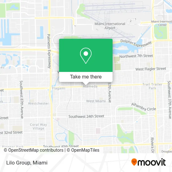
See Lilo Group, Miami, on the map
Public Transit to Lilo Group in Miami
Wondering how to get to Lilo Group in Miami? Moovit helps you find the best way to get to Lilo Group with step-by-step directions from the nearest public transit station.
Moovit provides free maps and live directions to help you navigate through your city. View schedules, routes, timetables, and find out how long does it take to get to Lilo Group in real time.
Looking for the nearest stop or station to Lilo Group? Check out this list of stops closest to your destination: Sw 8 St @ Sw 64 Av; Sw 8 St & Sw 64 Av; Sw 67 Av & Sw 8 St.
Bus: 73, 8, MIAFLAG.
Want to see if there’s another route that gets you there at an earlier time? Moovit helps you find alternative routes or times. Get directions from and directions to Lilo Group easily from the Moovit App or Website.
We make riding to Lilo Group easy, which is why over 1.5 million users, including users in Miami, trust Moovit as the best app for public transit. You don’t need to download an individual bus app or train app, Moovit is your all-in-one transit app that helps you find the best bus time or train time available.
For information on prices of bus and train, costs and ride fares to Lilo Group, please check the Moovit app.
Use the app to navigate to popular places including to the airport, hospital, stadium, grocery store, mall, coffee shop, school, college, and university.
Lilo Group Address: 6461 SW 8th St Miami, FL 33144 street in Miami
- Live Tatt2,
- Botanica Inshe Miami,
- Waruth Surplus,
- 305-800-Pain,
- 1good Pharmacy,
- Ginger Beauty,
- Southwest 8th Street & Southwest 64th Avenue,
- OCEAN BANK,
- West Miami Fl,
- Mauro J Cabrera DVM,
- The New Angel's Beauty Salon,
- Incometax8th St,
- Arturo Orta Beauty Salon,
- Toby Orthopaedics,
- Provocative Med Spa I,
- Daisy Joyeria,
- Calle Ocho Shopping Center,
- SW 8th St / SW 67th Ave,
- Alameda West,
- Iglesia Jesus El Camino
Places Near Lilo Group (Miami)
- Dolphin Mall, Miami,
- Port of Miami Cruise Terminal, Miami,
- Sawgrass Mall, Miami,
- Wynwood, Miami,
- Miami Design District, Miami,
- Keiser University Flagship Campus, West Palm Beach,
- Miami Freedom Park, Miami,
- Bayside Marketplace, Miami,
- Sawgrass mall ( FL ), Miami Beach,
- Dolphin Mall Bus, Miami,
- Little Havana, Miami,
- Miami VA Hospital, Miami,
- Zoo Miami, Miami,
- Miami-Dade County Courthouse, Miami,
- Aventura Mall, Miami,
- Marlins Park, Miami,
- Hard Rock Stadium, Miami Gardens,
- Richard E. Gerstein Justice Building, Miami,
- Brickell City Centre, Miami,
- Aventura Mall, Miami Beach
How to get to popular places in Miami with public transit
Get around Miami by public transit!
Traveling around Miami has never been so easy. See step by step directions as you travel to any attraction, street or major public transit station. View bus and train schedules, arrival times, service alerts and detailed routes on a map, so you know exactly how to get to anywhere in Miami.
When traveling to any destination around Miami use Moovit's Live Directions with Get Off Notifications to know exactly where and how far to walk, how long to wait for your line, and how many stops are left. Moovit will alert you when it's time to get off — no need to constantly re-check whether yours is the next stop.
Wondering how to use public transit in Miami or how to pay for public transit in Miami? Moovit public transit app can help you navigate your way with public transit easily, and at minimum cost. It includes public transit fees, ticket prices, and costs. Looking for a map of Miami public transit lines? Moovit public transit app shows all public transit maps in Miami with all Bus, Train, Light Rail and Ferry routes and stops on an interactive map.
Miami has 4 transit type(s), including: Bus, Train, Light Rail and Ferry, operated by several transit agencies, including Broward County Transit, Miami-Dade Transit, Metrorail, Palm Tran, Tri-Rail, Brightline, MARTY, City of Homestead Trolley, Key West Transit, Treasure Coast Connector, GoLine IRT, Amtrak, Greyhound-us, FlixBus-us and Aventura Express Shuttle Bus