Directions to Lina Rios, Do (Randolph) with public transportation
The following transit lines have routes that pass near Lina Rios, Do
 Bus: 12, 238, 240.
- Train: FALL RIVER/NEW BEDFORD.
How to get to Lina Rios, Do by bus?
Click on the bus route to see step by step directions with maps, line arrival times and updated time schedules.
From Good Samaritan Medical Center, Brockton
46 minFrom Quincy Center Station, Quincy
49 minFrom South Shore Plaza Mbta Bus Stop, Braintree Town
22 minFrom Beth Israel Deaconess Hospital-Milton, Milton
19 minFrom Quincy Market, Quincy
54 minFrom South Shore Plaza, Braintree Town
27 minFrom Milton, MA, Milton
38 minFrom Quincy, MA, Quincy
56 minFrom Curry College, Milton
64 min
How to get to Lina Rios, Do by train?
Click on the train route to see step by step directions with maps, line arrival times and updated time schedules.
Bus stops near Lina Rios, Do in Randolph
What are the closest stations to Lina Rios, Do?
The closest stations to Lina Rios, Do are:
- North Main St And School St is 135 yards away, 2 min walk.
- N Main St Opp Warren St is 170 yards away, 3 min walk.
- N Main St Opp Memorial Pkwy is 316 yards away, 4 min walk.
Which bus lines stop near Lina Rios, Do?
These bus lines stop near Lina Rios, Do: 12, 238, 240.
Which train line stops near Lina Rios, Do?
FALL RIVER/NEW BEDFORD (#1909 | Fall River)
What’s the nearest bus station to Lina Rios, Do in Randolph?
The nearest bus station to Lina Rios, Do in Randolph is North Main St And School St. It’s a 2 min walk away.
What time is the first bus to Lina Rios, Do in Randolph?
The 240 is the first bus that goes to Lina Rios, Do in Randolph. It stops nearby at 4:40 AM.
What time is the last bus to Lina Rios, Do in Randolph?
The 240 is the last bus that goes to Lina Rios, Do in Randolph. It stops nearby at 1:18 AM.
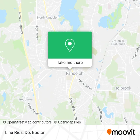
See Lina Rios, Do, Randolph, on the map
Public Transit to Lina Rios, Do in Randolph
Wondering how to get to Lina Rios, Do in Randolph? Moovit helps you find the best way to get to Lina Rios, Do with step-by-step directions from the nearest public transit station.
Moovit provides free maps and live directions to help you navigate through your city. View schedules, routes, timetables, and find out how long does it take to get to Lina Rios, Do in real time.
Looking for the nearest stop or station to Lina Rios, Do? Check out this list of stops closest to your destination: North Main St And School St; N Main St Opp Warren St; N Main St Opp Memorial Pkwy.
Bus: 12, 238, 240.Train: FALL RIVER/NEW BEDFORD.
Want to see if there’s another route that gets you there at an earlier time? Moovit helps you find alternative routes or times. Get directions from and directions to Lina Rios, Do easily from the Moovit App or Website.
We make riding to Lina Rios, Do easy, which is why over 1.7 million users, including users in Randolph, trust Moovit as the best app for public transit. You don’t need to download an individual bus app or train app, Moovit is your all-in-one transit app that helps you find the best bus time or train time available.
For information on prices of bus, train and subway, costs and ride fares to Lina Rios, Do, please check the Moovit app.
Use the app to navigate to popular places including to the airport, hospital, stadium, grocery store, mall, coffee shop, school, college, and university.
Lina Rios, Do Address: 25 Warren St street in Randolph
- Tori Japan,
- Randolph Garage Door Repair Garage Door,
- Randolph, MA,
- East Coast Laundry,
- ATM Walgreens,
- Abington Bank,
- Functional Therapy and Rehab,
- Pho 98 Vietnamese Cuisine,
- The Haitian American Business Expo, Inc.,
- ABC Commercial,
- Robinson,
- Lamour Patrice Ma Lamour by Design,
- Americas Food Basket,
- Premier Auto Collision,
- TAC-9 Radio,
- Kayliany Aesthetic,
- E-Flow Beauty Salon,
- Nickys Variety Store,
- New Life Counseling and Wellness Center, Inc.,
- Timmy Taylor
Places Near Lina Rios, Do (Randolph)
- Boston Convention & Exhibition Center, Boston,
- Wilbur Theatre, Boston,
- House Of Blues, Boston,
- North End, Boston,
- Isabella Stewart Gardner Museum, Boston,
- Mgm Music Hall, Boston,
- Boston Medical Center, Boston,
- Castle Island, Boston,
- Td Garden, Boston,
- Quincy Market, Boston,
- Leader Bank Pavilion (Leader Bank Pavillion), Boston,
- Museum Of Science, Boston,
- Prudential Center, Boston,
- Boston Children's Hospital, Boston,
- Faneuil Hall, Boston,
- Massachusetts General Hospital, Boston,
- Wang Theater, Boston,
- Seaport District, Boston,
- Boston Common, Boston,
- Cheers, Boston
How to get to popular places in Boston with public transit
Get around Randolph by public transit!
Traveling around Randolph has never been so easy. See step by step directions as you travel to any attraction, street or major public transit station. View bus and train schedules, arrival times, service alerts and detailed routes on a map, so you know exactly how to get to anywhere in Randolph.
When traveling to any destination around Randolph use Moovit's Live Directions with Get Off Notifications to know exactly where and how far to walk, how long to wait for your line, and how many stops are left. Moovit will alert you when it's time to get off — no need to constantly re-check whether yours is the next stop.
Wondering how to use public transit in Randolph or how to pay for public transit in Randolph? Moovit public transit app can help you navigate your way with public transit easily, and at minimum cost. It includes public transit fees, ticket prices, and costs. Looking for a map of Randolph public transit lines? Moovit public transit app shows all public transit maps in Randolph with all Bus, Train, Subway and Ferry routes and stops on an interactive map.
Boston has 4 transit type(s), including: Bus, Train, Subway and Ferry, operated by several transit agencies, including MBTA, Southeastern Regional Transit Authority, MetroWest Regional Transit Authority, Rhode Island Public Transit Authority, WRTA, Lowell Regional Transit Authority, Merrimack Valley Transit, Montachusett Regional Transit Authority, Cape Cod Regional Transit Authority, Brockton Area Transit Authority, Martha's Vineyard Transit Authority, the WAVE - Nantucket Regional Transit Authority, GATRA, Cape Ann Transportation Authority and Massport