Directions to Lincoln Commons Playground (Malden) with public transportation
The following transit lines have routes that pass near Lincoln Commons Playground
 Bus: 104, 105.
- Train: HAVERHILL, ORANGE LINE, NEWBURYPORT/ROCKPORT.
- Subway: ORANGE LINE.
How to get to Lincoln Commons Playground by bus?
Click on the bus route to see step by step directions with maps, line arrival times and updated time schedules.
From Simmons College, Boston
57 minFrom Mount Auburn Hospital, Cambridge
68 minFrom Woburn, MA, Woburn
56 minFrom Whole Foods Market, Boston
61 minFrom Northeastern University, Boston
97 minFrom COURTYARD-Boston Cambridge (Cambridge Marriott), Cambridge
61 minFrom Shapiro Center, Boston
87 minFrom Boston Medical Center / Shapiro Center, Boston
87 minFrom SoWa Vintage Market, Boston
82 minFrom Park Plaza Hotel Boston, Boston
62 min
How to get to Lincoln Commons Playground by subway?
Click on the subway route to see step by step directions with maps, line arrival times and updated time schedules.
From Simmons College, Boston
79 minFrom Mount Auburn Hospital, Cambridge
80 minFrom Whole Foods Market, Boston
56 minFrom Northeastern University, Boston
56 minFrom COURTYARD-Boston Cambridge (Cambridge Marriott), Cambridge
76 minFrom Shapiro Center, Boston
71 minFrom Boston Medical Center / Shapiro Center, Boston
70 minFrom SoWa Vintage Market, Boston
60 minFrom Park Plaza Hotel Boston, Boston
57 min
Bus stop near Lincoln Commons Playground in Malden
- Cross St @ Henry St, 1 min walk,VIEW
Train stations near Lincoln Commons Playground in Malden
Bus lines to Lincoln Commons Playground in Malden
- 105, Sullivan,VIEW
What are the closest stations to Lincoln Commons Playground?
The closest stations to Lincoln Commons Playground are:
- Cross St @ Henry St is 59 yards away, 1 min walk.
- Oak Grove is 2489 yards away, 30 min walk.
- Chelsea is 3480 yards away, 44 min walk.
Which bus lines stop near Lincoln Commons Playground?
These bus lines stop near Lincoln Commons Playground: 104, 105.
Which subway line stops near Lincoln Commons Playground?
ORANGE LINE (Oak Grove)
What’s the nearest train station to Lincoln Commons Playground in Malden?
The nearest train station to Lincoln Commons Playground in Malden is Oak Grove. It’s a 30 min walk away.
What’s the nearest bus station to Lincoln Commons Playground in Malden?
The nearest bus station to Lincoln Commons Playground in Malden is Cross St @ Henry St. It’s a 1 min walk away.
What time is the first subway to Lincoln Commons Playground in Malden?
The ORANGE LINE is the first subway that goes to Lincoln Commons Playground in Malden. It stops nearby at 5:15 AM.
What time is the last subway to Lincoln Commons Playground in Malden?
The ORANGE LINE is the last subway that goes to Lincoln Commons Playground in Malden. It stops nearby at 1:59 AM.
What time is the first train to Lincoln Commons Playground in Malden?
The HAVERHILL is the first train that goes to Lincoln Commons Playground in Malden. It stops nearby at 5:35 AM.
What time is the last train to Lincoln Commons Playground in Malden?
The NEWBURYPORT/ROCKPORT is the last train that goes to Lincoln Commons Playground in Malden. It stops nearby at 12:06 AM.
What time is the first bus to Lincoln Commons Playground in Malden?
The 105 is the first bus that goes to Lincoln Commons Playground in Malden. It stops nearby at 5:03 AM.
What time is the last bus to Lincoln Commons Playground in Malden?
The 105 is the last bus that goes to Lincoln Commons Playground in Malden. It stops nearby at 7:51 PM.
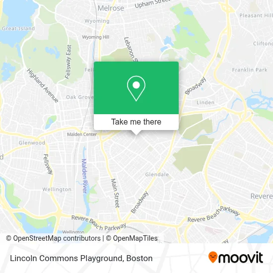
See Lincoln Commons Playground, Malden, on the map
Public Transit to Lincoln Commons Playground in Malden
Wondering how to get to Lincoln Commons Playground in Malden? Moovit helps you find the best way to get to Lincoln Commons Playground with step-by-step directions from the nearest public transit station.
Moovit provides free maps and live directions to help you navigate through your city. View schedules, routes, timetables, and find out how long does it take to get to Lincoln Commons Playground in real time.
Looking for the nearest stop or station to Lincoln Commons Playground? Check out this list of stops closest to your destination: Cross St @ Henry St; Oak Grove; Chelsea.
Bus: 104, 105.Train: HAVERHILL, ORANGE LINE, NEWBURYPORT/ROCKPORT.Subway: ORANGE LINE.
Want to see if there’s another route that gets you there at an earlier time? Moovit helps you find alternative routes or times. Get directions from and directions to Lincoln Commons Playground easily from the Moovit App or Website.
We make riding to Lincoln Commons Playground easy, which is why over 1.7 million users, including users in Malden, trust Moovit as the best app for public transit. You don’t need to download an individual bus app or train app, Moovit is your all-in-one transit app that helps you find the best bus time or train time available.
For information on prices of bus and subway, costs and ride fares to Lincoln Commons Playground, please check the Moovit app.
Use the app to navigate to popular places including to the airport, hospital, stadium, grocery store, mall, coffee shop, school, college, and university.
Lincoln Commons Playground Address: Cross St street in Malden
- Dogs for Days,
- City of Malden,
- Malden Life Insurance,
- Ie Commercial Floor Cleaning,
- Southern Baptist Convention,
- Thistle Safe and Lock Co Inc,
- Artistic Video Productions,
- D & D Construction,
- Alvim Team - Personal Training Studio,
- Malden Mission Ame Church,
- Ferryway School,
- Portillo Brothers Market II,
- Mystic Valley Regional Charter School-K,
- Mystic Valley Charter School (Mystic Valley Regional Charter School Turf Field),
- Justice Gladys,
- World Depot,
- Nego VIP Cleaning Services,
- Pk Motor Cars,
- Malden Mobile Locksmith Store,
- United Auto Repair & Collision Center
Places Near Lincoln Commons Playground (Malden)
- Leader Bank Pavilion (Leader Bank Pavillion), Boston,
- Seaport District, Boston,
- North End, Boston,
- Mgm Music Hall, Boston,
- Isabella Stewart Gardner Museum, Boston,
- Boston Medical Center, Boston,
- Prudential Center, Boston,
- Museum Of Science, Boston,
- Castle Island, Boston,
- Boston Children's Hospital, Boston,
- Wilbur Theatre, Boston,
- Massachusetts General Hospital, Boston,
- Boston Convention & Exhibition Center, Boston,
- House Of Blues, Boston,
- Quincy Market, Boston,
- Cheers, Boston,
- Td Garden, Boston,
- Wang Theater, Boston,
- Boston Common, Boston,
- Faneuil Hall, Boston
How to get to popular places in Boston with public transit
Get around Malden by public transit!
Traveling around Malden has never been so easy. See step by step directions as you travel to any attraction, street or major public transit station. View bus and train schedules, arrival times, service alerts and detailed routes on a map, so you know exactly how to get to anywhere in Malden.
When traveling to any destination around Malden use Moovit's Live Directions with Get Off Notifications to know exactly where and how far to walk, how long to wait for your line, and how many stops are left. Moovit will alert you when it's time to get off — no need to constantly re-check whether yours is the next stop.
Wondering how to use public transit in Malden or how to pay for public transit in Malden? Moovit public transit app can help you navigate your way with public transit easily, and at minimum cost. It includes public transit fees, ticket prices, and costs. Looking for a map of Malden public transit lines? Moovit public transit app shows all public transit maps in Malden with all Bus, Train, Subway and Ferry routes and stops on an interactive map.
Boston has 4 transit type(s), including: Bus, Train, Subway and Ferry, operated by several transit agencies, including MBTA, Southeastern Regional Transit Authority, MetroWest Regional Transit Authority, Rhode Island Public Transit Authority, WRTA, Lowell Regional Transit Authority, Merrimack Valley Transit, Montachusett Regional Transit Authority, Cape Cod Regional Transit Authority, Brockton Area Transit Authority, Martha's Vineyard Transit Authority, the WAVE - Nantucket Regional Transit Authority, GATRA, Cape Ann Transportation Authority and Massport