How to get to Lindo Parque by bus?
Click on the bus route to see step by step directions with maps, line arrival times and updated time schedules.
From 760D Niterói X Galeão, Niterói
42 minFrom UFF - Universidade Federal Fluminense, Niterói
47 minFrom Avenida Sete de Setembro 7, Niterói
51 minFrom UFF - Campus da Praia Vermelha, Niterói
49 minFrom Casa de Saúde Santa Martha, Niterói
59 minFrom Campo de São Bento, Niterói
42 minFrom Rua Mariz e Barros, Niterói
51 minFrom Niteroi-RJ, Niterói
47 minFrom Museu de Arte Contemporânea de Niterói (MAC), Niterói
52 minFrom camboinhas, Niterói
81 min
Bus stops near Lindo Parque in São Gonçalo
Bus lines to Lindo Parque in São Gonçalo
- 02, Circular CEASA (via Amaral Peixoto - Anti-horário),VIEW
- 520D, Estácio,VIEW
- 528, Galo Branco,VIEW
- 529, Ceasa,VIEW
- 531, Jardim Alcântara,VIEW
- 2520D (EXECUTIVO), Jardim Alcântara,VIEW
- 144C, Caxias,VIEW
- 516M, Mutuapira,VIEW
- 1931D, Duque De Caxias,VIEW
- 535, Estácio,VIEW
- 545, Passeio,VIEW
- 2545, Castelo,VIEW
- 4545, Castelo Expresso,VIEW
- 12, Covanca,VIEW
- 12A, Venda Da Cruz,VIEW
- 48, Zumbi,VIEW
- 48A, Engenho Pequeno,VIEW
- 425D, Campo Grande (Via Dr. March),VIEW
- 530, Niterói,VIEW
- 532M, Niterói,VIEW
What are the closest stations to Lindo Parque?
The closest stations to Lindo Parque are:
- Avenida Humberto De Alencar Castelo Branco, 1079 is 44 meters away, 1 min walk.
- Rua Coronel Cerrado Santa Catarina São Gonçalo - Rio De Janeiro 24440 Brasil is 409 meters away, 6 min walk.
- Rua Coronel Serrado, 331 is 430 meters away, 6 min walk.
- Rua Coronel Serrado, 538 is 509 meters away, 7 min walk.
Which bus lines stop near Lindo Parque?
These bus lines stop near Lindo Parque: 528, 529, 531.
What’s the nearest bus station to Lindo Parque in São Gonçalo?
The nearest bus station to Lindo Parque in São Gonçalo is Avenida Humberto De Alencar Castelo Branco, 1079. It’s a 1 min walk away.
What time is the first bus to Lindo Parque in São Gonçalo?
The 531 is the first bus that goes to Lindo Parque in São Gonçalo. It stops nearby at 3:00 AM.
What time is the last bus to Lindo Parque in São Gonçalo?
The 531 is the last bus that goes to Lindo Parque in São Gonçalo. It stops nearby at 2:54 AM.
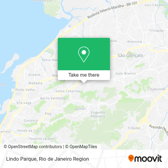
See Lindo Parque, São Gonçalo, on the map
Public Transit to Lindo Parque in São Gonçalo
Wondering how to get to Lindo Parque in São Gonçalo? Moovit helps you find the best way to get to Lindo Parque with step-by-step directions from the nearest public transit station.
Moovit provides free maps and live directions to help you navigate through your city. View schedules, routes, timetables, and find out how long does it take to get to Lindo Parque in real time.
Looking for the nearest stop or station to Lindo Parque? Check out this list of stops closest to your destination: Avenida Humberto De Alencar Castelo Branco; Rua Coronel Cerrado Santa Catarina São Gonçalo - Rio De Janeiro 24440 Brasil; Rua Coronel Serrado; Rua Coronel Serrado.
Bus: 528, 529, 531, 02, 520D, 144C, 516M, 1931D, 535, 545, 2545, 4545, 12, 13, 56.
Want to see if there’s another route that gets you there at an earlier time? Moovit helps you find alternative routes or times. Get directions from and directions to Lindo Parque easily from the Moovit App or Website.
We make riding to Lindo Parque easy, which is why over 1.7 million users, including users in São Gonçalo, trust Moovit as the best app for public transit. You don’t need to download an individual bus app or train app, Moovit is your all-in-one transit app that helps you find the best bus time or train time available.
For information on prices of bus, costs and ride fares to Lindo Parque, please check the Moovit app.
Use the app to navigate to popular places including to the airport, hospital, stadium, grocery store, mall, coffee shop, school, college, and university.
Lindo Parque Address: Avenida Humberto de Alencar Castelo Branco Lindo Parque II São Gonçalo-RJ 24420-060 street in São Gonçalo
- C.M. Amaral Peixoto,
- Igreja de Sao Jorge,
- Smash Academia de Tennis,
- Associacao de Moradores e Amigos do Coio,
- Hbl Toldos e Coberturas,
- Lindo Parque I,
- Vidraçaria Avenida Edson,
- Karyn Bessa Aulas de Programacao,
- Açaí do Coió Lanches,
- Rua Marcolino Dantas / Rua Júlia Guilherme,
- Favela do Coió - Lindo Parque,
- Conselho Escolar do Colegio Municipal Amaral Peixoto,
- Hospital São José dos Lírios,
- Casa de Saúde São José dos Lírios,
- Escola Estadual Merícia Quaresma,
- primaz,
- Lufe Eventos,
- Centro Espírita Pai Xangô,
- Ze Garoto,
- Escola Cristã Semear
Places Near Lindo Parque (São Gonçalo)
- Norte Shopping, Cachambi,
- Rodoviária Novo Rio (Rodoviária do Rio de Janeiro), Santo Cristo,
- Hospital Municipal Ronaldo Gazolla, Acari,
- Praia do Arpoador, Ipanema,
- Avenida Rio Branco, Centro,
- Hospital Federal Cardoso Fontes, Jacarepaguá,
- Niterói, Niterói,
- Shopping RioSul, Botafogo,
- Rio De Janeiro,
- Shopping Rio Sul, Botafogo,
- Rua Ulysses Guimarães 16, Cidade Nova,
- Feira Livre da Gloria, Glória,
- Shopping Nova América, Del Castilho,
- Hospital Pedro Ernesto, Vila Isabel,
- Hospital Federal Do Andaraí, Andaraí,
- Shopping Downtown, Barra Da Tijuca,
- Rua Licínio Cardoso, São Francisco Xavier,
- Museu Do Amanhã, Centro,
- Feirão De Malhas, Duque De Caxias,
- Avenida Venezuela 134, Saúde
How to get to popular places in Rio de Janeiro Region with public transit
Get around São Gonçalo by public transit!
Traveling around São Gonçalo has never been so easy. See step by step directions as you travel to any attraction, street or major public transit station. View bus and train schedules, arrival times, service alerts and detailed routes on a map, so you know exactly how to get to anywhere in São Gonçalo.
When traveling to any destination around São Gonçalo use Moovit's Live Directions with Get Off Notifications to know exactly where and how far to walk, how long to wait for your line, and how many stops are left. Moovit will alert you when it's time to get off — no need to constantly re-check whether yours is the next stop.
Wondering how to use public transit in São Gonçalo or how to pay for public transit in São Gonçalo? Moovit public transit app can help you navigate your way with public transit easily, and at minimum cost. It includes public transit fees, ticket prices, and costs. Looking for a map of São Gonçalo public transit lines? Moovit public transit app shows all public transit maps in São Gonçalo with all Bus, Train, Metro, Light Rail, Ferry, Cable Car, Gondola and Funicular routes and stops on an interactive map.
Rio de Janeiro Region has 8 transit type(s), including: Bus, Train, Metro, Light Rail, Ferry, Cable Car, Gondola and Funicular, operated by several transit agencies, including TrensRJ, Metrô Rio, VLT Carioca, Barcas Rio, BRT MOBI-Rio, Auto Viação Alpha, Auto Viação Tijuca, Gire Transportes, Transurb, Viação Nossa Senhora das Graças, Consórcio INTERSUL, Braso Lisboa (Municipal), Caprichosa Auto Ônibus, Auto Viação Três Amigos and Rodoviária Âncora Matias