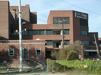
See Lindy Boggs Medical Center, New Orleans, on the map
Directions to Lindy Boggs Medical Center (New Orleans) with public transportation
The following transit lines have routes that pass near Lindy Boggs Medical Center
 Bus:
Bus: - Streetcar:
How to get to Lindy Boggs Medical Center by bus?
Click on the bus route to see step by step directions with maps, line arrival times and updated time schedules.
Streetcar stations near Lindy Boggs Medical Center in New Orleans
- Canal + Telemachus (Out),4 min walk,
Bus stations near Lindy Boggs Medical Center in New Orleans
- Orleans at Norman C. Francis,8 min walk,
- N. Carrollton at Bienville,8 min walk,
Bus lines to Lindy Boggs Medical Center in New Orleans
- 32,Children's Hospital,
- 31,Children's Hospital,
What are the closest stations to Lindy Boggs Medical Center?
The closest stations to Lindy Boggs Medical Center are:
- Canal + Telemachus (Out) is 252 yards away, 4 min walk.
- Orleans at Norman C. Francis is 572 yards away, 8 min walk.
- N. Carrollton at Bienville is 622 yards away, 8 min walk.
Which bus lines stop near Lindy Boggs Medical Center?
These bus lines stop near Lindy Boggs Medical Center: 3, 32, 9, E2.
Which Streetcar lines stop near Lindy Boggs Medical Center?
These Streetcar lines stop near Lindy Boggs Medical Center: 47, 48.
What’s the nearest Streetcar station to Lindy Boggs Medical Center in New Orleans?
The nearest Streetcar station to Lindy Boggs Medical Center in New Orleans is Canal + Telemachus (Out). It’s a 4 min walk away.
What’s the nearest bus stop to Lindy Boggs Medical Center in New Orleans?
The nearest bus stops to Lindy Boggs Medical Center in New Orleans are Orleans at Norman C. Francis and N. Carrollton at Bienville. The closest one is a 8 min walk away.
What time is the first Streetcar to Lindy Boggs Medical Center in New Orleans?
The 47 is the first Streetcar that goes to Lindy Boggs Medical Center in New Orleans. It stops nearby at 3:15 AM.
What time is the last Streetcar to Lindy Boggs Medical Center in New Orleans?
The 47 is the last Streetcar that goes to Lindy Boggs Medical Center in New Orleans. It stops nearby at 3:15 AM.
What time is the first bus to Lindy Boggs Medical Center in New Orleans?
The 32 is the first bus that goes to Lindy Boggs Medical Center in New Orleans. It stops nearby at 5:28 AM.
What time is the last bus to Lindy Boggs Medical Center in New Orleans?
The 32 is the last bus that goes to Lindy Boggs Medical Center in New Orleans. It stops nearby at 11:13 PM.
See Lindy Boggs Medical Center, New Orleans, on the map
Public Transit to Lindy Boggs Medical Center in New Orleans
Wondering how to get to Lindy Boggs Medical Center in New Orleans, United States? Moovit helps you find the best way to get to Lindy Boggs Medical Center with step-by-step directions from the nearest public transit station.
Moovit provides free maps and live directions to help you navigate through your city. View schedules, routes, timetables, and find out how long does it take to get to Lindy Boggs Medical Center in real time.
Looking for the nearest stop or station to Lindy Boggs Medical Center? Check out this list of stops closest to your destination: Canal + Telemachus (Out); Orleans at Norman C. Francis; N. Carrollton at Bienville.
Bus:Streetcar:
Want to see if there’s another route that gets you there at an earlier time? Moovit helps you find alternative routes or times. Get directions from and directions to Lindy Boggs Medical Center easily from the Moovit App or Website.
We make riding to Lindy Boggs Medical Center easy, which is why over 1.5 million users, including users in New Orleans, trust Moovit as the best app for public transit. You don’t need to download an individual bus app or train app, Moovit is your all-in-one transit app that helps you find the best bus time or train time available.
For information on prices of bus and Streetcar, costs and ride fares to Lindy Boggs Medical Center, please check the Moovit app.
Use the app to navigate to popular places including to the airport, hospital, stadium, grocery store, mall, coffee shop, school, college, and university.
Lindy Boggs Medical Center Address: Conti Street street in New Orleans
Attractions near Lindy Boggs Medical Center
Albert S Johnson MD,St. Margaret's at Mercy,Hogs for the Cause,Nyx Playground,FedEx,JW's Creative Solutions,Beth Christensen, PHD, NCC, LPC,Life Louisiana Mental Health Therapy and Counseling,Dr Matthew Morris, PHD,Neyow's Creole Café,Marilyn Dennis Wedding Officiant,Mid-City Bayou Boogaloo,Mid-City Auto Title,Womack Edward Dr,Womac Law Firm,Boys Town Louisiana,Smoke & Honey,The Love of People,Morgan Joanen,Law Office of Greta L WilsonHow to get to popular attractions in New Orleans with public transit
Lucky Title Auto Transfer & Notary Service, Gretna,Chais Delachaise, New Orleans,Jackson Square, New Orleans,RTA Streetcar City Park, New Orleans,Maple Street, New Orleans,Treme, New Orleans,Julia Street Wharf, New Orleans,james carville mary matlin's house, New Orleans,Southern University at New Orleans - Park Campus, New Orleans,300th Block of S. Jefferson Davis, New Orleans,Grace King High, Metairie,Ricrack Nola, New Orleans,Joey K's, New Orleans,NOPSI Hotel New Orleans, New Orleans,NORTA Bus Stop #1603, New Orleans,Maison St. Charles Hotel & Suites, New Orleans,New Orleans Magazine, Metairie,Ms Genevieve's Dungeon, New Orleans,Eric 'Big E' Airport Transportation Service, New Orleans,Bullard Exit, New OrleansGet around New Orleans by public transit!
Traveling around New Orleans has never been so easy. See step by step directions as you travel to any attraction, street or major public transit station. View bus and train schedules, arrival times, service alerts and detailed routes on a map, so you know exactly how to get to anywhere in New Orleans.
When traveling to any destination around New Orleans use Moovit's Live Directions with Get Off Notifications to know exactly where and how far to walk, how long to wait for your line, and how many stops are left. Moovit will alert you when it's time to get off — no need to constantly re-check whether yours is the next stop.
Wondering how to use public transit in New Orleans or how to pay for public transit in New Orleans? Moovit public transit app can help you navigate your way with public transit easily, and at minimum cost. It includes public transit fees, ticket prices, and costs. Looking for a map of New Orleans public transit lines? Moovit public transit app shows all public transit maps in New Orleans with all bus or Streetcar routes and stops on an interactive map.
New Orleans has 2 transit type(s), including: bus or Streetcar, operated by several transit agencies, including New Orleans RTA , New Orleans RTA , New Orleans RTA , JP Transit , Megabus, FlixBus-us and Greyhound-us