Directions to Linksquares (Boston) with public transportation
The following transit lines have routes that pass near Linksquares
 Bus: 354, 501, 504, 7, SL4.
- Train: FAIRMOUNT, FRAMINGHAM/WORCESTER, GREENBUSH, HAVERHILL.
- Subway: GREEN LINE D, ORANGE LINE, BLUE LINE, GREEN LINE B, GREEN LINE C.
How to get to Linksquares by bus?
Click on the bus route to see step by step directions with maps, line arrival times and updated time schedules.
From Qea, Quincy
105 minFrom Christian A Herter Park, Boston
72 minFrom Dorchester, Boston
66 minFrom UMass Boston Campus Center, Boston
67 minFrom The Mall At Chestnut Hill, Newton
81 minFrom Mount Auburn, Cambridge
69 minFrom Melrose, MA, Melrose
63 minFrom Arlington, MA, Arlington
75 minFrom FOUR POINTS BY SHERATON Boston Newton, Newton
37 minFrom JFK Library, Boston
66 min
How to get to Linksquares by train?
Click on the train route to see step by step directions with maps, line arrival times and updated time schedules.
How to get to Linksquares by subway?
Click on the subway route to see step by step directions with maps, line arrival times and updated time schedules.
Bus stops near Linksquares in Boston
- Pearl St @ Congress St, 5 min walk,VIEW
- Congress St @ State St, 6 min walk,VIEW
- State St @ Washington Mall - State St Sta, 6 min walk,VIEW
- Haymarket - Congress St Opp Hanover St, 6 min walk,VIEW
- State, 7 min walk,VIEW
- Congress St @ Haymarket Sta, 8 min walk,VIEW
- Cambridge St @ Government Ctr Sta, 9 min walk,VIEW
Bus lines to Linksquares in Boston
- 4, North Station,VIEW
- 15, Haymarket Via Fields Corner & Nubian,VIEW
- 39, Haymarket Via Forest Hills,VIEW
- 57, Haymarket Via Kenmore,VIEW
- 92, Sullivan,VIEW
- 93, Sullivan Via Navy Yard,VIEW
- RED LINE SHUTTLE, Harvard - JFK/UMass via Congress Street,VIEW
- RED LINE SHUTTLE, Harvard - Broadway,VIEW
- RED LINE SHUTTLE, Kendall/MIT - JFK/UMass,VIEW
- RED LINE SHUTTLE, JFK/UMass - Kendall/MIT (Shuttle),VIEW
- 116, Maverick - Wonderland,VIEW
- 354, Boston (Express) via Woburn - Burlington (Express) via Woburn,VIEW
- BLUE LINE SHUTTLE, Airport - Government Center (Express),VIEW
- BLUE LINE SHUTTLE, Airport - Government Center via Maverick,VIEW
- BLUE LINE SHUTTLE, Orient Heights - Government Center (Local),VIEW
- BLUE LINE SHUTTLE, Orient Heights - Government Center (Express),VIEW
- BLUE LINE SHUTTLE, Airport - Government Center (Local),VIEW
- BLUE LINE SHUTTLE, Wonderland - Government Center,VIEW
- RED LINE SHUTTLE, Harvard - JFK/UMass via State Street,VIEW
- GREEN LINE SHUTTLE, North Station (Shuttle),VIEW
What are the closest stations to Linksquares?
The closest stations to Linksquares are:
- State Street is 285 yards away, 4 min walk.
- Pearl St @ Congress St is 326 yards away, 5 min walk.
- Congress St @ State St is 417 yards away, 6 min walk.
- State St @ Washington Mall - State St Sta is 425 yards away, 6 min walk.
- Haymarket - Congress St Opp Hanover St is 452 yards away, 6 min walk.
- State is 509 yards away, 7 min walk.
- Haymarket is 584 yards away, 7 min walk.
- Congress St @ Haymarket Sta is 600 yards away, 8 min walk.
- Cambridge St @ Government Ctr Sta is 698 yards away, 9 min walk.
Which bus lines stop near Linksquares?
These bus lines stop near Linksquares: 354, 501, 504, 7, SL4, SL5.
Which train lines stop near Linksquares?
These train lines stop near Linksquares: FAIRMOUNT, FRAMINGHAM/WORCESTER, GREENBUSH, HAVERHILL.
Which subway lines stop near Linksquares?
These subway lines stop near Linksquares: GREEN LINE D, ORANGE LINE.
What’s the nearest subway station to Linksquares in Boston?
The nearest subway station to Linksquares in Boston is State Street. It’s a 4 min walk away.
What’s the nearest bus station to Linksquares in Boston?
The nearest bus station to Linksquares in Boston is Pearl St @ Congress St. It’s a 5 min walk away.
What time is the first subway to Linksquares in Boston?
The GREEN LINE E is the first subway that goes to Linksquares in Boston. It stops nearby at 5:03 AM.
What time is the last subway to Linksquares in Boston?
The GREEN LINE E is the last subway that goes to Linksquares in Boston. It stops nearby at 2:22 AM.
What time is the first bus to Linksquares in Boston?
The 116 is the first bus that goes to Linksquares in Boston. It stops nearby at 4:55 AM.
What time is the last bus to Linksquares in Boston?
The 116 is the last bus that goes to Linksquares in Boston. It stops nearby at 1:58 AM.
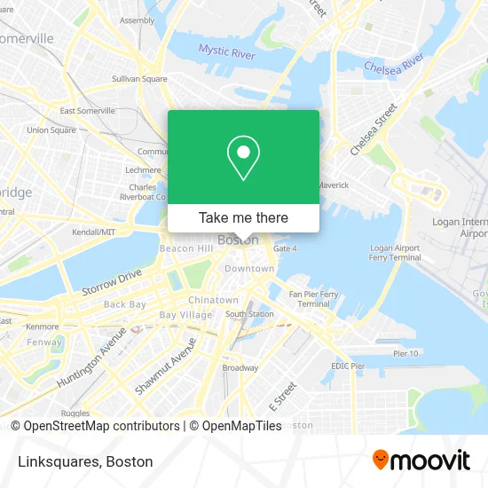
See Linksquares, Boston, on the map
Public Transit to Linksquares in Boston
Wondering how to get to Linksquares in Boston? Moovit helps you find the best way to get to Linksquares with step-by-step directions from the nearest public transit station.
Moovit provides free maps and live directions to help you navigate through your city. View schedules, routes, timetables, and find out how long does it take to get to Linksquares in real time.
Looking for the nearest stop or station to Linksquares? Check out this list of stops closest to your destination: State Street; Pearl St @ Congress St; Congress St @ State St; State St @ Washington Mall - State St Sta; Haymarket - Congress St Opp Hanover St; State; Haymarket; Congress St @ Haymarket Sta; Cambridge St @ Government Ctr Sta.
Bus: 354, 501, 504, 7, SL4, SL5, 4, 15, 39, 57, 92, RED LINE SHUTTLE, RED LINE SHUTTLE, RED LINE SHUTTLE, RED LINE SHUTTLE, 116, BLUE LINE SHUTTLE, BLUE LINE SHUTTLE, BLUE LINE SHUTTLE, GREEN LINE SHUTTLE, GREEN LINE SHUTTLE.Train: FAIRMOUNT, FRAMINGHAM/WORCESTER, GREENBUSH, HAVERHILL.Subway: GREEN LINE D, ORANGE LINE, BLUE LINE, GREEN LINE B, GREEN LINE C, GREEN LINE E.
Want to see if there’s another route that gets you there at an earlier time? Moovit helps you find alternative routes or times. Get directions from and directions to Linksquares easily from the Moovit App or Website.
We make riding to Linksquares easy, which is why over 1.7 million users, including users in Boston, trust Moovit as the best app for public transit. You don’t need to download an individual bus app or train app, Moovit is your all-in-one transit app that helps you find the best bus time or train time available.
For information on prices of bus, subway and train, costs and ride fares to Linksquares, please check the Moovit app.
Use the app to navigate to popular places including to the airport, hospital, stadium, grocery store, mall, coffee shop, school, college, and university.
Linksquares Address: 60 State St street in Boston
- Wilmerhale,
- 1 Day Demolition,
- Robert W Mahoney Lawyer,
- Shann Kerner,
- Chris Farley Rehab,
- Lisa Cameron,
- 60 State St,
- Samuel Adams Taproom,
- barking crab,
- State House Museum,
- Boston Massacre Monument,
- 60 State Street Parking Garage,
- State Street at Congress Street,
- One Medical (One Med Pcpo Gov Cente),
- Citadel,
- Boston Consulting Group,
- Library EC Boston,
- Boston, Massachusetts,
- Abercrombie & Fitch (Abercrombie Kids),
- Ghirardelli Chocolate
Places Near Linksquares (Boston)
- Prudential Center, Boston,
- Leader Bank Pavilion (Leader Bank Pavillion), Boston,
- Td Garden, Boston,
- Wang Theater, Boston,
- Massachusetts General Hospital, Boston,
- Isabella Stewart Gardner Museum, Boston,
- Museum Of Science, Boston,
- Boston Children's Hospital, Boston,
- Mgm Music Hall, Boston,
- Quincy Market, Boston,
- Wilbur Theatre, Boston,
- Boston Convention & Exhibition Center, Boston,
- North End, Boston,
- Cheers, Boston,
- Seaport District, Boston,
- Faneuil Hall, Boston,
- House Of Blues, Boston,
- Boston Medical Center, Boston,
- Boston Common, Boston,
- Castle Island, Boston
How to get to popular places in Boston with public transit
Get around Boston by public transit!
Traveling around Boston has never been so easy. See step by step directions as you travel to any attraction, street or major public transit station. View bus and train schedules, arrival times, service alerts and detailed routes on a map, so you know exactly how to get to anywhere in Boston.
When traveling to any destination around Boston use Moovit's Live Directions with Get Off Notifications to know exactly where and how far to walk, how long to wait for your line, and how many stops are left. Moovit will alert you when it's time to get off — no need to constantly re-check whether yours is the next stop.
Wondering how to use public transit in Boston or how to pay for public transit in Boston? Moovit public transit app can help you navigate your way with public transit easily, and at minimum cost. It includes public transit fees, ticket prices, and costs. Looking for a map of Boston public transit lines? Moovit public transit app shows all public transit maps in Boston with all Bus, Train, Subway and Ferry routes and stops on an interactive map.
Boston has 4 transit type(s), including: Bus, Train, Subway and Ferry, operated by several transit agencies, including MBTA, Southeastern Regional Transit Authority, MetroWest Regional Transit Authority, Rhode Island Public Transit Authority, WRTA, Lowell Regional Transit Authority, Merrimack Valley Transit, Montachusett Regional Transit Authority, Cape Cod Regional Transit Authority, Brockton Area Transit Authority, Martha's Vineyard Transit Authority, the WAVE - Nantucket Regional Transit Authority, GATRA, Cape Ann Transportation Authority and Massport