How to get to Little Sprouts by bus?
Click on the bus route to see step by step directions with maps, line arrival times and updated time schedules.
From Lawrence, MA, Lawrence
91 minFrom Rockingham Mall Salem New Hampshire, Lawrence
91 minFrom Methuen, Methuen Town
118 minFrom Lawrence, Massachusetts, Lawrence
90 minFrom Parque de las ardillas, Lawrence
88 minFrom Plum Island Beach, Newburyport
39 minFrom Salisbury Beach, Salisbury
31 minFrom Northern Essex Community College, Haverhill
34 min
Bus stops near Little Sprouts in Amesbury Town
Bus lines to Little Sprouts in Amesbury Town
What are the closest stations to Little Sprouts?
The closest stations to Little Sprouts are:
- Amesbury Health Center is 365 yards away, 5 min walk.
- Macy St And Main St Ob is 401 yards away, 5 min walk.
Which bus lines stop near Little Sprouts?
These bus lines stop near Little Sprouts: 17, 19.
What’s the nearest bus station to Little Sprouts in Amesbury Town?
The nearest bus stations to Little Sprouts in Amesbury Town are Amesbury Health Center and Macy St And Main St Ob. The closest one is a 5 min walk away.
What time is the first bus to Little Sprouts in Amesbury Town?
The 17 is the first bus that goes to Little Sprouts in Amesbury Town. It stops nearby at 5:19 AM.
What time is the last bus to Little Sprouts in Amesbury Town?
The 17 is the last bus that goes to Little Sprouts in Amesbury Town. It stops nearby at 8:15 PM.
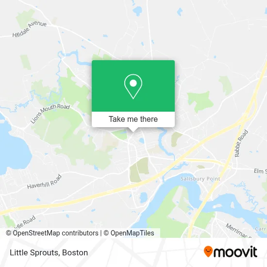
See Little Sprouts, Amesbury Town, on the map
Public Transit to Little Sprouts in Amesbury Town
Wondering how to get to Little Sprouts in Amesbury Town? Moovit helps you find the best way to get to Little Sprouts with step-by-step directions from the nearest public transit station.
Moovit provides free maps and live directions to help you navigate through your city. View schedules, routes, timetables, and find out how long does it take to get to Little Sprouts in real time.
Looking for the nearest stop or station to Little Sprouts? Check out this list of stops closest to your destination: Amesbury Health Center; Macy St And Main St Ob.
Bus: 17, 19.
Want to see if there’s another route that gets you there at an earlier time? Moovit helps you find alternative routes or times. Get directions from and directions to Little Sprouts easily from the Moovit App or Website.
We make riding to Little Sprouts easy, which is why over 1.7 million users, including users in Amesbury Town, trust Moovit as the best app for public transit. You don’t need to download an individual bus app or train app, Moovit is your all-in-one transit app that helps you find the best bus time or train time available.
For information on prices of bus, costs and ride fares to Little Sprouts, please check the Moovit app.
Use the app to navigate to popular places including to the airport, hospital, stadium, grocery store, mall, coffee shop, school, college, and university.
Little Sprouts Address: 36 Sparhawk St street in Amesbury Town
- Cheney Henry, DMD,
- Gould Insurance Agency,
- Brad Fulkerson, DMD,
- Northshore Weight And Metabolism,
- Main Stream Mechanical Inc.,
- David Cassidy Master Electrician,
- Amesbury Seventh-Day Adventist Church,
- E V Jutras And Sons,
- Amesbury Community Action,
- Town of Amesbury,
- ADT Alarm,
- Paul C Rogers & Sons,
- Rick Anthony: Elvis Tribute Artist,
- Brendan Shane Performance Marketing,
- Officer Guilmette School Resource Officer,
- All Saints' Anglican Church,
- Amesbury Cultural Council,
- Reliable Co-Signer,
- Amesbury Holiday Parade,
- Strong Empire Ent.
Places Near Little Sprouts (Amesbury Town)
- Boston Convention & Exhibition Center, Boston,
- Castle Island, Boston,
- Museum Of Science, Boston,
- Wilbur Theatre, Boston,
- Seaport District, Boston,
- Quincy Market, Boston,
- House Of Blues, Boston,
- Cheers, Boston,
- Prudential Center, Boston,
- Massachusetts General Hospital, Boston,
- Isabella Stewart Gardner Museum, Boston,
- Boston Common, Boston,
- Boston Children's Hospital, Boston,
- North End, Boston,
- Td Garden, Boston,
- Wang Theater, Boston,
- Faneuil Hall, Boston,
- Mgm Music Hall, Boston,
- Boston Medical Center, Boston,
- Leader Bank Pavilion (Leader Bank Pavillion), Boston
How to get to popular places in Boston with public transit
Get around Amesbury Town by public transit!
Traveling around Amesbury Town has never been so easy. See step by step directions as you travel to any attraction, street or major public transit station. View bus and train schedules, arrival times, service alerts and detailed routes on a map, so you know exactly how to get to anywhere in Amesbury Town.
When traveling to any destination around Amesbury Town use Moovit's Live Directions with Get Off Notifications to know exactly where and how far to walk, how long to wait for your line, and how many stops are left. Moovit will alert you when it's time to get off — no need to constantly re-check whether yours is the next stop.
Wondering how to use public transit in Amesbury Town or how to pay for public transit in Amesbury Town? Moovit public transit app can help you navigate your way with public transit easily, and at minimum cost. It includes public transit fees, ticket prices, and costs. Looking for a map of Amesbury Town public transit lines? Moovit public transit app shows all public transit maps in Amesbury Town with all Bus, Train, Subway and Ferry routes and stops on an interactive map.
Boston has 4 transit type(s), including: Bus, Train, Subway and Ferry, operated by several transit agencies, including MBTA, Southeastern Regional Transit Authority, MetroWest Regional Transit Authority, Rhode Island Public Transit Authority, WRTA, Lowell Regional Transit Authority, Merrimack Valley Transit, Montachusett Regional Transit Authority, Cape Cod Regional Transit Authority, Brockton Area Transit Authority, Martha's Vineyard Transit Authority, the WAVE - Nantucket Regional Transit Authority, GATRA, Cape Ann Transportation Authority and Massport