How to get to Lkl Artes Graficas by bus?
Click on the bus route to see step by step directions with maps, line arrival times and updated time schedules.
From Irajá, Irajá
38 minFrom Ponto da Van Central x Roncalli, Belford Roxo
63 minFrom Avenida Itaóca, Bonsucesso
46 minFrom São João De Meriti, São João De Meriti
32 minFrom Largo Do Bicão, Vila Da Penha
27 minFrom Parque Madureira, Madureira
54 minFrom Hospital Maternidade Alexander Fleming, Marechal Hermes
55 minFrom PAM Del Castilho, Inhaúma
43 minFrom Coelho Neto, Coelho Neto
32 minFrom Policlínica Rodolpho Rocco, Inhaúma
44 min
How to get to Lkl Artes Graficas by train?
Click on the train route to see step by step directions with maps, line arrival times and updated time schedules.
Bus stops near Lkl Artes Graficas in Duque De Caxias
- Terminal Shopping Center De Caxias (Master), 3 min walk,VIEW
- Rua Carlos Sampaio, 254, 3 min walk,VIEW
- R. José De Alvarenga 95 - Centro Duque De Caxias, 3 min walk,VIEW
- Marisa, 4 min walk,VIEW
- Guanabara De Caxias, 4 min walk,VIEW
- Terminal Shopping Center De Caxias (Limousine Carioca), 6 min walk,VIEW
- Terminal Shopping Center De Caxias (Jurema), 7 min walk,VIEW
Train station near Lkl Artes Graficas in Duque De Caxias
- Duque De Caxias, 24 min walk,VIEW
Bus lines to Lkl Artes Graficas in Duque De Caxias
- 131I, Caxias (Direto),VIEW
- 134I, Nova Iguaçu,VIEW
- 137I, Nova Iguaçu (Direto / Via Dutra),VIEW
- 138I, Nilópolis,VIEW
- 438L, Duque de Caxias ↔ Vigário Geral (Circular / Duloren),VIEW
- L012, Bar Dos Cavaleiros (Via Prainha),VIEW
- 429, Caxias,VIEW
- 603I, Nova Iguaçú,VIEW
- 06, Santa Tereza - Hospital Infantil (Via 14 de Julho),VIEW
- 09, Bela Vista - Chacrinha,VIEW
- 011, Bar dos Cavaleiros - Jardim Leal,VIEW
- L012, Bar dos Cavaleiros - São Jorge (Via Guanabara),VIEW
- 13, Gramacho - Hospital Infantil (Via Copacabana),VIEW
- 14, Gramacho - Hospital Infantil,VIEW
- 016, Jardim Gramacho - Hospital Duque de Caxias (Via Avenida Pistoia),VIEW
- 017, Variante - Periquitos (Via Itatiaia),VIEW
- 018, Olavo Bilac - Cohab (Via Fórum),VIEW
- 20, Bela Vista - Parque das Missões (Via Beira Mar),VIEW
- 022, Centenário - Carrefour (Via 25 de Agosto / Corte 8),VIEW
- 30, Gramacho - Hospital Infantil (Via General Rondon),VIEW
What are the closest stations to Lkl Artes Graficas?
The closest stations to Lkl Artes Graficas are:
- Terminal Shopping Center De Caxias (Master) is 158 meters away, 3 min walk.
- Rua Carlos Sampaio, 254 is 192 meters away, 3 min walk.
- R. José De Alvarenga 95 - Centro Duque De Caxias is 199 meters away, 3 min walk.
- Marisa is 244 meters away, 4 min walk.
- Guanabara De Caxias is 269 meters away, 4 min walk.
- Terminal Shopping Center De Caxias (Limousine Carioca) is 410 meters away, 6 min walk.
- Terminal Shopping Center De Caxias (Jurema) is 446 meters away, 7 min walk.
- Duque De Caxias is 1814 meters away, 24 min walk.
Which bus lines stop near Lkl Artes Graficas?
These bus lines stop near Lkl Artes Graficas: 119T, 415T, 451T, 492L, 561, 564, 603I.
Which train line stops near Lkl Artes Graficas?
RAMAL SARACURUNA (Gramacho)
What’s the nearest train station to Lkl Artes Graficas in Duque De Caxias?
The nearest train station to Lkl Artes Graficas in Duque De Caxias is Duque De Caxias. It’s a 24 min walk away.
What’s the nearest bus station to Lkl Artes Graficas in Duque De Caxias?
The nearest bus stations to Lkl Artes Graficas in Duque De Caxias are Terminal Shopping Center De Caxias (Master), Rua Carlos Sampaio, 254 and R. José De Alvarenga 95 - Centro Duque De Caxias. The closest one is a 3 min walk away.
What time is the first train to Lkl Artes Graficas in Duque De Caxias?
The RAMAL SARACURUNA is the first train that goes to Lkl Artes Graficas in Duque De Caxias. It stops nearby at 4:31 AM.
What time is the last train to Lkl Artes Graficas in Duque De Caxias?
The RAMAL SARACURUNA is the last train that goes to Lkl Artes Graficas in Duque De Caxias. It stops nearby at 11:17 PM.
What time is the first bus to Lkl Artes Graficas in Duque De Caxias?
The 427C is the first bus that goes to Lkl Artes Graficas in Duque De Caxias. It stops nearby at 3:17 AM.
What time is the last bus to Lkl Artes Graficas in Duque De Caxias?
The 429 is the last bus that goes to Lkl Artes Graficas in Duque De Caxias. It stops nearby at 4:23 AM.
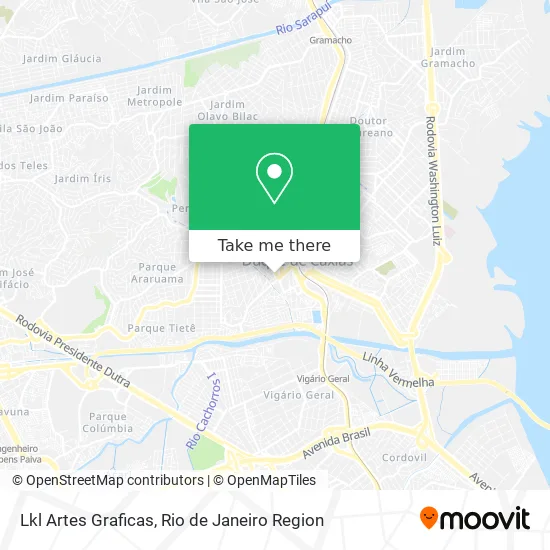
See Lkl Artes Graficas, Duque De Caxias, on the map
Public Transit to Lkl Artes Graficas in Duque De Caxias
Wondering how to get to Lkl Artes Graficas in Duque De Caxias? Moovit helps you find the best way to get to Lkl Artes Graficas with step-by-step directions from the nearest public transit station.
Moovit provides free maps and live directions to help you navigate through your city. View schedules, routes, timetables, and find out how long does it take to get to Lkl Artes Graficas in real time.
Looking for the nearest stop or station to Lkl Artes Graficas? Check out this list of stops closest to your destination: Terminal Shopping Center De Caxias (Master); Rua Carlos Sampaio; R. José De Alvarenga 95 - Centro Duque De Caxias; Marisa; Guanabara De Caxias; Terminal Shopping Center De Caxias (Limousine Carioca); Terminal Shopping Center De Caxias (Jurema); Duque De Caxias.
Bus: 119T, 415T, 451T, 492L, 561, 564, 603I, 131I, 134I, 137I, 138I, 438L, L012, 429, 06, 09, 011, L012, 13, 101C, 104C, 120T, 414I.Train: RAMAL SARACURUNA.
Want to see if there’s another route that gets you there at an earlier time? Moovit helps you find alternative routes or times. Get directions from and directions to Lkl Artes Graficas easily from the Moovit App or Website.
We make riding to Lkl Artes Graficas easy, which is why over 1.5 million users, including users in Duque De Caxias, trust Moovit as the best app for public transit. You don’t need to download an individual bus app or train app, Moovit is your all-in-one transit app that helps you find the best bus time or train time available.
For information on prices of bus and train, costs and ride fares to Lkl Artes Graficas, please check the Moovit app.
Use the app to navigate to popular places including to the airport, hospital, stadium, grocery store, mall, coffee shop, school, college, and university.
Lkl Artes Graficas Address: Rua das Pedras, 172 Centro Duque de Caxias-RJ 25010-040 street in Duque De Caxias
- Rua das Pedras 178,
- Rua Fausto Cardoso,
- Iluminart Iluminacao,
- Orgalent Caxias,
- Rua Tenente José Dias Próximo ao 393,
- Feijoada do Justino,
- Michel Barbearia,
- Patricia Equey Martinez de Oliveira,
- Rua Tenente José Dias, 400,
- Holistica Yoga,
- Fraternidade Eclética,
- Sindicato dos Trabalhadores no Comércio de Min Deriv Petróleo do Est RJ,
- Boate Enigma,
- Colégio Alfa,
- Supermercados Guanabara,
- GUANABARA,
- Dindin Geladin Gourmet,
- Bar e Padaria Barra Verde,
- Monalisa Soares Makeup,
- Bruttu's Hamburgueria
Places Near Lkl Artes Graficas (Duque De Caxias)
- Rio De Janeiro,
- Feirão De Malhas, Duque De Caxias,
- Shopping Rio Sul, Botafogo,
- Shopping Nova América, Del Castilho,
- Feira Livre da Gloria, Glória,
- Museu Do Amanhã, Centro,
- Rodoviária Novo Rio (Rodoviária do Rio de Janeiro), Santo Cristo,
- Niterói, Niterói,
- Rua Ulysses Guimarães 16, Cidade Nova,
- Rua Licínio Cardoso, São Francisco Xavier,
- Avenida Rio Branco, Centro,
- Praia do Arpoador, Ipanema,
- Hospital Federal Cardoso Fontes, Jacarepaguá,
- Avenida Venezuela 134, Saúde,
- Norte Shopping, Cachambi,
- Hospital Federal Do Andaraí, Andaraí,
- Shopping Downtown, Barra Da Tijuca,
- Hospital Municipal Ronaldo Gazolla, Acari,
- Hospital Pedro Ernesto, Vila Isabel,
- Shopping RioSul, Botafogo
How to get to popular places in Rio de Janeiro Region with public transit
Get around Duque De Caxias by public transit!
Traveling around Duque De Caxias has never been so easy. See step by step directions as you travel to any attraction, street or major public transit station. View bus and train schedules, arrival times, service alerts and detailed routes on a map, so you know exactly how to get to anywhere in Duque De Caxias.
When traveling to any destination around Duque De Caxias use Moovit's Live Directions with Get Off Notifications to know exactly where and how far to walk, how long to wait for your line, and how many stops are left. Moovit will alert you when it's time to get off — no need to constantly re-check whether yours is the next stop.
Wondering how to use public transit in Duque De Caxias or how to pay for public transit in Duque De Caxias? Moovit public transit app can help you navigate your way with public transit easily, and at minimum cost. It includes public transit fees, ticket prices, and costs. Looking for a map of Duque De Caxias public transit lines? Moovit public transit app shows all public transit maps in Duque De Caxias with all Bus, Train, Metro, Light Rail, Ferry, Cable Car, Gondola and Funicular routes and stops on an interactive map.
Rio de Janeiro Region has 8 transit type(s), including: Bus, Train, Metro, Light Rail, Ferry, Cable Car, Gondola and Funicular, operated by several transit agencies, including TrensRJ, Metrô Rio, VLT Carioca, Barcas Rio, BRT MOBI-Rio, Auto Viação Alpha, Auto Viação Tijuca, Gire Transportes, Transurb, Viação Nossa Senhora das Graças, Consórcio INTERSUL, Braso Lisboa (Municipal), Caprichosa Auto Ônibus, Auto Viação Três Amigos and Rodoviária Âncora Matias