Directions to Lms Pos (Arlington) with public transportation
The following transit lines have routes that pass near Lms Pos
 Bus: 77, 87, 350.
- Train: FITCHBURG, LOWELL.
- Subway: RED LINE, GREEN LINE B, GREEN LINE C, GREEN LINE E.
How to get to Lms Pos by bus?
Click on the bus route to see step by step directions with maps, line arrival times and updated time schedules.
From Crowne Plaza Boston - Woburn, Woburn
70 minFrom Puttshack, Boston
68 minFrom Citizens Bank Opera House, Boston
54 minFrom Hampton Inn Boston, Boston
65 minFrom MBTA-Chinatown, Boston
74 minFrom TJ Maxx, Boston
44 minFrom Hampton Inn & Suites Boston Crosstown Ctr, Boston
65 minFrom Moxy Hotel, Boston
62 minFrom ICA, Boston
69 minFrom St. Elizabeth's Medical Center, Boston
54 min
How to get to Lms Pos by train?
Click on the train route to see step by step directions with maps, line arrival times and updated time schedules.
How to get to Lms Pos by subway?
Click on the subway route to see step by step directions with maps, line arrival times and updated time schedules.
From Puttshack, Boston
63 minFrom Citizens Bank Opera House, Boston
82 minFrom Hampton Inn Boston, Boston
69 minFrom MBTA-Chinatown, Boston
52 minFrom TJ Maxx, Boston
56 minFrom Hampton Inn & Suites Boston Crosstown Ctr, Boston
70 minFrom Moxy Hotel, Boston
52 minFrom ICA, Boston
64 minFrom St. Elizabeth's Medical Center, Boston
95 min
Bus stops near Lms Pos in Arlington
Subway stations near Lms Pos in Arlington
Train station near Lms Pos in Arlington
- West Medford, 25 min walk,VIEW
What are the closest stations to Lms Pos?
The closest stations to Lms Pos are:
- Massachusetts Ave @ Lake St is 24 yards away, 1 min walk.
- Broadway @ Sunnyside Ave is 362 yards away, 5 min walk.
- Medford/Tufts Station is 1294 yards away, 16 min walk.
- West Medford is 2077 yards away, 25 min walk.
- Davis Sq. is 2768 yards away, 33 min walk.
Which bus lines stop near Lms Pos?
These bus lines stop near Lms Pos: 77, 87.
Which train lines stop near Lms Pos?
These train lines stop near Lms Pos: FITCHBURG, LOWELL.
Which subway line stops near Lms Pos?
RED LINE (Alewife)
What’s the nearest subway station to Lms Pos in Arlington?
The nearest subway station to Lms Pos in Arlington is Medford/Tufts Station. It’s a 16 min walk away.
What’s the nearest train station to Lms Pos in Arlington?
The nearest train station to Lms Pos in Arlington is West Medford. It’s a 25 min walk away.
What’s the nearest bus station to Lms Pos in Arlington?
The nearest bus station to Lms Pos in Arlington is Massachusetts Ave @ Lake St. It’s a 1 min walk away.
What time is the first subway to Lms Pos in Arlington?
The GREEN LINE E is the first subway that goes to Lms Pos in Arlington. It stops nearby at 4:55 AM.
What time is the last subway to Lms Pos in Arlington?
The GREEN LINE E is the last subway that goes to Lms Pos in Arlington. It stops nearby at 2:41 AM.
What time is the first train to Lms Pos in Arlington?
The LOWELL is the first train that goes to Lms Pos in Arlington. It stops nearby at 5:31 AM.
What time is the last train to Lms Pos in Arlington?
The LOWELL is the last train that goes to Lms Pos in Arlington. It stops nearby at 12:20 AM.
What time is the first bus to Lms Pos in Arlington?
The 77 is the first bus that goes to Lms Pos in Arlington. It stops nearby at 4:57 AM.
What time is the last bus to Lms Pos in Arlington?
The 87 is the last bus that goes to Lms Pos in Arlington. It stops nearby at 1:41 AM.
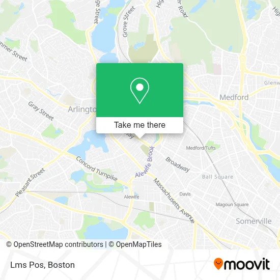
See Lms Pos, Arlington, on the map
Public Transit to Lms Pos in Arlington
Wondering how to get to Lms Pos in Arlington? Moovit helps you find the best way to get to Lms Pos with step-by-step directions from the nearest public transit station.
Moovit provides free maps and live directions to help you navigate through your city. View schedules, routes, timetables, and find out how long does it take to get to Lms Pos in real time.
Looking for the nearest stop or station to Lms Pos? Check out this list of stops closest to your destination: Massachusetts Ave @ Lake St; Broadway @ Sunnyside Ave; Medford/Tufts Station; West Medford; Davis Sq..
Bus: 77, 87, 350.Train: FITCHBURG, LOWELL.Subway: RED LINE, GREEN LINE B, GREEN LINE C, GREEN LINE E.
Want to see if there’s another route that gets you there at an earlier time? Moovit helps you find alternative routes or times. Get directions from and directions to Lms Pos easily from the Moovit App or Website.
We make riding to Lms Pos easy, which is why over 1.7 million users, including users in Arlington, trust Moovit as the best app for public transit. You don’t need to download an individual bus app or train app, Moovit is your all-in-one transit app that helps you find the best bus time or train time available.
For information on prices of bus, subway and train, costs and ride fares to Lms Pos, please check the Moovit app.
Use the app to navigate to popular places including to the airport, hospital, stadium, grocery store, mall, coffee shop, school, college, and university.
Lms Pos Address: 68 Broadway street in Arlington
- Compatible Couples,
- Crosby Tennis Courts,
- East Arlington, MA,
- Cutler Cleveland,
- Bradley Method Childbirth Class,
- Arlington Police Department,
- Support the Fox Library,
- A D T Security Services,
- The Fat Greek,
- Salon Foomin (Miami Hair Salon),
- Puffer Insurance,
- Laundry Delivery Express,
- Metro by T-Mobile,
- Mls Property Information Network, Inc.,
- Namaste Spice,
- Clarendon Hill Towers,
- Coinstar - Bitcoin ATM,
- Glenn S Rothfeld,
- Capitol Theatre,
- Prime Plumbing
Places Near Lms Pos (Arlington)
- Wang Theater, Boston,
- Museum Of Science, Boston,
- Massachusetts General Hospital, Boston,
- Isabella Stewart Gardner Museum, Boston,
- Seaport District, Boston,
- Boston Common, Boston,
- Wilbur Theatre, Boston,
- Boston Medical Center, Boston,
- Td Garden, Boston,
- House Of Blues, Boston,
- Boston Convention & Exhibition Center, Boston,
- Leader Bank Pavilion (Leader Bank Pavillion), Boston,
- North End, Boston,
- Castle Island, Boston,
- Cheers, Boston,
- Prudential Center, Boston,
- Mgm Music Hall, Boston,
- Faneuil Hall, Boston,
- Quincy Market, Boston,
- Boston Children's Hospital, Boston
How to get to popular places in Boston with public transit
Get around Arlington by public transit!
Traveling around Arlington has never been so easy. See step by step directions as you travel to any attraction, street or major public transit station. View bus and train schedules, arrival times, service alerts and detailed routes on a map, so you know exactly how to get to anywhere in Arlington.
When traveling to any destination around Arlington use Moovit's Live Directions with Get Off Notifications to know exactly where and how far to walk, how long to wait for your line, and how many stops are left. Moovit will alert you when it's time to get off — no need to constantly re-check whether yours is the next stop.
Wondering how to use public transit in Arlington or how to pay for public transit in Arlington? Moovit public transit app can help you navigate your way with public transit easily, and at minimum cost. It includes public transit fees, ticket prices, and costs. Looking for a map of Arlington public transit lines? Moovit public transit app shows all public transit maps in Arlington with all Bus, Train, Subway and Ferry routes and stops on an interactive map.
Boston has 4 transit type(s), including: Bus, Train, Subway and Ferry, operated by several transit agencies, including MBTA, Southeastern Regional Transit Authority, MetroWest Regional Transit Authority, Rhode Island Public Transit Authority, WRTA, Lowell Regional Transit Authority, Merrimack Valley Transit, Montachusett Regional Transit Authority, Cape Cod Regional Transit Authority, Brockton Area Transit Authority, Martha's Vineyard Transit Authority, the WAVE - Nantucket Regional Transit Authority, GATRA, Cape Ann Transportation Authority and Massport