Directions to Lo Vera Vip (Boston) with public transportation
The following transit lines have routes that pass near Lo Vera Vip
 Bus: 1, R, 6.
- Train: ACELA, NORTHEAST REGIONAL, PROVIDENCE LINE SHUTTLE, PROVIDENCE LINE SHUTTLE, PROVIDENCE LINE SHUTTLE.
How to get to Lo Vera Vip by bus?
Click on the bus route to see step by step directions with maps, line arrival times and updated time schedules.
Bus stops near Lo Vera Vip in Boston
Train stations near Lo Vera Vip in Boston
- Providence, 25 min walk,VIEW
Bus lines to Lo Vera Vip in Boston
What are the closest stations to Lo Vera Vip?
The closest stations to Lo Vera Vip are:
- Roger Williams Park is 202 yards away, 3 min walk.
- Prairie Before Early is 366 yards away, 5 min walk.
- Eddy at Pavilion is 377 yards away, 5 min walk.
- Providence is 2090 yards away, 25 min walk.
Which bus lines stop near Lo Vera Vip?
These bus lines stop near Lo Vera Vip: 1, R.
What’s the nearest train station to Lo Vera Vip in Boston?
The nearest train station to Lo Vera Vip in Boston is Providence. It’s a 25 min walk away.
What’s the nearest bus station to Lo Vera Vip in Boston?
The nearest bus station to Lo Vera Vip in Boston is Roger Williams Park. It’s a 3 min walk away.
What time is the first train to Lo Vera Vip in Boston?
The PROVIDENCE/STOUGHTON is the first train that goes to Lo Vera Vip in Boston. It stops nearby at 4:10 AM.
What time is the last train to Lo Vera Vip in Boston?
The NORTHEAST REGIONAL is the last train that goes to Lo Vera Vip in Boston. It stops nearby at 9:17 AM.
What time is the first bus to Lo Vera Vip in Boston?
The R is the first bus that goes to Lo Vera Vip in Boston. It stops nearby at 5:20 AM.
What time is the last bus to Lo Vera Vip in Boston?
The R is the last bus that goes to Lo Vera Vip in Boston. It stops nearby at 12:54 AM.
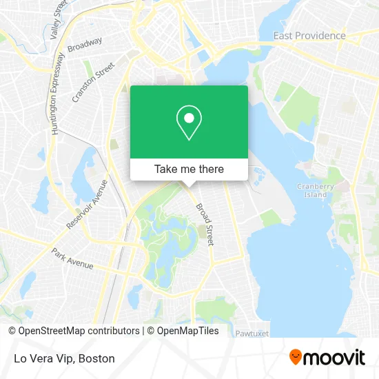
See Lo Vera Vip, Boston, on the map
Public Transit to Lo Vera Vip in Boston
Wondering how to get to Lo Vera Vip in Boston? Moovit helps you find the best way to get to Lo Vera Vip with step-by-step directions from the nearest public transit station.
Moovit provides free maps and live directions to help you navigate through your city. View schedules, routes, timetables, and find out how long does it take to get to Lo Vera Vip in real time.
Looking for the nearest stop or station to Lo Vera Vip? Check out this list of stops closest to your destination: Roger Williams Park; Prairie Before Early; Eddy at Pavilion; Providence.
Bus: 1, R, 6.Train: ACELA, NORTHEAST REGIONAL, PROVIDENCE LINE SHUTTLE, PROVIDENCE LINE SHUTTLE, PROVIDENCE LINE SHUTTLE, FOXBORO EVENT SERVICE, PROVIDENCE/STOUGHTON.
Want to see if there’s another route that gets you there at an earlier time? Moovit helps you find alternative routes or times. Get directions from and directions to Lo Vera Vip easily from the Moovit App or Website.
We make riding to Lo Vera Vip easy, which is why over 1.7 million users, including users in Boston, trust Moovit as the best app for public transit. You don’t need to download an individual bus app or train app, Moovit is your all-in-one transit app that helps you find the best bus time or train time available.
For information on prices of bus and train, costs and ride fares to Lo Vera Vip, please check the Moovit app.
Use the app to navigate to popular places including to the airport, hospital, stadium, grocery store, mall, coffee shop, school, college, and university.
Lo Vera Vip Address: 1266 Broad St street in Boston
- Auto Accident Injury Lawyer,
- Family Dollar,
- Gamma Locksmith & Key,
- USPS Collection Box - Po Lobby,
- TACO BELL,
- Washington Park Community Center,
- Suly Solution,
- Nanita Variety Store,
- Windham Senior Center & Human Services Department,
- Broad St Locksmith,
- Imcca,
- Cacmirror of God,
- Cruz Wireless,
- PVD Inkgods,
- Supreme Hookah,
- Rhode Island Hospital Center for Primary Care,
- Nairobis Photography,
- E E Weller MCS Finishing,
- Nicauris Beauty Salon,
- Cranial Technologies
Places Near Lo Vera Vip (Boston)
- Prudential Center, Boston,
- Seaport District, Boston,
- Faneuil Hall, Boston,
- Quincy Market, Boston,
- Museum Of Science, Boston,
- Boston Convention & Exhibition Center, Boston,
- Boston Children's Hospital, Boston,
- Cheers, Boston,
- Boston Common, Boston,
- Massachusetts General Hospital, Boston,
- Mgm Music Hall, Boston,
- Isabella Stewart Gardner Museum, Boston,
- Boston Medical Center, Boston,
- North End, Boston,
- House Of Blues, Boston,
- Wilbur Theatre, Boston,
- Leader Bank Pavilion (Leader Bank Pavillion), Boston,
- Wang Theater, Boston,
- Td Garden, Boston,
- Castle Island, Boston
How to get to popular places in Boston with public transit
Get around Boston by public transit!
Traveling around Boston has never been so easy. See step by step directions as you travel to any attraction, street or major public transit station. View bus and train schedules, arrival times, service alerts and detailed routes on a map, so you know exactly how to get to anywhere in Boston.
When traveling to any destination around Boston use Moovit's Live Directions with Get Off Notifications to know exactly where and how far to walk, how long to wait for your line, and how many stops are left. Moovit will alert you when it's time to get off — no need to constantly re-check whether yours is the next stop.
Wondering how to use public transit in Boston or how to pay for public transit in Boston? Moovit public transit app can help you navigate your way with public transit easily, and at minimum cost. It includes public transit fees, ticket prices, and costs. Looking for a map of Boston public transit lines? Moovit public transit app shows all public transit maps in Boston with all Bus, Train, Subway and Ferry routes and stops on an interactive map.
Boston has 4 transit type(s), including: Bus, Train, Subway and Ferry, operated by several transit agencies, including MBTA, Southeastern Regional Transit Authority, MetroWest Regional Transit Authority, Rhode Island Public Transit Authority, WRTA, Lowell Regional Transit Authority, Merrimack Valley Transit, Montachusett Regional Transit Authority, Cape Cod Regional Transit Authority, Brockton Area Transit Authority, Martha's Vineyard Transit Authority, the WAVE - Nantucket Regional Transit Authority, GATRA, Cape Ann Transportation Authority and Massport