Directions to Loaf N Jug (Boston) with public transportation
The following transit lines have routes that pass near Loaf N Jug
 Bus: 501, 65, 86, GREEN LINE B SHUTTLE, GREEN LINE B SHUTTLE.
- Train: FRAMINGHAM/WORCESTER.
- Subway: GREEN LINE B, GREEN LINE C.
How to get to Loaf N Jug by bus?
Click on the bus route to see step by step directions with maps, line arrival times and updated time schedules.
From Boston Scientific Shuttle: Prudential Center Stop, Boston
36 minFrom Vertex Pharmaceuticals (Fan Pier), Boston
54 minFrom KNL, Cambridge
47 minFrom Back Bay, Boston
43 minFrom South Bay Mall, Boston
59 minFrom Boston Dynamics, Waltham
81 minFrom Boston Harbor, Boston
54 minFrom UMass Boston Campus Center, Boston
88 minFrom East Boston, Boston
63 minFrom Sunrise Shuttle Pick Up, Boston
66 min
How to get to Loaf N Jug by train?
Click on the train route to see step by step directions with maps, line arrival times and updated time schedules.
How to get to Loaf N Jug by subway?
Click on the subway route to see step by step directions with maps, line arrival times and updated time schedules.
From Boston Scientific Shuttle: Prudential Center Stop, Boston
44 minFrom East Boston, Boston
67 minFrom Vertex Pharmaceuticals (Fan Pier), Boston
64 minFrom KNL, Cambridge
62 minFrom Back Bay, Boston
47 minFrom Sunrise Shuttle Pick Up, Boston
63 minFrom South Bay Mall, Boston
68 minFrom UMass Boston Campus Center, Boston
84 min
Bus stops near Loaf N Jug in Boston
Subway stations near Loaf N Jug in Boston
Bus lines to Loaf N Jug in Boston
- 86, Harvard,VIEW
- GREEN LINE B SHUTTLE, Boston College - Blandford Street,VIEW
- GREEN LINE B SHUTTLE, Boston College - Washington Street,VIEW
- GREEN LINE B SHUTTLE, Boston College - Back Bay (Shuttle),VIEW
- GREEN LINE B SHUTTLE, Boston College - Babcock Street,VIEW
- GREEN LINE B SHUTTLE, Boston College - Packard's Corner,VIEW
- SHUTTLE, Boston College - Kenmore (Shuttle),VIEW
- 66, Brighton Center Via Brookline,VIEW
- 501, Downtown Via Cambridge St And Copley (Express),VIEW
- 65, Brighton Center,VIEW
What are the closest stations to Loaf N Jug?
The closest stations to Loaf N Jug are:
- Chestnut Hill Ave @ Embassy Rd is 229 yards away, 3 min walk.
- Chiswick Road - Commonwealth Ave @ Chiswick Rd is 428 yards away, 6 min walk.
- Winship St @ Union St is 831 yards away, 10 min walk.
- Chiswick Road is 1242 yards away, 15 min walk.
- Cleveland Circle is 2542 yards away, 30 min walk.
Which bus lines stop near Loaf N Jug?
These bus lines stop near Loaf N Jug: 501, 65, 86.
Which train line stops near Loaf N Jug?
FRAMINGHAM/WORCESTER (#521 | Worcester)
Which subway line stops near Loaf N Jug?
GREEN LINE B (Boston College)
What’s the nearest subway station to Loaf N Jug in Boston?
The nearest subway station to Loaf N Jug in Boston is Chiswick Road. It’s a 15 min walk away.
What’s the nearest bus station to Loaf N Jug in Boston?
The nearest bus station to Loaf N Jug in Boston is Chestnut Hill Ave @ Embassy Rd. It’s a 3 min walk away.
What time is the first subway to Loaf N Jug in Boston?
The GREEN LINE C is the first subway that goes to Loaf N Jug in Boston. It stops nearby at 5:00 AM.
What time is the last subway to Loaf N Jug in Boston?
The GREEN LINE B is the last subway that goes to Loaf N Jug in Boston. It stops nearby at 2:36 AM.
What time is the first bus to Loaf N Jug in Boston?
The 86 is the first bus that goes to Loaf N Jug in Boston. It stops nearby at 5:18 AM.
What time is the last bus to Loaf N Jug in Boston?
The 86 is the last bus that goes to Loaf N Jug in Boston. It stops nearby at 12:57 AM.
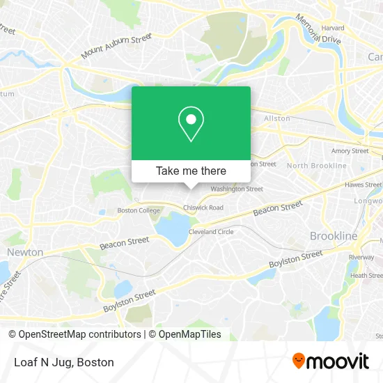
See Loaf N Jug, Boston, on the map
Public Transit to Loaf N Jug in Boston
Wondering how to get to Loaf N Jug in Boston? Moovit helps you find the best way to get to Loaf N Jug with step-by-step directions from the nearest public transit station.
Moovit provides free maps and live directions to help you navigate through your city. View schedules, routes, timetables, and find out how long does it take to get to Loaf N Jug in real time.
Looking for the nearest stop or station to Loaf N Jug? Check out this list of stops closest to your destination: Chestnut Hill Ave @ Embassy Rd; Chiswick Road - Commonwealth Ave @ Chiswick Rd; Winship St @ Union St; Chiswick Road; Cleveland Circle.
Bus: 501, 65, 86, GREEN LINE B SHUTTLE, GREEN LINE B SHUTTLE, GREEN LINE B SHUTTLE, GREEN LINE B SHUTTLE, GREEN LINE B SHUTTLE, 66.Train: FRAMINGHAM/WORCESTER.Subway: GREEN LINE B, GREEN LINE C.
Want to see if there’s another route that gets you there at an earlier time? Moovit helps you find alternative routes or times. Get directions from and directions to Loaf N Jug easily from the Moovit App or Website.
We make riding to Loaf N Jug easy, which is why over 1.7 million users, including users in Boston, trust Moovit as the best app for public transit. You don’t need to download an individual bus app or train app, Moovit is your all-in-one transit app that helps you find the best bus time or train time available.
For information on prices of bus, subway and train, costs and ride fares to Loaf N Jug, please check the Moovit app.
Use the app to navigate to popular places including to the airport, hospital, stadium, grocery store, mall, coffee shop, school, college, and university.
Loaf N Jug Address: 161 N Gate Blvd. street in Boston
- Loop,
- Bento Cafe,
- Acai Revolution,
- Engine 29 Ladder 11 Car 11,
- Dates & Olives,
- Brighton Mobile Locksmith Store,
- Boston Pizza,
- In House Cafe,
- JJ Carroll Apartments,
- Boston Safe Movers,
- Gerolimo,
- Mikhail Miramovich,
- Regency & Chiswick Apartments,
- Boston Professional Plumbing,
- David Moskovitz,
- Rabbi Joseph Shalom Shubow Park Playground,
- Abraham Dovek Memorial Foundation,
- Fasolo, Margaret G,
- Y M C A,
- Russian Community Assoc-Mass
Places Near Loaf N Jug (Boston)
- Cheers, Boston,
- Castle Island, Boston,
- Boston Common, Boston,
- Massachusetts General Hospital, Boston,
- House Of Blues, Boston,
- Boston Convention & Exhibition Center, Boston,
- Wang Theater, Boston,
- Boston Medical Center, Boston,
- Faneuil Hall, Boston,
- Prudential Center, Boston,
- Isabella Stewart Gardner Museum, Boston,
- Mgm Music Hall, Boston,
- Wilbur Theatre, Boston,
- North End, Boston,
- Museum Of Science, Boston,
- Td Garden, Boston,
- Boston Children's Hospital, Boston,
- Quincy Market, Boston,
- Leader Bank Pavilion (Leader Bank Pavillion), Boston,
- Seaport District, Boston
How to get to popular places in Boston with public transit
Get around Boston by public transit!
Traveling around Boston has never been so easy. See step by step directions as you travel to any attraction, street or major public transit station. View bus and train schedules, arrival times, service alerts and detailed routes on a map, so you know exactly how to get to anywhere in Boston.
When traveling to any destination around Boston use Moovit's Live Directions with Get Off Notifications to know exactly where and how far to walk, how long to wait for your line, and how many stops are left. Moovit will alert you when it's time to get off — no need to constantly re-check whether yours is the next stop.
Wondering how to use public transit in Boston or how to pay for public transit in Boston? Moovit public transit app can help you navigate your way with public transit easily, and at minimum cost. It includes public transit fees, ticket prices, and costs. Looking for a map of Boston public transit lines? Moovit public transit app shows all public transit maps in Boston with all Bus, Train, Subway and Ferry routes and stops on an interactive map.
Boston has 4 transit type(s), including: Bus, Train, Subway and Ferry, operated by several transit agencies, including MBTA, Southeastern Regional Transit Authority, MetroWest Regional Transit Authority, Rhode Island Public Transit Authority, WRTA, Lowell Regional Transit Authority, Merrimack Valley Transit, Montachusett Regional Transit Authority, Cape Cod Regional Transit Authority, Brockton Area Transit Authority, Martha's Vineyard Transit Authority, the WAVE - Nantucket Regional Transit Authority, GATRA, Cape Ann Transportation Authority and Massport