Directions to Local Ceo - Growth Platform (Boston) with public transportation
The following transit lines have routes that pass near Local Ceo - Growth Platform
 Bus: 1, 19, 39, 57, 85.
- Train: FRAMINGHAM/WORCESTER, NEEDHAM.
- Subway: GREEN LINE B, GREEN LINE C, GREEN LINE D, GREEN LINE E, ORANGE LINE.
How to get to Local Ceo - Growth Platform by bus?
Click on the bus route to see step by step directions with maps, line arrival times and updated time schedules.
From Boston College, Boston
60 minFrom Milton, MA, Milton
75 minFrom Chevalier Theatre (Chevalier Theater Show Line), Medford
72 minFrom Arnold Arboretum, Boston
46 minFrom Target, Everett
75 minFrom Melrose Wakefield Hospital, Malden
109 minFrom Qea, Quincy
101 minFrom Beth Israel Deaconess Hospital-Milton, Milton
86 minFrom Wollaston Beach, Quincy
114 minFrom Embassy Suites-Boston, Boston
48 min
How to get to Local Ceo - Growth Platform by train?
Click on the train route to see step by step directions with maps, line arrival times and updated time schedules.
How to get to Local Ceo - Growth Platform by subway?
Click on the subway route to see step by step directions with maps, line arrival times and updated time schedules.
From Embassy Suites-Boston, Boston
42 minFrom Boston College, Boston
51 minFrom Milton, MA, Milton
88 minFrom Chevalier Theatre (Chevalier Theater Show Line), Medford
76 minFrom Arnold Arboretum, Boston
36 minFrom Target, Everett
53 minFrom Melrose Wakefield Hospital, Malden
49 minFrom Qea, Quincy
50 minFrom Beth Israel Deaconess Hospital-Milton, Milton
87 minFrom Wollaston Beach, Quincy
63 min
Bus stops near Local Ceo - Growth Platform in Boston
Train station near Local Ceo - Growth Platform in Boston
- Lansdowne, 4 min walk,VIEW
Subway stations near Local Ceo - Growth Platform in Boston
Bus lines to Local Ceo - Growth Platform in Boston
- 8, Kenmore via South Bay Center - Harbor Point via South Bay Center,VIEW
- 19, Kenmore - Fields Corner,VIEW
- 60, Kenmore - Chestnut Hill Mall,VIEW
- 65, Kenmore - Brighton Center,VIEW
- 9, Kenmore Via Boston Latin,VIEW
- 57, Haymarket Via Kenmore,VIEW
- GREEN LINE B SHUTTLE, Babcock Street - Copley,VIEW
- GREEN LINE B SHUTTLE, Kenmore - Back Bay via Copley (Shuttle),VIEW
- GREEN LINE B SHUTTLE, Babcock Street - Back Bay via Copley (Shuttle),VIEW
- GREEN LINE B SHUTTLE, Boston College - Back Bay (Shuttle),VIEW
- GREEN LINE B SHUTTLE, Babcock Street - Back Bay,VIEW
- GREEN LINE D SHUTTLE, Brookline Hills - Back Bay (Shuttle),VIEW
- GREEN LINE SHUTTLE, Kenmore - Copley,VIEW
- GREEN LINE SHUTTLE, Kenmore - Back Bay,VIEW
- 1 BU (CHARLES RIVER-MEDICAL CAMPUS), 1 BU (Charles River-Medical Campus),VIEW
- GREEN LINE B SHUTTLE, Babcock Street - Kenmore,VIEW
- GREEN LINE B SHUTTLE, Washington Street - Kenmore,VIEW
- GREEN LINE B SHUTTLE, Boston University East - Back Bay,VIEW
- GREEN LINE C SHUTTLE, Saint Mary's Street - Kenmore,VIEW
- GREEN LINE C SHUTTLE, Saint Mary's Street - Back Bay,VIEW
What are the closest stations to Local Ceo - Growth Platform?
The closest stations to Local Ceo - Growth Platform are:
- Brookline Ave Opp Jersey St is 98 yards away, 2 min walk.
- Brookline Ave @ Jersey St is 114 yards away, 2 min walk.
- Kenmore is 151 yards away, 3 min walk.
- Kenmore - Commonwealth Ave @ Kenmore St is 164 yards away, 3 min walk.
- Lansdowne is 264 yards away, 4 min walk.
- Boylston St @ Jersey St is 388 yards away, 5 min walk.
- Hynes Convention Center is 459 yards away, 6 min walk.
- Northeastern University is 1172 yards away, 14 min walk.
Which bus lines stop near Local Ceo - Growth Platform?
These bus lines stop near Local Ceo - Growth Platform: 1, 19, 39, 57, 85, BB.
Which train lines stop near Local Ceo - Growth Platform?
These train lines stop near Local Ceo - Growth Platform: FRAMINGHAM/WORCESTER, NEEDHAM.
Which subway lines stop near Local Ceo - Growth Platform?
These subway lines stop near Local Ceo - Growth Platform: GREEN LINE B, GREEN LINE C, GREEN LINE D, GREEN LINE E, ORANGE LINE.
What’s the nearest subway station to Local Ceo - Growth Platform in Boston?
The nearest subway station to Local Ceo - Growth Platform in Boston is Hynes Convention Center. It’s a 6 min walk away.
What’s the nearest train station to Local Ceo - Growth Platform in Boston?
The nearest train station to Local Ceo - Growth Platform in Boston is Lansdowne. It’s a 4 min walk away.
What’s the nearest bus station to Local Ceo - Growth Platform in Boston?
The nearest bus stations to Local Ceo - Growth Platform in Boston are Brookline Ave Opp Jersey St and Brookline Ave @ Jersey St. The closest one is a 2 min walk away.
What time is the first subway to Local Ceo - Growth Platform in Boston?
The GREEN LINE D is the first subway that goes to Local Ceo - Growth Platform in Boston. It stops nearby at 5:00 AM.
What time is the last subway to Local Ceo - Growth Platform in Boston?
The GREEN LINE D is the last subway that goes to Local Ceo - Growth Platform in Boston. It stops nearby at 2:18 AM.
What time is the first train to Local Ceo - Growth Platform in Boston?
The FRAMINGHAM/WORCESTER is the first train that goes to Local Ceo - Growth Platform in Boston. It stops nearby at 4:55 AM.
What time is the last train to Local Ceo - Growth Platform in Boston?
The FRAMINGHAM/WORCESTER is the last train that goes to Local Ceo - Growth Platform in Boston. It stops nearby at 12:06 AM.
What time is the first bus to Local Ceo - Growth Platform in Boston?
The 57 is the first bus that goes to Local Ceo - Growth Platform in Boston. It stops nearby at 4:46 AM.
What time is the last bus to Local Ceo - Growth Platform in Boston?
The 57 is the last bus that goes to Local Ceo - Growth Platform in Boston. It stops nearby at 2:09 AM.
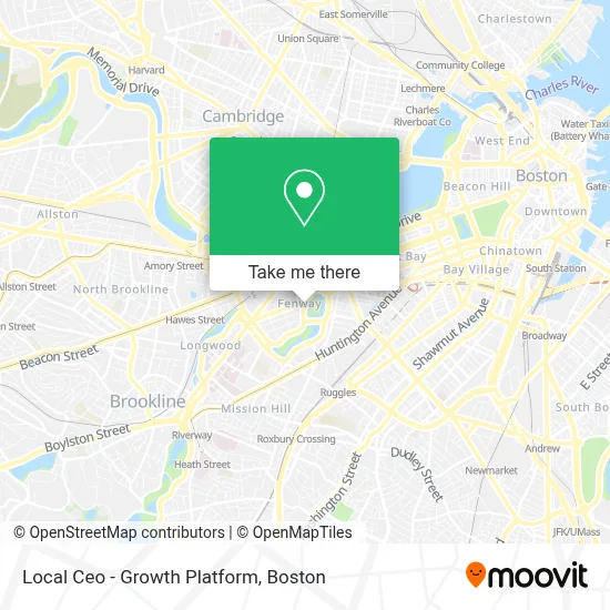
See Local Ceo - Growth Platform, Boston, on the map
Public Transit to Local Ceo - Growth Platform in Boston
Wondering how to get to Local Ceo - Growth Platform in Boston? Moovit helps you find the best way to get to Local Ceo - Growth Platform with step-by-step directions from the nearest public transit station.
Moovit provides free maps and live directions to help you navigate through your city. View schedules, routes, timetables, and find out how long does it take to get to Local Ceo - Growth Platform in real time.
Looking for the nearest stop or station to Local Ceo - Growth Platform? Check out this list of stops closest to your destination: Brookline Ave Opp Jersey St; Brookline Ave @ Jersey St; Kenmore; Kenmore - Commonwealth Ave @ Kenmore St; Lansdowne; Boylston St @ Jersey St; Hynes Convention Center; Northeastern University.
Bus: 1, 19, 39, 57, 85, BB, 8, 60, 65, 9.Train: FRAMINGHAM/WORCESTER, NEEDHAM.Subway: GREEN LINE B, GREEN LINE C, GREEN LINE D, GREEN LINE E, ORANGE LINE.
Want to see if there’s another route that gets you there at an earlier time? Moovit helps you find alternative routes or times. Get directions from and directions to Local Ceo - Growth Platform easily from the Moovit App or Website.
We make riding to Local Ceo - Growth Platform easy, which is why over 1.7 million users, including users in Boston, trust Moovit as the best app for public transit. You don’t need to download an individual bus app or train app, Moovit is your all-in-one transit app that helps you find the best bus time or train time available.
For information on prices of subway, bus and train, costs and ride fares to Local Ceo - Growth Platform, please check the Moovit app.
Use the app to navigate to popular places including to the airport, hospital, stadium, grocery store, mall, coffee shop, school, college, and university.
Local Ceo - Growth Platform Address: 1 Marina Park Drive, 1410, Suite 1472 street in Boston
- The Harvey,
- Vernick & Gopal,
- Growth,
- 43670 Roofing,
- Sunoco,
- Siena at Ink Block,
- Laundry Room,
- CITGO,
- Back Bay Fens,
- Carbon Health Urgent Care Boston - Fenway,
- Sojuba,
- Boston Arts Academy,
- Jack Richman Od,
- Devon Locksmith,
- Tony C's Sports Bar & Grill Fenway,
- Jerry Remy's Sports Bar & Grill (Tony C's Sports Bar & Grill),
- Guitar Center,
- Harvard M2 Shuttle,
- Fenway High School,
- Van Ness St / Ipswich St
Places Near Local Ceo - Growth Platform (Boston)
- Boston Convention & Exhibition Center, Boston,
- Mgm Music Hall, Boston,
- Quincy Market, Boston,
- North End, Boston,
- Boston Children's Hospital, Boston,
- Leader Bank Pavilion (Leader Bank Pavillion), Boston,
- Wang Theater, Boston,
- Seaport District, Boston,
- Prudential Center, Boston,
- House Of Blues, Boston,
- Cheers, Boston,
- Isabella Stewart Gardner Museum, Boston,
- Massachusetts General Hospital, Boston,
- Wilbur Theatre, Boston,
- Boston Common, Boston,
- Castle Island, Boston,
- Faneuil Hall, Boston,
- Td Garden, Boston,
- Museum Of Science, Boston,
- Boston Medical Center, Boston
How to get to popular places in Boston with public transit
Get around Boston by public transit!
Traveling around Boston has never been so easy. See step by step directions as you travel to any attraction, street or major public transit station. View bus and train schedules, arrival times, service alerts and detailed routes on a map, so you know exactly how to get to anywhere in Boston.
When traveling to any destination around Boston use Moovit's Live Directions with Get Off Notifications to know exactly where and how far to walk, how long to wait for your line, and how many stops are left. Moovit will alert you when it's time to get off — no need to constantly re-check whether yours is the next stop.
Wondering how to use public transit in Boston or how to pay for public transit in Boston? Moovit public transit app can help you navigate your way with public transit easily, and at minimum cost. It includes public transit fees, ticket prices, and costs. Looking for a map of Boston public transit lines? Moovit public transit app shows all public transit maps in Boston with all Bus, Train, Subway and Ferry routes and stops on an interactive map.
Boston has 4 transit type(s), including: Bus, Train, Subway and Ferry, operated by several transit agencies, including MBTA, Southeastern Regional Transit Authority, MetroWest Regional Transit Authority, Rhode Island Public Transit Authority, WRTA, Lowell Regional Transit Authority, Merrimack Valley Transit, Montachusett Regional Transit Authority, Cape Cod Regional Transit Authority, Brockton Area Transit Authority, Martha's Vineyard Transit Authority, the WAVE - Nantucket Regional Transit Authority, GATRA, Cape Ann Transportation Authority and Massport