Directions to Local Storage (St. Cloud) with public transportation
The following transit lines have routes that pass near Local Storage
 Bus: FLIXBUS 2548.
- Train: EMPIRE BUILDER.
How to get to Local Storage by bus?
Click on the bus route to see step by step directions with maps, line arrival times and updated time schedules.
Train station near Local Storage in St. Cloud
- St. Cloud Amtrak Station, 24 min walk,VIEW
What are the closest stations to Local Storage?
The closest stations to Local Storage are:
- St. Cloud Amtrak Station is 1996 yards away, 24 min walk.
Which bus line stops near Local Storage?
FLIXBUS 2548 (Saint Cloud (Metro Bus))
What’s the nearest train station to Local Storage in St. Cloud?
The nearest train station to Local Storage in St. Cloud is St. Cloud Amtrak Station. It’s a 24 min walk away.
What time is the first train to Local Storage in St. Cloud?
The EMPIRE BUILDER is the first train that goes to Local Storage in St. Cloud. It stops nearby at 1:09 AM.
What time is the last train to Local Storage in St. Cloud?
The EMPIRE BUILDER is the last train that goes to Local Storage in St. Cloud. It stops nearby at 6:58 AM.
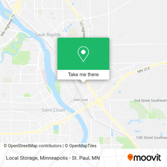
See Local Storage, St. Cloud, on the map
Public Transit to Local Storage in St. Cloud
Wondering how to get to Local Storage in St. Cloud? Moovit helps you find the best way to get to Local Storage with step-by-step directions from the nearest public transit station.
Moovit provides free maps and live directions to help you navigate through your city. View schedules, routes, timetables, and find out how long does it take to get to Local Storage in real time.
Looking for the nearest stop or station to Local Storage? Check out this list of stops closest to your destination: St. Cloud Amtrak Station.
Bus: FLIXBUS 2548.Train: EMPIRE BUILDER.
Want to see if there’s another route that gets you there at an earlier time? Moovit helps you find alternative routes or times. Get directions from and directions to Local Storage easily from the Moovit App or Website.
We make riding to Local Storage easy, which is why over 1.7 million users, including users in St. Cloud, trust Moovit as the best app for public transit. You don’t need to download an individual bus app or train app, Moovit is your all-in-one transit app that helps you find the best bus time or train time available.
For information on prices of bus, costs and ride fares to Local Storage, please check the Moovit app.
Use the app to navigate to popular places including to the airport, hospital, stadium, grocery store, mall, coffee shop, school, college, and university.
Local Storage Address: 540 Apollo Ave NE street in St. Cloud
- Python's (Pythons Recycling),
- Zip Code,
- Granite City Substation,
- 50 Highway 10 North Parking,
- US Bank,
- Roadrunner Transportation Services,
- Auto Repair Clinic,
- Alcohol & Drug Rehab Detox,
- Amazon Counter-Handyman's Hardware,
- United Motors,
- Falcon Auto LLC.,
- Shopko ST.Cloud East,
- Iron Street Distillery,
- Western Auto,
- Benton County Fairgrounds,
- Country Inn & Suites by Radisson, St. Cloud East, Mn,
- Lovely Lashes by Shine,
- Eastgate Business Center,
- Cornerstones Center,
- Epilepsy Foundation
Places Near Local Storage (St. Cloud)
- Surly Brewing Co., Minneapolis,
- Minnehaha Falls, Minneapolis,
- Mpls. Convention Center, Minneapolis,
- Harriet Island Regional Park, St. Paul,
- St. Paul College, St. Paul,
- Orpheum Theatre (Minneapolis, Minnesota), Minneapolis,
- Minneapolis Sculpture Garden, Minneapolis,
- Grand Casino Hinckley,MN, Minneapolis,
- Northrop Auditorium, Minneapolis,
- Huntington Bank Stadium, Minneapolis,
- Abbott Northwestern Piper Building, Minneapolis,
- Mystic lake casino bus, Minneapolis,
- 3m Arena at Mariucci, Minneapolis,
- Xcel Energy Center, St. Paul,
- Bishop Henry Whipple Federal Building,
- Minnesota State Capitol, St. Paul,
- Minneapolis Institute of Art, Minneapolis,
- Target Center, Minneapolis,
- Treasure Island Resort & Casino, St. Paul,
- Target Field, Minneapolis
How to get to popular places in Minneapolis - St. Paul, MN with public transit
Get around St. Cloud by public transit!
Traveling around St. Cloud has never been so easy. See step by step directions as you travel to any attraction, street or major public transit station. View bus and train schedules, arrival times, service alerts and detailed routes on a map, so you know exactly how to get to anywhere in St. Cloud.
When traveling to any destination around St. Cloud use Moovit's Live Directions with Get Off Notifications to know exactly where and how far to walk, how long to wait for your line, and how many stops are left. Moovit will alert you when it's time to get off — no need to constantly re-check whether yours is the next stop.
Wondering how to use public transit in St. Cloud or how to pay for public transit in St. Cloud? Moovit public transit app can help you navigate your way with public transit easily, and at minimum cost. It includes public transit fees, ticket prices, and costs. Looking for a map of St. Cloud public transit lines? Moovit public transit app shows all public transit maps in St. Cloud with all Bus, Train and Light Rail routes and stops on an interactive map.
Minneapolis - St. Paul, MN has 3 transit type(s), including: Bus, Train and Light Rail, operated by several transit agencies, including Metro Transit , Metro Transit, MVTA, Plymouth Metrolink, SouthWest Transit, Maple Grove, University of Minnesota, Airport (MAC), Amtrak, Mankato Transit System, SMART, FlixBus-us and Greyhound-us