How to get to Localmn Interactive by bus?
Click on the bus route to see step by step directions with maps, line arrival times and updated time schedules.
From Aquila Park, St. Louis Park
51 minFrom I-394 & Xenia/Park Place, St. Louis Park
29 minFrom University and Snelling Ave, St. Paul
32 minFrom Central High School Service Station, St. Paul
52 minFrom Roseville, Minnesota, Roseville
48 minFrom La Fitness, St. Louis Park
36 minFrom Garden City Park, Brooklyn Center
46 minFrom Minneapolis Veterans Home, Minneapolis
62 minFrom University of Northwestern St Paul, Arden Hills
80 min
Bus stops near Localmn Interactive in Minneapolis
- Hennepin Ave & 1st St S, 2 min walk,VIEW
- Washington Ave S & 2nd / Marquette Ave, 2 min walk,VIEW
- 1st St N & Hennepin Ave, 3 min walk,VIEW
- Hennepin & Gateway Station, 3 min walk,VIEW
- Marquette Ave & Wash Ave S - Stop Grp A, 3 min walk,VIEW
- Washington Ave S & Marquette Ave, 3 min walk,VIEW
- 2nd Ave S & 1st St S, 5 min walk,VIEW
Light Rail stations near Localmn Interactive in Minneapolis
- Government Plaza, 10 min walk,VIEW
Bus lines to Localmn Interactive in Minneapolis
- 4, Johnson St / Silver Lk Vlg / Via Penn,VIEW
- 11, 4av S / To 46st-Nic,VIEW
- 61, Henn-Larp / Dwtn Mpls / Via Arcade,VIEW
- 824, Ltd Stop / University / Dtwn Mpls,VIEW
- 827, E River Rd / Northtown,VIEW
- 667, Express / Hwy 7 / Co 101,VIEW
- 673, Express / Cr 73 P&R / Cedar Lk Rd,VIEW
- 3, Como Av / Eustis Pr,VIEW
- 7, Plymouth / Theo Wirth,VIEW
- 10, Central / Via Univ / Northtown,VIEW
- 17, Mtka Blvd / 24st-Uptown / Downtown,VIEW
- 25, Kenwood / Cedar Trail,VIEW
- METRO E LINE, Henn-France / Westgate Station,VIEW
- 156, Express / 56st-Xerxes,VIEW
- 747, Station 73 / Xenium Ln,VIEW
- 774, Plymouth / Sta73 / Greenway,VIEW
- 776, Plymouth / St Phillp / Greenway,VIEW
- 777, Plymouth / Sta73 / Reserve,VIEW
- 790, Plymouth / Nathan Ln,VIEW
- 795, East Town / Mpls / Sta73 / Plymouth,VIEW
What are the closest stations to Localmn Interactive?
The closest stations to Localmn Interactive are:
- Hennepin Ave & 1st St S is 119 yards away, 2 min walk.
- 1st St N & Hennepin Ave is 122 yards away, 3 min walk.
- Washington Ave S & 2nd / Marquette Ave is 130 yards away, 2 min walk.
- Hennepin & Gateway Station is 136 yards away, 3 min walk.
- Marquette Ave & Wash Ave S - Stop Grp A is 226 yards away, 3 min walk.
- Washington Ave S & Marquette Ave is 234 yards away, 3 min walk.
- 2nd Ave S & 1st St S is 352 yards away, 5 min walk.
- Government Plaza is 779 yards away, 10 min walk.
Which bus lines stop near Localmn Interactive?
These bus lines stop near Localmn Interactive: 11, 14, 17, 22, 3, 4, 61, 645, METRO E LINE.
Which light rail line stops near Localmn Interactive?
METRO BLUE LINE (Mpls-Target Field)
What’s the nearest light rail station to Localmn Interactive in Minneapolis?
The nearest light rail station to Localmn Interactive in Minneapolis is Government Plaza. It’s a 10 min walk away.
What’s the nearest bus station to Localmn Interactive in Minneapolis?
The nearest bus stations to Localmn Interactive in Minneapolis are Hennepin Ave & 1st St S and Washington Ave S & 2nd / Marquette Ave. The closest one is a 2 min walk away.
What time is the first light rail to Localmn Interactive in Minneapolis?
The METRO BLUE LINE is the first light rail that goes to Localmn Interactive in Minneapolis. It stops nearby at 4:26 AM.
What time is the last light rail to Localmn Interactive in Minneapolis?
The METRO BLUE LINE is the last light rail that goes to Localmn Interactive in Minneapolis. It stops nearby at 12:50 AM.
What time is the first bus to Localmn Interactive in Minneapolis?
The 3 is the first bus that goes to Localmn Interactive in Minneapolis. It stops nearby at 4:09 AM.
What time is the last bus to Localmn Interactive in Minneapolis?
The 3 is the last bus that goes to Localmn Interactive in Minneapolis. It stops nearby at 2:00 AM.
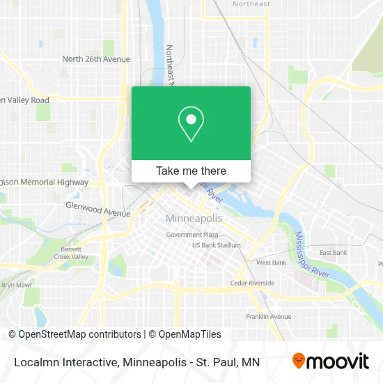
See Localmn Interactive, Minneapolis, on the map
Public Transit to Localmn Interactive in Minneapolis
Wondering how to get to Localmn Interactive in Minneapolis? Moovit helps you find the best way to get to Localmn Interactive with step-by-step directions from the nearest public transit station.
Moovit provides free maps and live directions to help you navigate through your city. View schedules, routes, timetables, and find out how long does it take to get to Localmn Interactive in real time.
Looking for the nearest stop or station to Localmn Interactive? Check out this list of stops closest to your destination: Hennepin Ave & 1st St S; 1st St N & Hennepin Ave; Washington Ave S & 2nd / Marquette Ave; Hennepin & Gateway Station; Marquette Ave & Wash Ave S - Stop Grp A; Washington Ave S & Marquette Ave; 2nd Ave S & 1st St S; Government Plaza.
Bus: 11, 14, 17, 22, 3, 4, 61, 645, METRO E LINE, 7, 10, 25, 824, 827, 667, 673, 156, 747, 774, 776, 777, 467, 698.Light Rail: METRO BLUE LINE.
Want to see if there’s another route that gets you there at an earlier time? Moovit helps you find alternative routes or times. Get directions from and directions to Localmn Interactive easily from the Moovit App or Website.
We make riding to Localmn Interactive easy, which is why over 1.7 million users, including users in Minneapolis, trust Moovit as the best app for public transit. You don’t need to download an individual bus app or train app, Moovit is your all-in-one transit app that helps you find the best bus time or train time available.
For information on prices of bus and light rail, costs and ride fares to Localmn Interactive, please check the Moovit app.
Use the app to navigate to popular places including to the airport, hospital, stadium, grocery store, mall, coffee shop, school, college, and university.
Localmn Interactive Address: 15 S 1st St street in Minneapolis
- Minneapolis Post Office,
- Bim Bam Boo Paper,
- Zach Kirchoff - Minneapolis Real Estate,
- Northwestern National Life Building,
- Minneapolis Fed Reserve BK,
- Federal Reserve Bank,
- United States Postal Service,
- General Contractor Web Design,
- Firebase Movement,
- Hennepin Avenue Parking Ramp,
- UPS,
- The Coven,
- Coven,
- Greater Minneapolis Convention & Visitors Association,
- 222 Hennepin Apartments,
- River Valley Church,
- Microsoft Building Minneapolis-100 Washington Ave S,
- Billy Sushi ビリー寿司,
- Billy After Dark,
- Sweet Chow Restaurant And Bar
Places Near Localmn Interactive (Minneapolis)
- Orpheum Theatre (Minneapolis, Minnesota), Minneapolis,
- Minnesota State Capitol, St. Paul,
- Treasure Island Resort & Casino, St. Paul,
- Mystic lake casino bus, Minneapolis,
- Harriet Island Regional Park, St. Paul,
- Huntington Bank Stadium, Minneapolis,
- Minnehaha Falls, Minneapolis,
- Minneapolis Sculpture Garden, Minneapolis,
- Xcel Energy Center, St. Paul,
- 3m Arena at Mariucci, Minneapolis,
- Grand Casino Hinckley,MN, Minneapolis,
- Mpls. Convention Center, Minneapolis,
- Target Field, Minneapolis,
- Bishop Henry Whipple Federal Building,
- Northrop Auditorium, Minneapolis,
- Surly Brewing Co., Minneapolis,
- Target Center, Minneapolis,
- St. Paul College, St. Paul,
- Minneapolis Institute of Art, Minneapolis,
- Abbott Northwestern Piper Building, Minneapolis
How to get to popular places in Minneapolis - St. Paul, MN with public transit
Get around Minneapolis by public transit!
Traveling around Minneapolis has never been so easy. See step by step directions as you travel to any attraction, street or major public transit station. View bus and train schedules, arrival times, service alerts and detailed routes on a map, so you know exactly how to get to anywhere in Minneapolis.
When traveling to any destination around Minneapolis use Moovit's Live Directions with Get Off Notifications to know exactly where and how far to walk, how long to wait for your line, and how many stops are left. Moovit will alert you when it's time to get off — no need to constantly re-check whether yours is the next stop.
Wondering how to use public transit in Minneapolis or how to pay for public transit in Minneapolis? Moovit public transit app can help you navigate your way with public transit easily, and at minimum cost. It includes public transit fees, ticket prices, and costs. Looking for a map of Minneapolis public transit lines? Moovit public transit app shows all public transit maps in Minneapolis with all Bus, Train and Light Rail routes and stops on an interactive map.
Minneapolis - St. Paul, MN has 3 transit type(s), including: Bus, Train and Light Rail, operated by several transit agencies, including Metro Transit , Metro Transit, MVTA, Plymouth Metrolink, SouthWest Transit, Maple Grove, University of Minnesota, Airport (MAC), Amtrak, Mankato Transit System, SMART, FlixBus-us and Greyhound-us