Directions to Lock Tight Security (Jersey City) with public transportation
The following transit lines have routes that pass near Lock Tight Security
 Bus: 119, 6, 81, 87, PORT LIBERTE - PIER 11/WALL ST.
How to get to Lock Tight Security by bus?
Click on the bus route to see step by step directions with maps, line arrival times and updated time schedules.
Bus stops near Lock Tight Security in Jersey City
Light Rail stations near Lock Tight Security in Jersey City
- Danforth Avenue Light Rail Station, 9 min walk,VIEW
Bus lines to Lock Tight Security in Jersey City
What are the closest stations to Lock Tight Security?
The closest stations to Lock Tight Security are:
- Ocean Avenue 214 is 23 yards away, 1 min walk.
- Old Bergen Rd at Danforth Ave is 326 yards away, 4 min walk.
- Danforth Avenue Light Rail Station is 740 yards away, 9 min walk.
Which bus lines stop near Lock Tight Security?
These bus lines stop near Lock Tight Security: 119, 6, 81, 87, PORT LIBERTE - PIER 11/WALL ST.
What’s the nearest light rail station to Lock Tight Security in Jersey City?
The nearest light rail station to Lock Tight Security in Jersey City is Danforth Avenue Light Rail Station. It’s a 9 min walk away.
What’s the nearest bus station to Lock Tight Security in Jersey City?
The nearest bus station to Lock Tight Security in Jersey City is Ocean Avenue 214. It’s a 1 min walk away.
What time is the first light rail to Lock Tight Security in Jersey City?
The HBLR is the first light rail that goes to Lock Tight Security in Jersey City. It stops nearby at 4:37 AM.
What time is the last light rail to Lock Tight Security in Jersey City?
The HBLR is the last light rail that goes to Lock Tight Security in Jersey City. It stops nearby at 2:30 AM.
What time is the first bus to Lock Tight Security in Jersey City?
The 87 is the first bus that goes to Lock Tight Security in Jersey City. It stops nearby at 3:01 AM.
What time is the last bus to Lock Tight Security in Jersey City?
The 81 is the last bus that goes to Lock Tight Security in Jersey City. It stops nearby at 1:19 AM.
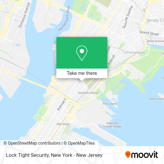
See Lock Tight Security, Jersey City, on the map
Public Transit to Lock Tight Security in Jersey City
Wondering how to get to Lock Tight Security in Jersey City? Moovit helps you find the best way to get to Lock Tight Security with step-by-step directions from the nearest public transit station.
Moovit provides free maps and live directions to help you navigate through your city. View schedules, routes, timetables, and find out how long does it take to get to Lock Tight Security in real time.
Looking for the nearest stop or station to Lock Tight Security? Check out this list of stops closest to your destination: Ocean Avenue 214; Old Bergen Rd at Danforth Ave; Danforth Avenue Light Rail Station.
Bus: 119, 6, 81, 87, PORT LIBERTE - PIER 11/WALL ST, 8.
Want to see if there’s another route that gets you there at an earlier time? Moovit helps you find alternative routes or times. Get directions from and directions to Lock Tight Security easily from the Moovit App or Website.
We make riding to Lock Tight Security easy, which is why over 1.5 million users, including users in Jersey City, trust Moovit as the best app for public transit. You don’t need to download an individual bus app or train app, Moovit is your all-in-one transit app that helps you find the best bus time or train time available.
For information on prices of bus, train and subway, costs and ride fares to Lock Tight Security, please check the Moovit app.
Use the app to navigate to popular places including to the airport, hospital, stadium, grocery store, mall, coffee shop, school, college, and university.
Lock Tight Security Address: 108 Danforth Ave street in Jersey City
- Danforth Ave at Ocean,
- El Tabernaculo,
- Dunkin',
- Mira Greens Llc,
- Western Union,
- Lou's,
- Mauricio's Restaurant,
- American Laundromat Of Jersey City,
- NJ Home Health Care,
- K Squared Designs,
- Glenn D. Cunningham Early Childhood Center,
- Athens II,
- The Parlor,
- Gotta Go Gaming Hub & Sci-Tech Learning Center,
- Mount Calvary Missionary Baptist Church,
- Truth Church NJ,
- Keane Virginia,
- A Better Life Ministry,
- Greater Neighborhood Alliance,
- Dr. Maya Angelou School
Places Near Lock Tight Security (Jersey City)
- Pier 83, Manhattan,
- Katz's Deli, Manhattan,
- Chinatown, Manhattan,
- 1 Police Plaza, Manhattan,
- 3 Stone St, Manhattan,
- qqqq, Manhattan,
- 911 Memorial, Manhattan,
- San Gennaro Feast, Manhattan,
- Rockefeller Center, Manhattan,
- 66 John Street, Manhattan,
- Hudson Yards, Manhattan,
- 111 Centre New York City Supreme Court, Manhattan,
- 376 Hudson Street, Manhattan,
- 26 Federal Plaza, Manhattan,
- Queens Center Mall, Queens,
- Bellevue Hospital, Manhattan,
- Times Square, Manhattan,
- Mountainside Hospital, Glen Ridge,
- Wall Street, Manhattan,
- SoHo, Manhattan
How to get to popular places in New York - New Jersey with public transit
Get around Jersey City by public transit!
Traveling around Jersey City has never been so easy. See step by step directions as you travel to any attraction, street or major public transit station. View bus and train schedules, arrival times, service alerts and detailed routes on a map, so you know exactly how to get to anywhere in Jersey City.
When traveling to any destination around Jersey City use Moovit's Live Directions with Get Off Notifications to know exactly where and how far to walk, how long to wait for your line, and how many stops are left. Moovit will alert you when it's time to get off — no need to constantly re-check whether yours is the next stop.
Wondering how to use public transit in Jersey City or how to pay for public transit in Jersey City? Moovit public transit app can help you navigate your way with public transit easily, and at minimum cost. It includes public transit fees, ticket prices, and costs. Looking for a map of Jersey City public transit lines? Moovit public transit app shows all public transit maps in Jersey City with all Bus, Train, Subway, Light Rail, Ferry and Cable Car routes and stops on an interactive map.
New York - New Jersey has 6 transit type(s), including: Bus, Train, Subway, Light Rail, Ferry and Cable Car, operated by several transit agencies, including MTA Subway, Metro-North Railroad, LIRR, PATH, MTA New York City Transit - Express routes, MTA Bus, NJ Transit, NYC Ferry, NICE bus, Bee-Line Bus, NJ Transit Rail, Norwalk Transit District, Hartford Line, River Valley Transit and HART