Directions to Lockout (St. Paul) with public transportation
The following transit lines have routes that pass near Lockout
 Bus: 62, 74.
- Train: BOREALIS, EMPIRE BUILDER.
How to get to Lockout by bus?
Click on the bus route to see step by step directions with maps, line arrival times and updated time schedules.
From 38th Street LRT Station, Minneapolis
75 minFrom The Market at Malcolm Yards, Minneapolis
65 minFrom Target, St. Paul
45 minFrom Highland Park Senior High School, St. Paul
53 minFrom 35e And Lone Oak Road, Eagan
86 minFrom The Cardinal Restaurant & Bar, Minneapolis
76 minFrom Minnehaha Park, Minneapolis
60 minFrom Pride Transportation Bus Services, St. Paul
36 min
Bus stop near Lockout in St. Paul
- Smith Ave & King St W, 2 min walk,VIEW
Light Rail stations near Lockout in St. Paul
- Union Depot Station, 11 min walk,VIEW
Train station near Lockout in St. Paul
- St. Paul-Minneapolis, 14 min walk,VIEW
Bus lines to Lockout in St. Paul
- 62, Rice St / Little Canada / Via Canabury,VIEW
What are the closest stations to Lockout?
The closest stations to Lockout are:
- Smith Ave & King St W is 103 yards away, 2 min walk.
- Union Depot Station is 875 yards away, 11 min walk.
- St. Paul-Minneapolis is 1115 yards away, 14 min walk.
Which bus lines stop near Lockout?
These bus lines stop near Lockout: 62, 74.
What’s the nearest light rail station to Lockout in St. Paul?
The nearest light rail station to Lockout in St. Paul is Union Depot Station. It’s a 11 min walk away.
What’s the nearest train station to Lockout in St. Paul?
The nearest train station to Lockout in St. Paul is St. Paul-Minneapolis. It’s a 14 min walk away.
What’s the nearest bus station to Lockout in St. Paul?
The nearest bus station to Lockout in St. Paul is Smith Ave & King St W. It’s a 2 min walk away.
What time is the first light rail to Lockout in St. Paul?
The METRO GREEN LINE is the first light rail that goes to Lockout in St. Paul. It stops nearby at 4:26 AM.
What time is the last light rail to Lockout in St. Paul?
The METRO GREEN LINE is the last light rail that goes to Lockout in St. Paul. It stops nearby at 12:10 AM.
What time is the first train to Lockout in St. Paul?
The BOREALIS is the first train that goes to Lockout in St. Paul. It stops nearby at 11:39 AM.
What time is the last train to Lockout in St. Paul?
The EMPIRE BUILDER is the last train that goes to Lockout in St. Paul. It stops nearby at 8:50 AM.
What time is the first bus to Lockout in St. Paul?
The 62 is the first bus that goes to Lockout in St. Paul. It stops nearby at 4:28 AM.
What time is the last bus to Lockout in St. Paul?
The 62 is the last bus that goes to Lockout in St. Paul. It stops nearby at 11:27 PM.
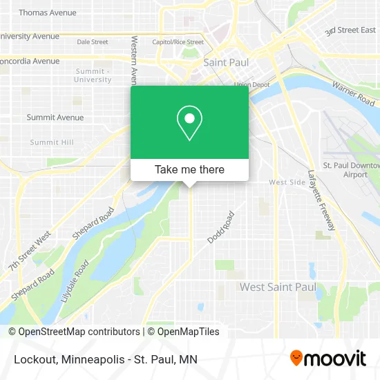
See Lockout, St. Paul, on the map
Public Transit to Lockout in St. Paul
Wondering how to get to Lockout in St. Paul? Moovit helps you find the best way to get to Lockout with step-by-step directions from the nearest public transit station.
Moovit provides free maps and live directions to help you navigate through your city. View schedules, routes, timetables, and find out how long does it take to get to Lockout in real time.
Looking for the nearest stop or station to Lockout? Check out this list of stops closest to your destination: Smith Ave & King St W; Union Depot Station; St. Paul-Minneapolis.
Bus: 62, 74.Train: BOREALIS, EMPIRE BUILDER.
Want to see if there’s another route that gets you there at an earlier time? Moovit helps you find alternative routes or times. Get directions from and directions to Lockout easily from the Moovit App or Website.
We make riding to Lockout easy, which is why over 1.7 million users, including users in St. Paul, trust Moovit as the best app for public transit. You don’t need to download an individual bus app or train app, Moovit is your all-in-one transit app that helps you find the best bus time or train time available.
For information on prices of bus and light rail, costs and ride fares to Lockout, please check the Moovit app.
Use the app to navigate to popular places including to the airport, hospital, stadium, grocery store, mall, coffee shop, school, college, and university.
Lockout Address: 577 Smith Ave S St Paul, MN 55107 street in St. Paul
- Chiropractors Decompression Therapy,
- Vicious Ink by Syd,
- Sparkling Image Detail,
- Minnesota Society,
- Trierweiler Lawn & Snow,
- Hawks View Cottages,
- River Ridge Condo Association,
- The Lighthouse of St. Paul,
- United Methodist Hmong Ministry,
- Sam Morgan Regional Trail,
- Tulips and A Kiss,
- Cherokee Regional Park,
- Harriet Island Regional Park,
- Fossil Grounds Parking Lot,
- Cashnetwork,
- Steel City Auto Recycling-St Paul & Minneapolis MN,
- In the Word Church Ministries,
- River of Hope Ministries,
- Bidwell St Building 435,
- Ecuador Manta
Places Near Lockout (St. Paul)
- Target Field, Minneapolis,
- Target Center, Minneapolis,
- St. Paul College, St. Paul,
- 3m Arena at Mariucci, Minneapolis,
- Surly Brewing Co., Minneapolis,
- Huntington Bank Stadium, Minneapolis,
- Minnehaha Falls, Minneapolis,
- Orpheum Theatre (Minneapolis, Minnesota), Minneapolis,
- Minnesota State Capitol, St. Paul,
- Northrop Auditorium, Minneapolis,
- Minneapolis Sculpture Garden, Minneapolis,
- Abbott Northwestern Piper Building, Minneapolis,
- Minneapolis Institute of Art, Minneapolis,
- Mpls. Convention Center, Minneapolis,
- Xcel Energy Center, St. Paul,
- Bishop Henry Whipple Federal Building,
- Grand Casino Hinckley,MN, Minneapolis,
- Harriet Island Regional Park, St. Paul,
- Treasure Island Resort & Casino, St. Paul,
- Mystic lake casino bus, Minneapolis
How to get to popular places in Minneapolis - St. Paul, MN with public transit
Get around St. Paul by public transit!
Traveling around St. Paul has never been so easy. See step by step directions as you travel to any attraction, street or major public transit station. View bus and train schedules, arrival times, service alerts and detailed routes on a map, so you know exactly how to get to anywhere in St. Paul.
When traveling to any destination around St. Paul use Moovit's Live Directions with Get Off Notifications to know exactly where and how far to walk, how long to wait for your line, and how many stops are left. Moovit will alert you when it's time to get off — no need to constantly re-check whether yours is the next stop.
Wondering how to use public transit in St. Paul or how to pay for public transit in St. Paul? Moovit public transit app can help you navigate your way with public transit easily, and at minimum cost. It includes public transit fees, ticket prices, and costs. Looking for a map of St. Paul public transit lines? Moovit public transit app shows all public transit maps in St. Paul with all Bus, Train and Light Rail routes and stops on an interactive map.
Minneapolis - St. Paul, MN has 3 transit type(s), including: Bus, Train and Light Rail, operated by several transit agencies, including Metro Transit , Metro Transit, MVTA, Plymouth Metrolink, SouthWest Transit, Maple Grove, University of Minnesota, Airport (MAC), Amtrak, Mankato Transit System, SMART, FlixBus-us and Greyhound-us