Directions to Locks & Key (Coon Rapids) with public transportation
The following transit lines have routes that pass near Locks & Key
 Bus: 805.
How to get to Locks & Key by bus?
Click on the bus route to see step by step directions with maps, line arrival times and updated time schedules.
From Michal's Boots & Shoe Repair, Osseo
121 minFrom 7650 Sunwood Dr NW Garage, Ramsey
39 minFrom Cobblestone Square, Osseo
120 minFrom Hwy 169/Bottineau Blvd/85th Ave N, Osseo
120 minFrom Coinstar, Brooklyn Park
144 minFrom North Hennepin Community College, Brooklyn Park
106 minFrom Cutter Sales, Brooklyn Park
112 minFrom Vilhauer Physical Therapy, Brooklyn Park
97 minFrom 7545 Veterans Drive, Ramsey
40 minFrom Sherburne Masonic Lodge #95, Osseo
121 min
Bus stop near Locks & Key in Coon Rapids
- Riverdale Crossing & Cub Foods, 1 min walk,VIEW
Bus lines to Locks & Key in Coon Rapids
- 805, Riverdale / Coon Rapids / Northtown,VIEW
What are the closest stations to Locks & Key?
The closest stations to Locks & Key are:
- Riverdale Crossing & Cub Foods is 45 yards away, 1 min walk.
Which bus line stops near Locks & Key?
805 (Riverdale / Coon Rapids / Northtown)
What’s the nearest bus station to Locks & Key in Coon Rapids?
The nearest bus station to Locks & Key in Coon Rapids is Riverdale Crossing & Cub Foods. It’s a 1 min walk away.
What time is the first bus to Locks & Key in Coon Rapids?
The 805 is the first bus that goes to Locks & Key in Coon Rapids. It stops nearby at 6:17 AM.
What time is the last bus to Locks & Key in Coon Rapids?
The 805 is the last bus that goes to Locks & Key in Coon Rapids. It stops nearby at 7:39 PM.
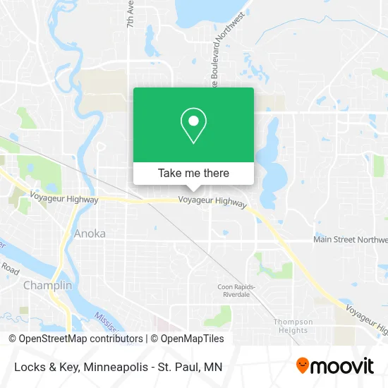
See Locks & Key, Coon Rapids, on the map
Public Transit to Locks & Key in Coon Rapids
Wondering how to get to Locks & Key in Coon Rapids? Moovit helps you find the best way to get to Locks & Key with step-by-step directions from the nearest public transit station.
Moovit provides free maps and live directions to help you navigate through your city. View schedules, routes, timetables, and find out how long does it take to get to Locks & Key in real time.
Looking for the nearest stop or station to Locks & Key? Check out this list of stops closest to your destination: Riverdale Crossing & Cub Foods.
Bus: 805.
Want to see if there’s another route that gets you there at an earlier time? Moovit helps you find alternative routes or times. Get directions from and directions to Locks & Key easily from the Moovit App or Website.
We make riding to Locks & Key easy, which is why over 1.7 million users, including users in Coon Rapids, trust Moovit as the best app for public transit. You don’t need to download an individual bus app or train app, Moovit is your all-in-one transit app that helps you find the best bus time or train time available.
For information on prices of bus, costs and ride fares to Locks & Key, please check the Moovit app.
Use the app to navigate to popular places including to the airport, hospital, stadium, grocery store, mall, coffee shop, school, college, and university.
Locks & Key Address: 12900 Riverdale Dr NW Minneapolis, MN 55448 street in Coon Rapids
- The Huntington National Bank,
- Cub Foods,
- Minute Key,
- Turn Style Consignment,
- Bakers Square (Baker's Square),
- Navy Federal Credit Union,
- Thu T. Doan, DDS,
- Tina Nguyen DDS,
- High Monkey,
- Universal Medical Data,
- Shred Nations,
- Flooring Expo,
- Papa John's,
- Total by Verizon,
- Posh 22 Cat Leavy,
- bp,
- Circle K,
- CK Holiday,
- Phillips 66,
- STARBUCKS
Places Near Locks & Key (Coon Rapids)
- Bishop Henry Whipple Federal Building,
- St. Paul College, St. Paul,
- Grand Casino Hinckley,MN, Minneapolis,
- 3m Arena at Mariucci, Minneapolis,
- Mpls. Convention Center, Minneapolis,
- Harriet Island Regional Park, St. Paul,
- Abbott Northwestern Piper Building, Minneapolis,
- Xcel Energy Center, St. Paul,
- Target Field, Minneapolis,
- Treasure Island Resort & Casino, St. Paul,
- Mystic lake casino bus, Minneapolis,
- Minneapolis Institute of Art, Minneapolis,
- Northrop Auditorium, Minneapolis,
- Minneapolis Sculpture Garden, Minneapolis,
- Target Center, Minneapolis,
- Huntington Bank Stadium, Minneapolis,
- Surly Brewing Co., Minneapolis,
- Minnesota State Capitol, St. Paul,
- Orpheum Theatre (Minneapolis, Minnesota), Minneapolis,
- Minnehaha Falls, Minneapolis
How to get to popular places in Minneapolis - St. Paul, MN with public transit
Get around Coon Rapids by public transit!
Traveling around Coon Rapids has never been so easy. See step by step directions as you travel to any attraction, street or major public transit station. View bus and train schedules, arrival times, service alerts and detailed routes on a map, so you know exactly how to get to anywhere in Coon Rapids.
When traveling to any destination around Coon Rapids use Moovit's Live Directions with Get Off Notifications to know exactly where and how far to walk, how long to wait for your line, and how many stops are left. Moovit will alert you when it's time to get off — no need to constantly re-check whether yours is the next stop.
Wondering how to use public transit in Coon Rapids or how to pay for public transit in Coon Rapids? Moovit public transit app can help you navigate your way with public transit easily, and at minimum cost. It includes public transit fees, ticket prices, and costs. Looking for a map of Coon Rapids public transit lines? Moovit public transit app shows all public transit maps in Coon Rapids with all Bus, Train and Light Rail routes and stops on an interactive map.
Minneapolis - St. Paul, MN has 3 transit type(s), including: Bus, Train and Light Rail, operated by several transit agencies, including Metro Transit , Metro Transit, MVTA, Plymouth Metrolink, SouthWest Transit, Maple Grove, University of Minnesota, Airport (MAC), Amtrak, Mankato Transit System, SMART, FlixBus-us and Greyhound-us