Directions to Locks & Locksmiths (Wakefield) with public transportation
The following transit lines have routes that pass near Locks & Locksmiths
How to get to Locks & Locksmiths by bus?
Click on the bus route to see step by step directions with maps, line arrival times and updated time schedules.
From Walmart, Saugus
79 minFrom Burlington, MA, Burlington
104 minFrom Chevalier Theatre (Chevalier Theater Show Line), Medford
66 minFrom Saugus, MA, Saugus
72 minFrom Woburn, MA, Woburn
90 minFrom 200 Trade Center, Woburn
114 minFrom Chevalier Theater, Medford
67 minFrom Market Basket, Revere
73 minFrom GE Aviation, Lynn
117 minFrom Winchester, MA, Winchester
96 min
How to get to Locks & Locksmiths by train?
Click on the train route to see step by step directions with maps, line arrival times and updated time schedules.
Bus stops near Locks & Locksmiths in Wakefield
Bus lines to Locks & Locksmiths in Wakefield
- 137, Malden,VIEW
- HAVERHILL LINE SHUTTLE, Ballardvale - Malden Center,VIEW
- HAVERHILL LINE SHUTTLE, Reading - Oak Grove,VIEW
- HAVERHILL LINE SHUTTLE, Haverhill - Malden Center,VIEW
- HAVERHILL LINE SHUTTLE, Haverhill - North Station,VIEW
- HAVERHILL LINE SHUTTLE, Ballardvale - North Station,VIEW
- HAVERHILL, Haverhill,VIEW
What are the closest stations to Locks & Locksmiths?
The closest stations to Locks & Locksmiths are:
- Main St @ Water St is 404 yards away, 6 min walk.
- Wakefield is 626 yards away, 8 min walk.
Which bus line stops near Locks & Locksmiths?
137 (Reading Depot)
Which train line stops near Locks & Locksmiths?
HAVERHILL (#229 | Haverhill)
What’s the nearest bus station to Locks & Locksmiths in Wakefield?
The nearest bus station to Locks & Locksmiths in Wakefield is Main St @ Water St. It’s a 6 min walk away.
What time is the first train to Locks & Locksmiths in Wakefield?
The HAVERHILL is the first train that goes to Locks & Locksmiths in Wakefield. It stops nearby at 5:18 AM.
What time is the last train to Locks & Locksmiths in Wakefield?
The HAVERHILL is the last train that goes to Locks & Locksmiths in Wakefield. It stops nearby at 12:13 AM.
What time is the first bus to Locks & Locksmiths in Wakefield?
The 137 is the first bus that goes to Locks & Locksmiths in Wakefield. It stops nearby at 5:09 AM.
What time is the last bus to Locks & Locksmiths in Wakefield?
The 137 is the last bus that goes to Locks & Locksmiths in Wakefield. It stops nearby at 10:46 PM.
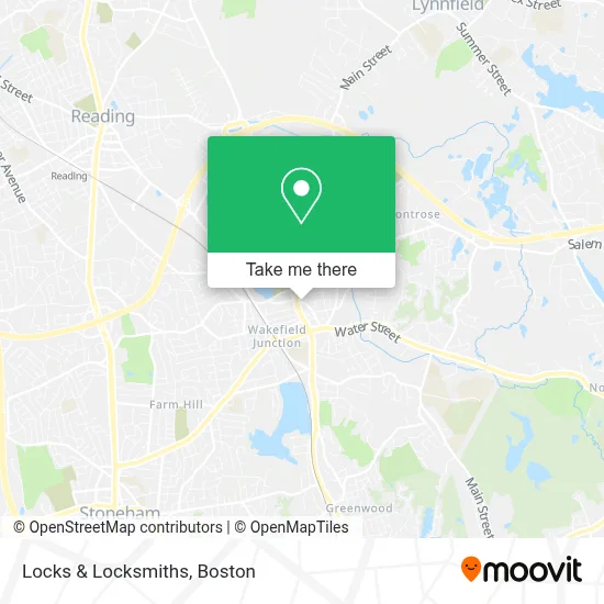
See Locks & Locksmiths, Wakefield, on the map
Public Transit to Locks & Locksmiths in Wakefield
Wondering how to get to Locks & Locksmiths in Wakefield? Moovit helps you find the best way to get to Locks & Locksmiths with step-by-step directions from the nearest public transit station.
Moovit provides free maps and live directions to help you navigate through your city. View schedules, routes, timetables, and find out how long does it take to get to Locks & Locksmiths in real time.
Looking for the nearest stop or station to Locks & Locksmiths? Check out this list of stops closest to your destination: Main St @ Water St; Wakefield.
Bus: 137, HAVERHILL LINE SHUTTLE, HAVERHILL LINE SHUTTLE, HAVERHILL LINE SHUTTLE, HAVERHILL LINE SHUTTLE, HAVERHILL LINE SHUTTLE.Train: HAVERHILL.
Want to see if there’s another route that gets you there at an earlier time? Moovit helps you find alternative routes or times. Get directions from and directions to Locks & Locksmiths easily from the Moovit App or Website.
We make riding to Locks & Locksmiths easy, which is why over 1.7 million users, including users in Wakefield, trust Moovit as the best app for public transit. You don’t need to download an individual bus app or train app, Moovit is your all-in-one transit app that helps you find the best bus time or train time available.
For information on prices of bus, subway and train, costs and ride fares to Locks & Locksmiths, please check the Moovit app.
Use the app to navigate to popular places including to the airport, hospital, stadium, grocery store, mall, coffee shop, school, college, and university.
Locks & Locksmiths Address: 7 Crescent St street in Wakefield
- Michael Doherty DDS,
- Mojo Sushi,
- Wakefield Locksmith,
- Three Four Zero Main Restaurant Group,
- Always Available Emergency Locksmith,
- Lucius Beebe Memorial Library (Friends of the Beebe Library),
- FedEx Drop Box,
- Kookipets,
- The Speech Therapy Center,
- Balance Yoga Studio,
- Nawadaha Fa,
- Luise Richard,
- Posner Philip B Attorney at Law,
- WM C Skulley Attorney,
- Nathan Car Locksmith,
- Amazon Locker-Lenora,
- Nonnie's Kitchen,
- Veterans Memorial Common,
- Adocicadoce,
- MBTA Bus 137
Places Near Locks & Locksmiths (Wakefield)
- Wang Theater, Boston,
- Massachusetts General Hospital, Boston,
- Cheers, Boston,
- Td Garden, Boston,
- Boston Medical Center, Boston,
- Quincy Market, Boston,
- North End, Boston,
- Seaport District, Boston,
- Faneuil Hall, Boston,
- Isabella Stewart Gardner Museum, Boston,
- Boston Convention & Exhibition Center, Boston,
- Museum Of Science, Boston,
- Boston Common, Boston,
- Leader Bank Pavilion (Leader Bank Pavillion), Boston,
- Wilbur Theatre, Boston,
- Mgm Music Hall, Boston,
- Prudential Center, Boston,
- Castle Island, Boston,
- House Of Blues, Boston,
- Boston Children's Hospital, Boston
How to get to popular places in Boston with public transit
Get around Wakefield by public transit!
Traveling around Wakefield has never been so easy. See step by step directions as you travel to any attraction, street or major public transit station. View bus and train schedules, arrival times, service alerts and detailed routes on a map, so you know exactly how to get to anywhere in Wakefield.
When traveling to any destination around Wakefield use Moovit's Live Directions with Get Off Notifications to know exactly where and how far to walk, how long to wait for your line, and how many stops are left. Moovit will alert you when it's time to get off — no need to constantly re-check whether yours is the next stop.
Wondering how to use public transit in Wakefield or how to pay for public transit in Wakefield? Moovit public transit app can help you navigate your way with public transit easily, and at minimum cost. It includes public transit fees, ticket prices, and costs. Looking for a map of Wakefield public transit lines? Moovit public transit app shows all public transit maps in Wakefield with all Bus, Train, Subway and Ferry routes and stops on an interactive map.
Boston has 4 transit type(s), including: Bus, Train, Subway and Ferry, operated by several transit agencies, including MBTA, Southeastern Regional Transit Authority, MetroWest Regional Transit Authority, Rhode Island Public Transit Authority, WRTA, Lowell Regional Transit Authority, Merrimack Valley Transit, Montachusett Regional Transit Authority, Cape Cod Regional Transit Authority, Brockton Area Transit Authority, Martha's Vineyard Transit Authority, the WAVE - Nantucket Regional Transit Authority, GATRA, Cape Ann Transportation Authority and Massport