Directions to Locks & Locksmiths (Malden) with public transportation
The following transit lines have routes that pass near Locks & Locksmiths
 Bus: 101, 104, 105, 97, 99.
- Train: HAVERHILL, NEWBURYPORT/ROCKPORT.
- Subway: ORANGE LINE, GREEN LINE B, GREEN LINE C, GREEN LINE E.
How to get to Locks & Locksmiths by bus?
Click on the bus route to see step by step directions with maps, line arrival times and updated time schedules.
From Boston Burger Company - Boston, Boston
78 minFrom MBTA-Museum of Fine Arts, Boston
88 minFrom Sonia, Boston
80 minFrom Massachusetts Institute of Technology (MIT), Cambridge
54 minFrom Massachusetts Eye And Ear, Boston
60 minFrom Hampton Inn & Suites-Hampton Watertown Boston (Hampton Inn & Suites Watertown Boston), Watertown Town
102 minFrom Spaulding Hospital, Cambridge
56 minFrom Beth Israel Deaconess Medical Center, Boston
66 minFrom North End, Boston
53 minFrom Beth Israel Hospital, Boston
67 min
How to get to Locks & Locksmiths by train?
Click on the train route to see step by step directions with maps, line arrival times and updated time schedules.
How to get to Locks & Locksmiths by subway?
Click on the subway route to see step by step directions with maps, line arrival times and updated time schedules.
From Boston Burger Company - Boston, Boston
37 minFrom MBTA-Museum of Fine Arts, Boston
36 minFrom Sonia, Boston
72 minFrom Massachusetts Institute of Technology (MIT), Cambridge
46 minFrom Massachusetts Eye And Ear, Boston
30 minFrom Spaulding Hospital, Cambridge
53 minFrom Beth Israel Deaconess Medical Center, Boston
53 minFrom North End, Boston
22 minFrom Beth Israel Hospital, Boston
53 min
Bus stops near Locks & Locksmiths in Malden
Subway station near Locks & Locksmiths in Malden
- Medford/Tufts Station, 55 min walk,VIEW
Train station near Locks & Locksmiths in Malden
- Chelsea, 66 min walk,VIEW
Bus lines to Locks & Locksmiths in Malden
- 99, Wellington - Woodland Rd,VIEW
- 105, Sullivan - Malden,VIEW
- 106, Wellington - Lebanon Loop,VIEW
- 108, Wellington - Linden Square,VIEW
- 131, Malden via Oak Grove - Melrose Highlands via Oak Grove,VIEW
- 137, Malden - Reading Depot,VIEW
- 411, Malden - Jack Satter House,VIEW
- 430, Malden via Square One Mall - Saugus Center via Square One Mall,VIEW
- 104, Malden,VIEW
- 132, Malden,VIEW
- 101, Malden,VIEW
- 97, Malden,VIEW
- HAVERHILL LINE SHUTTLE, Ballardvale - North Station,VIEW
- HAVERHILL LINE SHUTTLE, Ballardvale - Malden Center,VIEW
- HAVERHILL LINE SHUTTLE, Haverhill - Malden Center,VIEW
- HAVERHILL LINE SHUTTLE, Haverhill - North Station,VIEW
- ORANGE LINE SHUTTLE, North Station - Oak Grove (Local),VIEW
- ORANGE LINE SHUTTLE, North Station - Oak Grove (Express),VIEW
- HAVERHILL, Haverhill,VIEW
- ORANGE LINE, Orange Line,VIEW
What are the closest stations to Locks & Locksmiths?
The closest stations to Locks & Locksmiths are:
- Main St Opp Pleasant St is 323 yards away, 4 min walk.
- Centre St @ Stop & Shop is 371 yards away, 5 min walk.
- Summer St @ Clifton St is 458 yards away, 6 min walk.
- Pleasant St @ Elm St is 501 yards away, 6 min walk.
- Commercial St @ Charles St is 582 yards away, 7 min walk.
- Malden Center is 645 yards away, 8 min walk.
- Medford/Tufts Station is 4666 yards away, 55 min walk.
- Chelsea is 5352 yards away, 66 min walk.
Which bus lines stop near Locks & Locksmiths?
These bus lines stop near Locks & Locksmiths: 101, 104, 105, 97.
Which train line stops near Locks & Locksmiths?
HAVERHILL (#229 | Haverhill)
Which subway line stops near Locks & Locksmiths?
ORANGE LINE (Oak Grove)
What’s the nearest bus station to Locks & Locksmiths in Malden?
The nearest bus station to Locks & Locksmiths in Malden is Main St Opp Pleasant St. It’s a 4 min walk away.
What time is the first subway to Locks & Locksmiths in Malden?
The GREEN LINE E is the first subway that goes to Locks & Locksmiths in Malden. It stops nearby at 4:57 AM.
What time is the last subway to Locks & Locksmiths in Malden?
The GREEN LINE E is the last subway that goes to Locks & Locksmiths in Malden. It stops nearby at 2:41 AM.
What time is the first train to Locks & Locksmiths in Malden?
The HAVERHILL is the first train that goes to Locks & Locksmiths in Malden. It stops nearby at 5:35 AM.
What time is the last train to Locks & Locksmiths in Malden?
The NEWBURYPORT/ROCKPORT is the last train that goes to Locks & Locksmiths in Malden. It stops nearby at 12:06 AM.
What time is the first bus to Locks & Locksmiths in Malden?
The 104 is the first bus that goes to Locks & Locksmiths in Malden. It stops nearby at 4:26 AM.
What time is the last bus to Locks & Locksmiths in Malden?
The 104 is the last bus that goes to Locks & Locksmiths in Malden. It stops nearby at 1:40 AM.
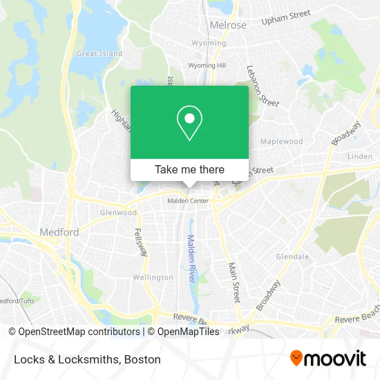
See Locks & Locksmiths, Malden, on the map
Public Transit to Locks & Locksmiths in Malden
Wondering how to get to Locks & Locksmiths in Malden? Moovit helps you find the best way to get to Locks & Locksmiths with step-by-step directions from the nearest public transit station.
Moovit provides free maps and live directions to help you navigate through your city. View schedules, routes, timetables, and find out how long does it take to get to Locks & Locksmiths in real time.
Looking for the nearest stop or station to Locks & Locksmiths? Check out this list of stops closest to your destination: Main St Opp Pleasant St; Centre St @ Stop & Shop; Summer St @ Clifton St; Pleasant St @ Elm St; Commercial St @ Charles St; Malden Center; Medford/Tufts Station; Chelsea.
Bus: 101, 104, 105, 97, 99, 106, 108, 131, 132.Train: HAVERHILL, NEWBURYPORT/ROCKPORT.Subway: ORANGE LINE, GREEN LINE B, GREEN LINE C, GREEN LINE E.
Want to see if there’s another route that gets you there at an earlier time? Moovit helps you find alternative routes or times. Get directions from and directions to Locks & Locksmiths easily from the Moovit App or Website.
We make riding to Locks & Locksmiths easy, which is why over 1.7 million users, including users in Malden, trust Moovit as the best app for public transit. You don’t need to download an individual bus app or train app, Moovit is your all-in-one transit app that helps you find the best bus time or train time available.
For information on prices of subway, bus and train, costs and ride fares to Locks & Locksmiths, please check the Moovit app.
Use the app to navigate to popular places including to the airport, hospital, stadium, grocery store, mall, coffee shop, school, college, and university.
Locks & Locksmiths Address: 201 Pleasant St street in Malden
- Right at Home,
- Malden Government Center,
- Malden City Hall,
- Santa Fe Burrito Grill,
- Nikchar Events,
- Wjo Driving School,
- Guardian Door Repair,
- Nilkanth Convenience,
- Gallagher & Assoc,
- Massachusetts Institute Tech,
- MBTA Malden Center Station,
- Malden Police Relief Association,
- Mayor Gary Christenson,
- Plan Malden Square,
- Malden Mosque,
- Rock Spot Climbing,
- DT Express-Malden,
- Residences at Malden Station Apartment Building,
- Boston Trainers Club,
- Malden Center Station Parking
Places Near Locks & Locksmiths (Malden)
- Boston Medical Center, Boston,
- Prudential Center, Boston,
- House Of Blues, Boston,
- Quincy Market, Boston,
- Boston Common, Boston,
- Museum Of Science, Boston,
- Isabella Stewart Gardner Museum, Boston,
- Seaport District, Boston,
- Leader Bank Pavilion (Leader Bank Pavillion), Boston,
- Castle Island, Boston,
- North End, Boston,
- Boston Children's Hospital, Boston,
- Boston Convention & Exhibition Center, Boston,
- Massachusetts General Hospital, Boston,
- Wilbur Theatre, Boston,
- Faneuil Hall, Boston,
- Cheers, Boston,
- Mgm Music Hall, Boston,
- Wang Theater, Boston,
- Td Garden, Boston
How to get to popular places in Boston with public transit
Get around Malden by public transit!
Traveling around Malden has never been so easy. See step by step directions as you travel to any attraction, street or major public transit station. View bus and train schedules, arrival times, service alerts and detailed routes on a map, so you know exactly how to get to anywhere in Malden.
When traveling to any destination around Malden use Moovit's Live Directions with Get Off Notifications to know exactly where and how far to walk, how long to wait for your line, and how many stops are left. Moovit will alert you when it's time to get off — no need to constantly re-check whether yours is the next stop.
Wondering how to use public transit in Malden or how to pay for public transit in Malden? Moovit public transit app can help you navigate your way with public transit easily, and at minimum cost. It includes public transit fees, ticket prices, and costs. Looking for a map of Malden public transit lines? Moovit public transit app shows all public transit maps in Malden with all Bus, Train, Subway and Ferry routes and stops on an interactive map.
Boston has 4 transit type(s), including: Bus, Train, Subway and Ferry, operated by several transit agencies, including MBTA, Southeastern Regional Transit Authority, MetroWest Regional Transit Authority, Rhode Island Public Transit Authority, WRTA, Lowell Regional Transit Authority, Merrimack Valley Transit, Montachusett Regional Transit Authority, Cape Cod Regional Transit Authority, Brockton Area Transit Authority, Martha's Vineyard Transit Authority, the WAVE - Nantucket Regional Transit Authority, GATRA, Cape Ann Transportation Authority and Massport