Directions to Locksmith Masters (Boston) with public transportation
The following transit lines have routes that pass near Locksmith Masters
 Bus: 51, 86, GREEN LINE B SHUTTLE, GREEN LINE B SHUTTLE, GREEN LINE B SHUTTLE.
- Train: FRAMINGHAM/WORCESTER.
- Subway: GREEN LINE C, GREEN LINE B, GREEN LINE D.
How to get to Locksmith Masters by bus?
Click on the bus route to see step by step directions with maps, line arrival times and updated time schedules.
From Raffles Boston Back Bay Hotel & Residences, Boston
36 minFrom Peter Pan Bus Lines at South Station, Boston
47 minFrom Park Plaza Hotel Boston, Boston
37 minFrom USS Constitution, Boston
88 minFrom Boston Common, Boston
46 minFrom Carmelina's, Boston
59 minFrom Academy Of the Pacific Rim Charter Public School, Boston
77 minFrom moakley federal court house, Boston
88 minFrom Santarpio's Pizza, Boston
87 minFrom Downeast Cider, Boston
62 min
How to get to Locksmith Masters by train?
Click on the train route to see step by step directions with maps, line arrival times and updated time schedules.
How to get to Locksmith Masters by subway?
Click on the subway route to see step by step directions with maps, line arrival times and updated time schedules.
From Raffles Boston Back Bay Hotel & Residences, Boston
33 minFrom Peter Pan Bus Lines at South Station, Boston
40 minFrom Park Plaza Hotel Boston, Boston
33 minFrom Downeast Cider, Boston
57 minFrom USS Constitution, Boston
51 minFrom Boston Common, Boston
34 minFrom Carmelina's, Boston
45 minFrom moakley federal court house, Boston
53 minFrom Santarpio's Pizza, Boston
52 min
Bus stops near Locksmith Masters in Boston
Subway stations near Locksmith Masters in Boston
Bus lines to Locksmith Masters in Boston
- 86, Harvard,VIEW
- GREEN LINE B SHUTTLE, Boston College - Blandford Street,VIEW
- GREEN LINE B SHUTTLE, Boston College - Washington Street,VIEW
- GREEN LINE B SHUTTLE, Boston College - Back Bay (Shuttle),VIEW
- GREEN LINE B SHUTTLE, Boston College - Babcock Street,VIEW
- GREEN LINE B SHUTTLE, Boston College - Packard's Corner,VIEW
- SHUTTLE, Boston College - Kenmore (Shuttle),VIEW
- GREEN LINE C SHUTTLE, Saint Mary's Street (Shuttle),VIEW
- GREEN LINE C SHUTTLE, Coolidge Corner (Shuttle),VIEW
- SHUTTLE, Cleveland Circle (Shuttle),VIEW
- 51, Forest Hills - Reservoir,VIEW
- GREEN LINE D SHUTTLE, Riverside - Kenmore (Shuttle),VIEW
- GREEN LINE D SHUTTLE, Reservoir - Fenway,VIEW
- GREEN LINE D SHUTTLE, Riverside - Reservoir,VIEW
- GREEN LINE D SHUTTLE, Newton Highlands - Brookline Hills,VIEW
- GREEN LINE D SHUTTLE, Reservoir - Brookline Hills,VIEW
- GREEN LINE D SHUTTLE, Riverside - Fenway,VIEW
- GREEN LINE D SHUTTLE, Newton Highlands - Reservoir,VIEW
- GREEN LINE D SHUTTLE, Reservoir - Kenmore,VIEW
- GREEN LINE D SHUTTLE, Newton Highlands - Kenmore,VIEW
What are the closest stations to Locksmith Masters?
The closest stations to Locksmith Masters are:
- Chestnut Hill Ave @ Englewood Ave is 40 yards away, 1 min walk.
- Chestnut Hill Ave. is 200 yards away, 3 min walk.
- Cleveland Circle is 264 yards away, 4 min walk.
- Chestnut Hill Avenue - Commonwealth Ave @ Chestnut Hill Ave is 281 yards away, 4 min walk.
- Reservoir is 390 yards away, 5 min walk.
Which bus lines stop near Locksmith Masters?
These bus lines stop near Locksmith Masters: 51, 86.
Which train line stops near Locksmith Masters?
FRAMINGHAM/WORCESTER (#521 | Worcester)
Which subway line stops near Locksmith Masters?
GREEN LINE C (Cleveland Circle)
What’s the nearest subway station to Locksmith Masters in Boston?
The nearest subway station to Locksmith Masters in Boston is Chestnut Hill Ave.. It’s a 3 min walk away.
What’s the nearest bus station to Locksmith Masters in Boston?
The nearest bus station to Locksmith Masters in Boston is Chestnut Hill Ave @ Englewood Ave. It’s a 1 min walk away.
What time is the first subway to Locksmith Masters in Boston?
The GREEN LINE D is the first subway that goes to Locksmith Masters in Boston. It stops nearby at 4:45 AM.
What time is the last subway to Locksmith Masters in Boston?
The GREEN LINE B is the last subway that goes to Locksmith Masters in Boston. It stops nearby at 2:34 AM.
What time is the first bus to Locksmith Masters in Boston?
The 86 is the first bus that goes to Locksmith Masters in Boston. It stops nearby at 5:21 AM.
What time is the last bus to Locksmith Masters in Boston?
The 86 is the last bus that goes to Locksmith Masters in Boston. It stops nearby at 12:56 AM.
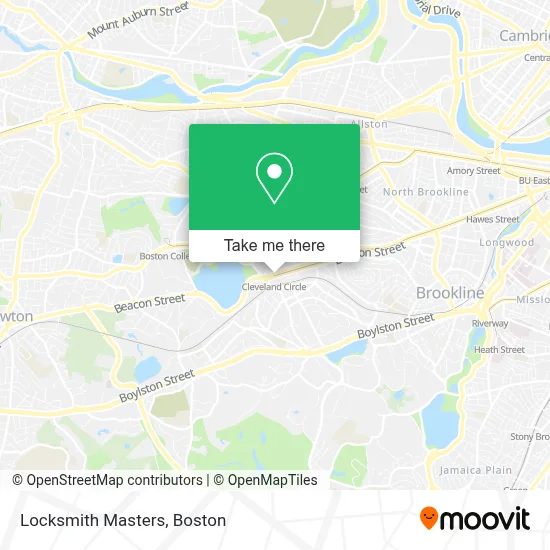
See Locksmith Masters, Boston, on the map
Public Transit to Locksmith Masters in Boston
Wondering how to get to Locksmith Masters in Boston? Moovit helps you find the best way to get to Locksmith Masters with step-by-step directions from the nearest public transit station.
Moovit provides free maps and live directions to help you navigate through your city. View schedules, routes, timetables, and find out how long does it take to get to Locksmith Masters in real time.
Looking for the nearest stop or station to Locksmith Masters? Check out this list of stops closest to your destination: Chestnut Hill Ave @ Englewood Ave; Chestnut Hill Ave.; Cleveland Circle; Chestnut Hill Avenue - Commonwealth Ave @ Chestnut Hill Ave; Reservoir.
Bus: 51, 86, GREEN LINE B SHUTTLE, GREEN LINE B SHUTTLE, GREEN LINE B SHUTTLE, GREEN LINE B SHUTTLE, GREEN LINE B SHUTTLE, GREEN LINE C SHUTTLE, GREEN LINE C SHUTTLE, SHUTTLE.Train: FRAMINGHAM/WORCESTER.Subway: GREEN LINE C, GREEN LINE B, GREEN LINE D.
Want to see if there’s another route that gets you there at an earlier time? Moovit helps you find alternative routes or times. Get directions from and directions to Locksmith Masters easily from the Moovit App or Website.
We make riding to Locksmith Masters easy, which is why over 1.7 million users, including users in Boston, trust Moovit as the best app for public transit. You don’t need to download an individual bus app or train app, Moovit is your all-in-one transit app that helps you find the best bus time or train time available.
For information on prices of subway, bus and train, costs and ride fares to Locksmith Masters, please check the Moovit app.
Use the app to navigate to popular places including to the airport, hospital, stadium, grocery store, mall, coffee shop, school, college, and university.
Locksmith Masters Address: 1916 Beacon St street in Boston
- Eagle's Deli,
- MBTA Cleveland Circle Station,
- Kung Fu Tea Shop,
- DUNKIN',
- Coin Cloud DCM,
- Pino's Pizza (Pinos Pizza),
- Brighton Locksmith Shop,
- Body Balance Spa,
- Brighton Chiropractor,
- 24 Hr 7 Days Locksmith Service,
- 123 Locksmith Service,
- Cassidy Playground,
- Cassidy Park,
- STARBUCKS,
- Mbta Reservoir Carhouse,
- Touchstone Water Damage Restoration of Boston,
- Ntsad,
- Medical Interpreter Training,
- Job Exchange,
- American Healthcare Professionals and Friends for Medicine in Israel
Places Near Locksmith Masters (Boston)
- Boston Medical Center, Boston,
- Leader Bank Pavilion (Leader Bank Pavillion), Boston,
- House Of Blues, Boston,
- Mgm Music Hall, Boston,
- Museum Of Science, Boston,
- Castle Island, Boston,
- Boston Convention & Exhibition Center, Boston,
- Isabella Stewart Gardner Museum, Boston,
- Td Garden, Boston,
- Wang Theater, Boston,
- Massachusetts General Hospital, Boston,
- Quincy Market, Boston,
- Boston Common, Boston,
- North End, Boston,
- Wilbur Theatre, Boston,
- Seaport District, Boston,
- Cheers, Boston,
- Faneuil Hall, Boston,
- Boston Children's Hospital, Boston,
- Prudential Center, Boston
How to get to popular places in Boston with public transit
Get around Boston by public transit!
Traveling around Boston has never been so easy. See step by step directions as you travel to any attraction, street or major public transit station. View bus and train schedules, arrival times, service alerts and detailed routes on a map, so you know exactly how to get to anywhere in Boston.
When traveling to any destination around Boston use Moovit's Live Directions with Get Off Notifications to know exactly where and how far to walk, how long to wait for your line, and how many stops are left. Moovit will alert you when it's time to get off — no need to constantly re-check whether yours is the next stop.
Wondering how to use public transit in Boston or how to pay for public transit in Boston? Moovit public transit app can help you navigate your way with public transit easily, and at minimum cost. It includes public transit fees, ticket prices, and costs. Looking for a map of Boston public transit lines? Moovit public transit app shows all public transit maps in Boston with all Bus, Train, Subway and Ferry routes and stops on an interactive map.
Boston has 4 transit type(s), including: Bus, Train, Subway and Ferry, operated by several transit agencies, including MBTA, Southeastern Regional Transit Authority, MetroWest Regional Transit Authority, Rhode Island Public Transit Authority, WRTA, Lowell Regional Transit Authority, Merrimack Valley Transit, Montachusett Regional Transit Authority, Cape Cod Regional Transit Authority, Brockton Area Transit Authority, Martha's Vineyard Transit Authority, the WAVE - Nantucket Regional Transit Authority, GATRA, Cape Ann Transportation Authority and Massport