Directions to Locksmithy (Baltimore County) with public transportation
The following transit lines have routes that pass near Locksmithy
 Bus: 51.
How to get to Locksmithy by bus?
Click on the bus route to see step by step directions with maps, line arrival times and updated time schedules.
From Power Plant Live, Baltimore
54 minFrom Mva, Baltimore
51 minFrom Hopkins Plaza, Baltimore
42 minFrom University Of Maryland Medical Center, Baltimore
52 minFrom Johns Hopkins Mountcastle Auditorium, Baltimore
51 minFrom Baltimore Arena, Baltimore
45 minFrom The Maryland Zoo In Baltimore, Baltimore
67 minFrom Lexington Market, Baltimore
47 minFrom City Hall Fields, Baltimore
46 minFrom CFG Bank Arena, Baltimore
45 min
Bus stop near Locksmithy in Baltimore County
- Bellona Ave & Charles St Wb FS, 7 min walk,VIEW
Light Rail stations near Locksmithy in Baltimore County
- Mt. Washington, 22 min walk,VIEW
Bus lines to Locksmithy in Baltimore County
- 51, Downtown,VIEW
What are the closest stations to Locksmithy?
The closest stations to Locksmithy are:
- Bellona Ave & Charles St Wb FS is 560 yards away, 7 min walk.
- Mt. Washington is 1871 yards away, 22 min walk.
Which bus line stops near Locksmithy?
51 (Towson Town Center)
What’s the nearest light rail station to Locksmithy in Baltimore County?
The nearest light rail station to Locksmithy in Baltimore County is Mt. Washington. It’s a 22 min walk away.
What’s the nearest bus station to Locksmithy in Baltimore County?
The nearest bus station to Locksmithy in Baltimore County is Bellona Ave & Charles St Wb FS. It’s a 7 min walk away.
What time is the first light rail to Locksmithy in Baltimore County?
The LIGHT RAILLINK is the first light rail that goes to Locksmithy in Baltimore County. It stops nearby at 4:32 AM.
What time is the last light rail to Locksmithy in Baltimore County?
The LIGHT RAILLINK is the last light rail that goes to Locksmithy in Baltimore County. It stops nearby at 1:09 AM.
What time is the first bus to Locksmithy in Baltimore County?
The 51 is the first bus that goes to Locksmithy in Baltimore County. It stops nearby at 5:13 AM.
What time is the last bus to Locksmithy in Baltimore County?
The 51 is the last bus that goes to Locksmithy in Baltimore County. It stops nearby at 12:25 AM.
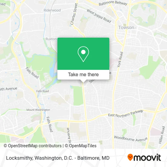
See Locksmithy, Baltimore County, on the map
Public Transit to Locksmithy in Baltimore County
Wondering how to get to Locksmithy in Baltimore County? Moovit helps you find the best way to get to Locksmithy with step-by-step directions from the nearest public transit station.
Moovit provides free maps and live directions to help you navigate through your city. View schedules, routes, timetables, and find out how long does it take to get to Locksmithy in real time.
Looking for the nearest stop or station to Locksmithy? Check out this list of stops closest to your destination: Bellona Ave & Charles St Wb FS; Mt. Washington.
Bus: 51.
Want to see if there’s another route that gets you there at an earlier time? Moovit helps you find alternative routes or times. Get directions from and directions to Locksmithy easily from the Moovit App or Website.
We make riding to Locksmithy easy, which is why over 1.5 million users, including users in Baltimore County, trust Moovit as the best app for public transit. You don’t need to download an individual bus app or train app, Moovit is your all-in-one transit app that helps you find the best bus time or train time available.
For information on prices of bus, costs and ride fares to Locksmithy, please check the Moovit app.
Use the app to navigate to popular places including to the airport, hospital, stadium, grocery store, mall, coffee shop, school, college, and university.
Locksmithy Address: 6223 N Charles St Baltimore, MD 21212 street in Baltimore County
- DUNKIN',
- Apartment Carpet Cleaning Carpet Cleaning,
- STARBUCKS,
- Magan Drane Properties,
- Dudley Roan Home Team,
- Work in Towson,
- Kol Halev,
- Jesuits of Jamshedpur India,
- Ecco,
- Joe Franz Golf Professional,
- Baltimore Eden Korean School,
- Lacy Foundries,
- William S Spicer,
- Service Master by Singer-MD,
- Truist Atm,
- F13 Design Studio,
- Glyndon Travel,
- Rodgers Forge,
- Best Chiropractic Adjustment,
- Milbourn & Associates
Places Near Locksmithy (Baltimore County)
- Warner Theatre, Washington,
- Camden Yards, Baltimore,
- Westfield Montgomery Mall, Montgomery County,
- PG Mall, Prince George's County,
- National Museum of African American History and Culture, Washington,
- National Zoo, Washington,
- Amazon Hq2, Arlington County,
- Capital One Arena, Washington,
- National Theatre, Washington,
- Museum Of The Bible, Washington,
- Basilica of the National Shrine, Washington,
- The Anthem, Washington,
- M&T Bank Stadium, Baltimore,
- Georgetown, Washington,
- Pennsylvania Ave NW (3rd st and pennsylvania), Washington,
- Marriott Marquis Washington, DC, Washington,
- Washington National Cathedral, Washington,
- Rock Creek Tennis Center, Washington,
- Sibley Memorial Hospital, Washington,
- Washington DC VA Medical Center, Washington
How to get to popular places in Washington, D.C. - Baltimore, MD with public transit
Get around Baltimore County by public transit!
Traveling around Baltimore County has never been so easy. See step by step directions as you travel to any attraction, street or major public transit station. View bus and train schedules, arrival times, service alerts and detailed routes on a map, so you know exactly how to get to anywhere in Baltimore County.
When traveling to any destination around Baltimore County use Moovit's Live Directions with Get Off Notifications to know exactly where and how far to walk, how long to wait for your line, and how many stops are left. Moovit will alert you when it's time to get off — no need to constantly re-check whether yours is the next stop.
Wondering how to use public transit in Baltimore County or how to pay for public transit in Baltimore County? Moovit public transit app can help you navigate your way with public transit easily, and at minimum cost. It includes public transit fees, ticket prices, and costs. Looking for a map of Baltimore County public transit lines? Moovit public transit app shows all public transit maps in Baltimore County with all Bus, Train, Metro, Light Rail and Ferry routes and stops on an interactive map.
Washington, D.C. - Baltimore, MD has 5 transit type(s), including: Bus, Train, Metro, Light Rail and Ferry, operated by several transit agencies, including WMATA, Montgomery County Ride On, Fairfax Connector, TheBus, PRTC, DASH - Alexandria, Arlington Transit (ART), RTA of Central Maryland, MDOT MTA, MDOT MTA Light RailLink, MDOT MTA Commuter Bus, MDOT MTA Local Bus, FXBGO!, Virginia Railway Express (VRE) and MARC