Directions to Loeb Fellows (Cambridge) with public transportation
The following transit lines have routes that pass near Loeb Fellows
 Bus: 1, 109, 66, RED LINE SHUTTLE, RED LINE SHUTTLE.
- Train: FITCHBURG, FRAMINGHAM/WORCESTER.
- Subway: RED LINE, GREEN LINE D, GREEN LINE E.
How to get to Loeb Fellows by bus?
Click on the bus route to see step by step directions with maps, line arrival times and updated time schedules.
From Fort Independence, Boston
93 minFrom JFK Library, Boston
81 minFrom Castle Island, Boston
85 minFrom Franklin Park Zoo, Boston
75 minFrom Boston Harbor Hotel, Boston
53 minFrom The Monument, Boston
62 minFrom Suffolk Downs, Boston
99 minFrom Boston Common, Boston
45 minFrom Codman Square, Boston
93 minFrom Boston Opera House, Boston
44 min
How to get to Loeb Fellows by train?
Click on the train route to see step by step directions with maps, line arrival times and updated time schedules.
How to get to Loeb Fellows by subway?
Click on the subway route to see step by step directions with maps, line arrival times and updated time schedules.
Bus stops near Loeb Fellows in Cambridge
Subway stations near Loeb Fellows in Cambridge
Train station near Loeb Fellows in Cambridge
- Porter, 19 min walk,VIEW
Bus lines to Loeb Fellows in Cambridge
- RED LINE SHUTTLE, Jfk/Umass (Shuttle),VIEW
- RED LINE SHUTTLE, Park Street (Shuttle),VIEW
- RED LINE SHUTTLE, Harvard (Shuttle),VIEW
- RED LINE SHUTTLE, Kendall/MIT (Local Shuttle),VIEW
- 66, Harvard Via Allston,VIEW
- 68, Kendall/MIT,VIEW
- 69, Lechmere,VIEW
- 71, Harvard - Watertown Square,VIEW
- 74, Harvard - Belmont Center,VIEW
- 75, Harvard - Belmont Center,VIEW
- 77, Harvard - Arlington Heights,VIEW
- 78, Harvard - Arlmont Village,VIEW
- 86, Reservoir - Harvard,VIEW
- 96, Harvard - Medford Square,VIEW
- 109, Harvard via Sullivan - Linden Square via Sullivan,VIEW
- 73, Waverley,VIEW
- 83, Rindge Ave,VIEW
What are the closest stations to Loeb Fellows?
The closest stations to Loeb Fellows are:
- Harvard - Brattle St @ Palmer St is 209 yards away, 3 min walk.
- Massachusetts Ave @ Johnston Gate is 297 yards away, 4 min walk.
- Eliot St @ Bennett St is 331 yards away, 5 min walk.
- Mt Auburn St @ University Rd is 369 yards away, 5 min walk.
- Massachusetts Ave Opp Waterhouse St is 585 yards away, 7 min walk.
- Central is 772 yards away, 10 min walk.
- Porter is 1542 yards away, 19 min walk.
- Union Square is 1633 yards away, 20 min walk.
Which bus lines stop near Loeb Fellows?
These bus lines stop near Loeb Fellows: 1, 109, 66.
Which train lines stop near Loeb Fellows?
These train lines stop near Loeb Fellows: FITCHBURG, FRAMINGHAM/WORCESTER.
Which subway line stops near Loeb Fellows?
RED LINE (Alewife)
What’s the nearest subway station to Loeb Fellows in Cambridge?
The nearest subway station to Loeb Fellows in Cambridge is Central. It’s a 10 min walk away.
What’s the nearest train station to Loeb Fellows in Cambridge?
The nearest train station to Loeb Fellows in Cambridge is Porter. It’s a 19 min walk away.
What’s the nearest bus station to Loeb Fellows in Cambridge?
The nearest bus station to Loeb Fellows in Cambridge is Harvard - Brattle St @ Palmer St. It’s a 3 min walk away.
What time is the first subway to Loeb Fellows in Cambridge?
The GREEN LINE E is the first subway that goes to Loeb Fellows in Cambridge. It stops nearby at 4:50 AM.
What time is the last subway to Loeb Fellows in Cambridge?
The GREEN LINE D is the last subway that goes to Loeb Fellows in Cambridge. It stops nearby at 2:10 AM.
What time is the first train to Loeb Fellows in Cambridge?
The FITCHBURG is the first train that goes to Loeb Fellows in Cambridge. It stops nearby at 5:47 AM.
What time is the last train to Loeb Fellows in Cambridge?
The FITCHBURG is the last train that goes to Loeb Fellows in Cambridge. It stops nearby at 12:17 AM.
What time is the first bus to Loeb Fellows in Cambridge?
The 73 is the first bus that goes to Loeb Fellows in Cambridge. It stops nearby at 4:45 AM.
What time is the last bus to Loeb Fellows in Cambridge?
The 66 is the last bus that goes to Loeb Fellows in Cambridge. It stops nearby at 2:36 AM.
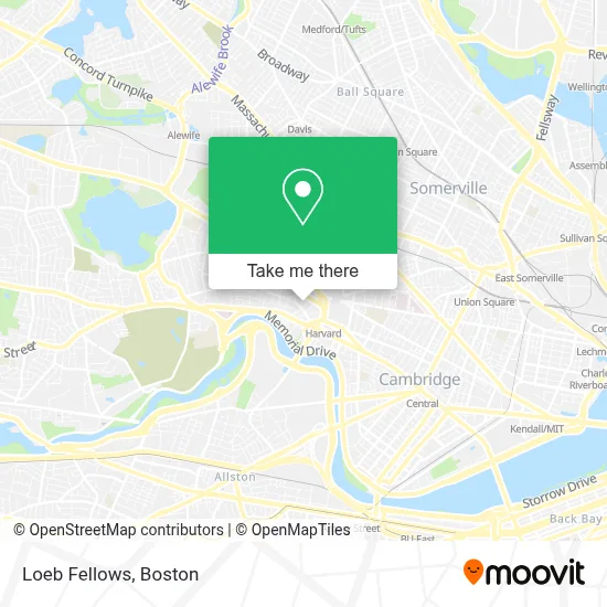
See Loeb Fellows, Cambridge, on the map
Public Transit to Loeb Fellows in Cambridge
Wondering how to get to Loeb Fellows in Cambridge? Moovit helps you find the best way to get to Loeb Fellows with step-by-step directions from the nearest public transit station.
Moovit provides free maps and live directions to help you navigate through your city. View schedules, routes, timetables, and find out how long does it take to get to Loeb Fellows in real time.
Looking for the nearest stop or station to Loeb Fellows? Check out this list of stops closest to your destination: Harvard - Brattle St @ Palmer St; Massachusetts Ave @ Johnston Gate; Eliot St @ Bennett St; Mt Auburn St @ University Rd; Massachusetts Ave Opp Waterhouse St; Central; Porter; Union Square.
Bus: 1, 109, 66, RED LINE SHUTTLE, RED LINE SHUTTLE, RED LINE SHUTTLE, RED LINE SHUTTLE, 68, 69, 71, 74, 75, 77, 78.Train: FITCHBURG, FRAMINGHAM/WORCESTER.Subway: RED LINE, GREEN LINE D, GREEN LINE E.
Want to see if there’s another route that gets you there at an earlier time? Moovit helps you find alternative routes or times. Get directions from and directions to Loeb Fellows easily from the Moovit App or Website.
We make riding to Loeb Fellows easy, which is why over 1.7 million users, including users in Cambridge, trust Moovit as the best app for public transit. You don’t need to download an individual bus app or train app, Moovit is your all-in-one transit app that helps you find the best bus time or train time available.
For information on prices of subway, bus and train, costs and ride fares to Loeb Fellows, please check the Moovit app.
Use the app to navigate to popular places including to the airport, hospital, stadium, grocery store, mall, coffee shop, school, college, and university.
Loeb Fellows Address: Harvard University-Graduate School of Design, 48 Quincy St street in Cambridge
- Gutman Conference Center,
- American Repertory Theater,
- Loeb Drama Center,
- Elizabeth Cary Agassiz House,
- harvard square lower busway,
- First Church in Cambridge Cong'l,
- The Armenian Museum of America,
- First Church in C Shelter,
- Lesley University - Washburn Hall,
- Lesley University Library,
- Club Passim,
- Patagonia,
- Nadja B. Gould, Licsw,
- Cambridge Revolutionary War Monument,
- Hotel Commander (Sheraton Commander Club Lounge),
- Tesla,
- Engaging Schools,
- CarGurus,
- Insurance Articles,
- Internet Insure Mart
Places Near Loeb Fellows (Cambridge)
- Leader Bank Pavilion (Leader Bank Pavillion), Boston,
- Seaport District, Boston,
- North End, Boston,
- Mgm Music Hall, Boston,
- Isabella Stewart Gardner Museum, Boston,
- Boston Medical Center, Boston,
- Prudential Center, Boston,
- Museum Of Science, Boston,
- Castle Island, Boston,
- Boston Children's Hospital, Boston,
- Wilbur Theatre, Boston,
- Massachusetts General Hospital, Boston,
- Boston Convention & Exhibition Center, Boston,
- House Of Blues, Boston,
- Quincy Market, Boston,
- Cheers, Boston,
- Td Garden, Boston,
- Wang Theater, Boston,
- Boston Common, Boston,
- Faneuil Hall, Boston
How to get to popular places in Boston with public transit
Get around Cambridge by public transit!
Traveling around Cambridge has never been so easy. See step by step directions as you travel to any attraction, street or major public transit station. View bus and train schedules, arrival times, service alerts and detailed routes on a map, so you know exactly how to get to anywhere in Cambridge.
When traveling to any destination around Cambridge use Moovit's Live Directions with Get Off Notifications to know exactly where and how far to walk, how long to wait for your line, and how many stops are left. Moovit will alert you when it's time to get off — no need to constantly re-check whether yours is the next stop.
Wondering how to use public transit in Cambridge or how to pay for public transit in Cambridge? Moovit public transit app can help you navigate your way with public transit easily, and at minimum cost. It includes public transit fees, ticket prices, and costs. Looking for a map of Cambridge public transit lines? Moovit public transit app shows all public transit maps in Cambridge with all Bus, Train, Subway and Ferry routes and stops on an interactive map.
Boston has 4 transit type(s), including: Bus, Train, Subway and Ferry, operated by several transit agencies, including MBTA, Southeastern Regional Transit Authority, MetroWest Regional Transit Authority, Rhode Island Public Transit Authority, WRTA, Lowell Regional Transit Authority, Merrimack Valley Transit, Montachusett Regional Transit Authority, Cape Cod Regional Transit Authority, Brockton Area Transit Authority, Martha's Vineyard Transit Authority, the WAVE - Nantucket Regional Transit Authority, GATRA, Cape Ann Transportation Authority and Massport