Directions to Loewen Field (Dedham) with public transportation
The following transit lines have routes that pass near Loewen Field
 Bus: 34, 34E, 35.
- Train: PROVIDENCE/STOUGHTON, FRANKLIN/FOXBORO, FOXBORO EVENT SERVICE.
How to get to Loewen Field by bus?
Click on the bus route to see step by step directions with maps, line arrival times and updated time schedules.
From Jamaica Plain V.A., Boston
55 minFrom Jamaica Plain VA Medical Center (VA Hospital), Boston
56 minFrom Forest Hills Station MBTA, Boston
34 minFrom Hebrew Rehab Center, Boston
51 minFrom AC Hotel by Marriott Boston Cleveland Circle, Boston
72 minFrom Arnold Arboretum, Boston
48 minFrom Hotel Hilton Boston/Woburn, Boston
58 minFrom Jamaica Plain, Boston
57 minFrom Chestnut Hill, Boston
101 minFrom Boston College (BC), Boston
95 min
How to get to Loewen Field by train?
Click on the train route to see step by step directions with maps, line arrival times and updated time schedules.
Bus stops near Loewen Field in Dedham
Train stations near Loewen Field in Dedham
Bus lines to Loewen Field in Dedham
What are the closest stations to Loewen Field?
The closest stations to Loewen Field are:
- Opp 450 Washington St is 462 yards away, 6 min walk.
- 245 Washington St is 878 yards away, 11 min walk.
- Endicott is 1025 yards away, 12 min walk.
- Dedham Corporate Center is 1439 yards away, 17 min walk.
- Readville is 2410 yards away, 30 min walk.
Which bus lines stop near Loewen Field?
These bus lines stop near Loewen Field: 34, 34E, 35.
Which train line stops near Loewen Field?
PROVIDENCE/STOUGHTON (#827 | Wickford Junction)
What’s the nearest train station to Loewen Field in Dedham?
The nearest train station to Loewen Field in Dedham is Endicott. It’s a 12 min walk away.
What’s the nearest bus station to Loewen Field in Dedham?
The nearest bus station to Loewen Field in Dedham is Opp 450 Washington St. It’s a 6 min walk away.
What time is the first train to Loewen Field in Dedham?
The PROVIDENCE/STOUGHTON is the first train that goes to Loewen Field in Dedham. It stops nearby at 5:05 AM.
What time is the last train to Loewen Field in Dedham?
The PROVIDENCE/STOUGHTON is the last train that goes to Loewen Field in Dedham. It stops nearby at 12:20 AM.
What time is the first bus to Loewen Field in Dedham?
The 34 is the first bus that goes to Loewen Field in Dedham. It stops nearby at 4:44 AM.
What time is the last bus to Loewen Field in Dedham?
The 34 is the last bus that goes to Loewen Field in Dedham. It stops nearby at 1:32 AM.
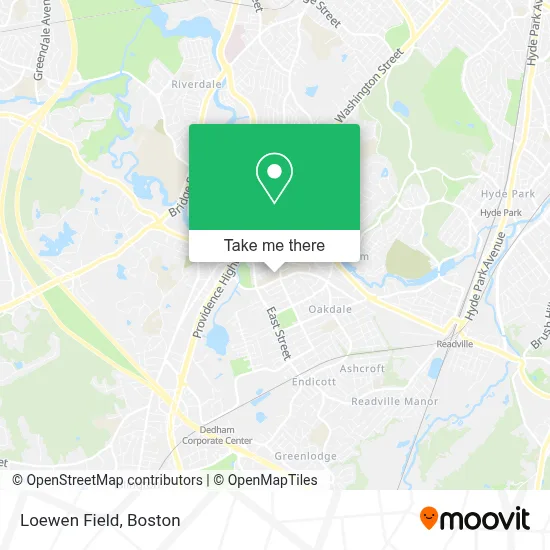
See Loewen Field, Dedham, on the map
Public Transit to Loewen Field in Dedham
Wondering how to get to Loewen Field in Dedham? Moovit helps you find the best way to get to Loewen Field with step-by-step directions from the nearest public transit station.
Moovit provides free maps and live directions to help you navigate through your city. View schedules, routes, timetables, and find out how long does it take to get to Loewen Field in real time.
Looking for the nearest stop or station to Loewen Field? Check out this list of stops closest to your destination: Opp 450 Washington St; 245 Washington St; Endicott; Dedham Corporate Center; Readville.
Bus: 34, 34E, 35.Train: PROVIDENCE/STOUGHTON, FRANKLIN/FOXBORO, FOXBORO EVENT SERVICE.
Want to see if there’s another route that gets you there at an earlier time? Moovit helps you find alternative routes or times. Get directions from and directions to Loewen Field easily from the Moovit App or Website.
We make riding to Loewen Field easy, which is why over 1.7 million users, including users in Dedham, trust Moovit as the best app for public transit. You don’t need to download an individual bus app or train app, Moovit is your all-in-one transit app that helps you find the best bus time or train time available.
For information on prices of bus, train and subway, costs and ride fares to Loewen Field, please check the Moovit app.
Use the app to navigate to popular places including to the airport, hospital, stadium, grocery store, mall, coffee shop, school, college, and university.
Loewen Field Address: 100 Whiting Ave street in Dedham
- Dedham Middle School ,
- Juju's Pool- Dedham,
- 12 Mt Vernon St,
- Dedham High School Track,
- Gonzalez Field,
- ATM,
- Crown Contracting,
- Sampson Landscaping Service,
- Barnes Memorial Park,
- Italian American Citizens Club - San Giovanni Battista,
- Consolidated Plumbing & Heating,
- New Flooring Pro,
- Lily Rose's Landscaping Services,
- Pat Kerins Electrician,
- Evolve Training,
- ATM,
- Dedham Town Locksmith Solutions,
- A To Z Custom Home S,
- Coastal Glow Skin Clinic,
- Hair by Marianne - Hair Salon Dedham Ma
Places Near Loewen Field (Dedham)
- Boston Common, Boston,
- Td Garden, Boston,
- Boston Medical Center, Boston,
- Mgm Music Hall, Boston,
- Seaport District, Boston,
- Boston Convention & Exhibition Center, Boston,
- Isabella Stewart Gardner Museum, Boston,
- Prudential Center, Boston,
- Faneuil Hall, Boston,
- Wilbur Theatre, Boston,
- Boston Children's Hospital, Boston,
- House Of Blues, Boston,
- Castle Island, Boston,
- Massachusetts General Hospital, Boston,
- Quincy Market, Boston,
- North End, Boston,
- Wang Theater, Boston,
- Cheers, Boston,
- Museum Of Science, Boston,
- Leader Bank Pavilion (Leader Bank Pavillion), Boston
How to get to popular places in Boston with public transit
Get around Dedham by public transit!
Traveling around Dedham has never been so easy. See step by step directions as you travel to any attraction, street or major public transit station. View bus and train schedules, arrival times, service alerts and detailed routes on a map, so you know exactly how to get to anywhere in Dedham.
When traveling to any destination around Dedham use Moovit's Live Directions with Get Off Notifications to know exactly where and how far to walk, how long to wait for your line, and how many stops are left. Moovit will alert you when it's time to get off — no need to constantly re-check whether yours is the next stop.
Wondering how to use public transit in Dedham or how to pay for public transit in Dedham? Moovit public transit app can help you navigate your way with public transit easily, and at minimum cost. It includes public transit fees, ticket prices, and costs. Looking for a map of Dedham public transit lines? Moovit public transit app shows all public transit maps in Dedham with all Bus, Train, Subway and Ferry routes and stops on an interactive map.
Boston has 4 transit type(s), including: Bus, Train, Subway and Ferry, operated by several transit agencies, including MBTA, Southeastern Regional Transit Authority, MetroWest Regional Transit Authority, Rhode Island Public Transit Authority, WRTA, Lowell Regional Transit Authority, Merrimack Valley Transit, Montachusett Regional Transit Authority, Cape Cod Regional Transit Authority, Brockton Area Transit Authority, Martha's Vineyard Transit Authority, the WAVE - Nantucket Regional Transit Authority, GATRA, Cape Ann Transportation Authority and Massport