Directions to Loft (Boston) with public transportation
The following transit lines have routes that pass near Loft
 Bus: 1, 39, 501, 504, 10.
- Train: ACELA, NEEDHAM, FOXBORO EVENT SERVICE, FRAMINGHAM/WORCESTER, FRANKLIN/FOXBORO.
- Subway: GREEN LINE D, ORANGE LINE, GREEN LINE B, GREEN LINE C, GREEN LINE E.
How to get to Loft by bus?
Click on the bus route to see step by step directions with maps, line arrival times and updated time schedules.
From West Roxbury, Boston
54 minFrom Hilton Garden Inn Boston Logan Airport, Boston
52 minFrom Market Basket, Revere
88 minFrom VFW Parkway, Boston
56 minFrom Arlington, MA, Arlington
78 minFrom Apple Cinemas, Cambridge
63 minFrom AC Hotel by Marriott Boston Cleveland Circle, Boston
43 minFrom Charles W. Eliot Bridge, Boston
60 minFrom Milton Academy, Milton
94 minFrom Showa Boston Institute, Boston
56 min
How to get to Loft by train?
Click on the train route to see step by step directions with maps, line arrival times and updated time schedules.
How to get to Loft by subway?
Click on the subway route to see step by step directions with maps, line arrival times and updated time schedules.
Train station near Loft in Boston
- Back Bay - South End, 1 min walk,VIEW
Bus stops near Loft in Boston
- Back Bay Station (Dartmouth Street), 2 min walk,VIEW
- Back Bay, 2 min walk,VIEW
- Dartmouth Street Opposite Back Bay Station, 2 min walk,VIEW
- Back Bay - 167 Dartmouth St, 3 min walk,VIEW
- Stuart St @ Dartmouth St, 3 min walk,VIEW
- Ring Rd @ Boylston St, 4 min walk,VIEW
- Saint James Ave @ Dartmouth St, 5 min walk,VIEW
- Copley - Boylston St @ Dartmouth St, 9 min walk,VIEW
Subway station near Loft in Boston
- Copley, 7 min walk,VIEW
Bus lines to Loft in Boston
- 10, Arlington via South Bay Center - City Point via South Bay Center,VIEW
- ORANGE LINE SHUTTLE, Ruggles - Back Bay,VIEW
- ORANGE LINE SHUTTLE, Jackson Square - Copley,VIEW
- ORANGE LINE SHUTTLE, Jackson Square - Back Bay,VIEW
- ORANGE LINE SHUTTLE, Ruggles - Copley,VIEW
- ORANGE LINE SHUTTLE, Forest Hills - Back Bay (Shuttle),VIEW
- ORANGE LINE SHUTTLE, Forest Hills - Back Bay via Copley (Shuttle),VIEW
- ORANGE LINE SHUTTLE, Forest Hills - Back Bay via Ruggles Busway (Shuttle),VIEW
- ORANGE LINE SHUTTLE, Forest Hills - Copley,VIEW
- 39, Haymarket Via Forest Hills,VIEW
- WORCESTER LINE SHUTTLE, Back Bay (Shuttle),VIEW
- BB, Back Bay,VIEW
- GREEN LINE SHUTTLE, Back Bay (Shuttle),VIEW
- 501, Downtown via Copley (Express) - Brighton via Copley (Express),VIEW
- 504, Downtown via Copley (Express) - Watertown via Copley and Newton Corner (Express),VIEW
- GREEN LINE B SHUTTLE, Babcock Street - Back Bay,VIEW
- GREEN LINE B SHUTTLE, Boston College - Back Bay (Shuttle),VIEW
- GREEN LINE B SHUTTLE, Kenmore - Back Bay via Copley (Shuttle),VIEW
- GREEN LINE B SHUTTLE, Babcock Street - Back Bay via Copley (Shuttle),VIEW
- GREEN LINE D SHUTTLE, Brookline Hills - Back Bay (Shuttle),VIEW
What are the closest stations to Loft?
The closest stations to Loft are:
- Back Bay - South End is 26 yards away, 1 min walk.
- Back Bay Station (Dartmouth Street) is 78 yards away, 2 min walk.
- Back Bay is 84 yards away, 2 min walk.
- Dartmouth Street Opposite Back Bay Station is 110 yards away, 2 min walk.
- Back Bay - 167 Dartmouth St is 163 yards away, 3 min walk.
- Stuart St @ Dartmouth St is 189 yards away, 3 min walk.
- Ring Rd @ Boylston St is 253 yards away, 4 min walk.
- Saint James Ave @ Dartmouth St is 365 yards away, 5 min walk.
- Copley is 511 yards away, 7 min walk.
- Copley - Boylston St @ Dartmouth St is 727 yards away, 9 min walk.
Which bus lines stop near Loft?
These bus lines stop near Loft: 1, 39, 501, 504.
Which train lines stop near Loft?
These train lines stop near Loft: ACELA, NEEDHAM.
Which subway lines stop near Loft?
These subway lines stop near Loft: GREEN LINE D, ORANGE LINE.
What’s the nearest subway station to Loft in Boston?
The nearest subway station to Loft in Boston is Copley. It’s a 7 min walk away.
What’s the nearest train station to Loft in Boston?
The nearest train station to Loft in Boston is Back Bay - South End. It’s a 1 min walk away.
What’s the nearest bus station to Loft in Boston?
The nearest bus stations to Loft in Boston are Back Bay Station (Dartmouth Street), Back Bay and Dartmouth Street Opposite Back Bay Station. The closest one is a 2 min walk away.
What time is the first subway to Loft in Boston?
The GREEN LINE D is the first subway that goes to Loft in Boston. It stops nearby at 5:03 AM.
What time is the last subway to Loft in Boston?
The GREEN LINE D is the last subway that goes to Loft in Boston. It stops nearby at 2:15 AM.
What time is the first train to Loft in Boston?
The PROVIDENCE/STOUGHTON is the first train that goes to Loft in Boston. It stops nearby at 4:25 AM.
What time is the last train to Loft in Boston?
The LAKE SHORE LIMITED is the last train that goes to Loft in Boston. It stops nearby at 8:26 PM.
What time is the first bus to Loft in Boston?
The 57 is the first bus that goes to Loft in Boston. It stops nearby at 4:53 AM.
What time is the last bus to Loft in Boston?
The 10 is the last bus that goes to Loft in Boston. It stops nearby at 1:18 AM.
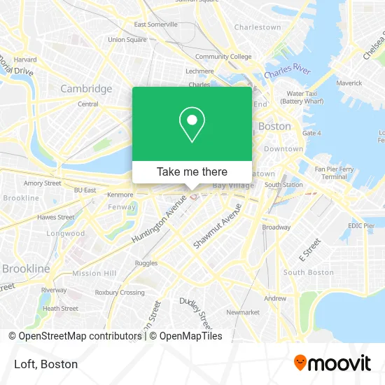
See Loft, Boston, on the map
Public Transit to Loft in Boston
Wondering how to get to Loft in Boston? Moovit helps you find the best way to get to Loft with step-by-step directions from the nearest public transit station.
Moovit provides free maps and live directions to help you navigate through your city. View schedules, routes, timetables, and find out how long does it take to get to Loft in real time.
Looking for the nearest stop or station to Loft? Check out this list of stops closest to your destination: Back Bay - South End; Back Bay Station (Dartmouth Street); Back Bay; Dartmouth Street Opposite Back Bay Station; Back Bay - 167 Dartmouth St; Stuart St @ Dartmouth St; Ring Rd @ Boylston St; Saint James Ave @ Dartmouth St; Copley; Copley - Boylston St @ Dartmouth St.
Bus: 1, 39, 501, 504, 10, ORANGE LINE SHUTTLE, ORANGE LINE SHUTTLE, ORANGE LINE SHUTTLE, ORANGE LINE SHUTTLE, WORCESTER LINE SHUTTLE, BB, GREEN LINE SHUTTLE.Train: ACELA, NEEDHAM, FOXBORO EVENT SERVICE, FRAMINGHAM/WORCESTER, FRANKLIN/FOXBORO, ORANGE LINE.Subway: GREEN LINE D, ORANGE LINE, GREEN LINE B, GREEN LINE C, GREEN LINE E.
Want to see if there’s another route that gets you there at an earlier time? Moovit helps you find alternative routes or times. Get directions from and directions to Loft easily from the Moovit App or Website.
We make riding to Loft easy, which is why over 1.7 million users, including users in Boston, trust Moovit as the best app for public transit. You don’t need to download an individual bus app or train app, Moovit is your all-in-one transit app that helps you find the best bus time or train time available.
For information on prices of subway, bus and train, costs and ride fares to Loft, please check the Moovit app.
Use the app to navigate to popular places including to the airport, hospital, stadium, grocery store, mall, coffee shop, school, college, and university.
Loft Address: 100 Huntington Ave street in Boston
- IKEA Philippines,
- Starbucks (Westin Copley),
- Lucky Brand,
- Copley Square Hotel,
- BMC HealthNet Plan,
- Hue,
- Perigold Internet (All Modern Internet),
- Louis Vuitton Boston Copley,
- The Westin Copley Place, Boston,
- Skybridge b/t Westin & Copley,
- Sorellina,
- Kashmir,
- Westin Copley Place Hotel Boston,
- The Westin Copley Place,
- Currency Exchange International,
- COURTYARD-Boston Copley Square,
- German Consulate General,
- Copley Plaza Hotel,
- MICHAEL KORS,
- Avalon Exeter
Places Near Loft (Boston)
- Wang Theater, Boston,
- Massachusetts General Hospital, Boston,
- Cheers, Boston,
- Td Garden, Boston,
- Boston Medical Center, Boston,
- Quincy Market, Boston,
- North End, Boston,
- Seaport District, Boston,
- Faneuil Hall, Boston,
- Isabella Stewart Gardner Museum, Boston,
- Boston Convention & Exhibition Center, Boston,
- Museum Of Science, Boston,
- Boston Common, Boston,
- Leader Bank Pavilion (Leader Bank Pavillion), Boston,
- Wilbur Theatre, Boston,
- Mgm Music Hall, Boston,
- Prudential Center, Boston,
- Castle Island, Boston,
- House Of Blues, Boston,
- Boston Children's Hospital, Boston
How to get to popular places in Boston with public transit
Get around Boston by public transit!
Traveling around Boston has never been so easy. See step by step directions as you travel to any attraction, street or major public transit station. View bus and train schedules, arrival times, service alerts and detailed routes on a map, so you know exactly how to get to anywhere in Boston.
When traveling to any destination around Boston use Moovit's Live Directions with Get Off Notifications to know exactly where and how far to walk, how long to wait for your line, and how many stops are left. Moovit will alert you when it's time to get off — no need to constantly re-check whether yours is the next stop.
Wondering how to use public transit in Boston or how to pay for public transit in Boston? Moovit public transit app can help you navigate your way with public transit easily, and at minimum cost. It includes public transit fees, ticket prices, and costs. Looking for a map of Boston public transit lines? Moovit public transit app shows all public transit maps in Boston with all Bus, Train, Subway and Ferry routes and stops on an interactive map.
Boston has 4 transit type(s), including: Bus, Train, Subway and Ferry, operated by several transit agencies, including MBTA, Southeastern Regional Transit Authority, MetroWest Regional Transit Authority, Rhode Island Public Transit Authority, WRTA, Lowell Regional Transit Authority, Merrimack Valley Transit, Montachusett Regional Transit Authority, Cape Cod Regional Transit Authority, Brockton Area Transit Authority, Martha's Vineyard Transit Authority, the WAVE - Nantucket Regional Transit Authority, GATRA, Cape Ann Transportation Authority and Massport