Directions to Logmein (Boston) with public transportation
The following transit lines have routes that pass near Logmein
 Bus: 504, 92, 93, SL3, SL4.
- Train: FITCHBURG, FRAMINGHAM/WORCESTER, LOWELL, NEEDHAM, COMMUTER RAIL SHUTTLE.
- Subway: BLUE LINE, GREEN LINE D, ORANGE LINE, RED LINE, GREEN LINE B.
How to get to Logmein by bus?
Click on the bus route to see step by step directions with maps, line arrival times and updated time schedules.
From FOUR POINTS BY SHERATON Boston Newton, Newton
26 minFrom Milton Academy, Milton
95 minFrom The Monument, Boston
51 minFrom Malden Catholic High School, Malden
82 minFrom Mount Auburn Hospital, Cambridge
56 minFrom The Mall At Chestnut Hill, Newton
69 minFrom Belmont, MA, Belmont
59 minFrom Revere Beach, Revere
72 minFrom Brattle St / Harvard Sq, Cambridge
57 minFrom Regent Theatre, Arlington
70 min
How to get to Logmein by train?
Click on the train route to see step by step directions with maps, line arrival times and updated time schedules.
How to get to Logmein by subway?
Click on the subway route to see step by step directions with maps, line arrival times and updated time schedules.
Bus stops near Logmein in Boston
- Washington St @ Essex St, 3 min walk,VIEW
- South Station - Summer St @ Surface Rd, 4 min walk,VIEW
- Downtown Crossing - Franklin St @ Washington St, 4 min walk,VIEW
- South Station Boston, 5 min walk,VIEW
- Essex St @ Atlantic Ave, 6 min walk,VIEW
- Chinatown Gate, 6 min walk,VIEW
- Congress St @ Franklin St, 7 min walk,VIEW
- Chauncy St @ Summer St, 7 min walk,VIEW
- Federal St @ Franklin St, 8 min walk,VIEW
- Otis St @ Summer St, 8 min walk,VIEW
- Boston-South Station, 10 min walk,VIEW
- Summer St @ Atlantic Ave, 10 min walk,VIEW
Subway stations near Logmein in Boston
Train station near Logmein in Boston
- South Station, 14 min walk,VIEW
Bus lines to Logmein in Boston
- SL5, Downtown,VIEW
- RED LINE SHUTTLE, Jfk/Umass (Shuttle),VIEW
- RED LINE SHUTTLE, Ashmont - Park Street via Post Office,VIEW
- RED LINE SHUTTLE, JFK/UMass - Park Street via Post Office,VIEW
- RED LINE SHUTTLE, JFK/UMass - Park Street,VIEW
- PETER PAN, BOSTON - WORCESTER - SPRINGFIELD - NORTHAMPTON - AMHERST,VIEW
- PETER PAN, NEW YORK - BOSTON Express Service,VIEW
- PETER PAN, BOSTON LOGAN AIRPORT - BOSTON - PROVIDENCE,VIEW
- PETER PAN, BOSTON LOGAN AIRPORT - BOSTON - FALMOUTH - WOODS HOLE,VIEW
- PETER PAN, BOSTON - NEW YORK Express Service,VIEW
- PETER PAN, BOSTON SOUTH STATION - NEWARK,VIEW
- PETER PAN, HYANNIS - BOSTON - BOSTON LOGAN AIRPORT,VIEW
- PETER PAN, PNEWARK - BOSTON SOUTH STATION,VIEW
- PETER PAN, PROVIDENCE - BOSTON - BOSTON LOGAN AIRPORT,VIEW
- PETER PAN, BOSTON LOGAN AIRPORT - BOSTON - HYANNIS,VIEW
- PETER PAN, AMHERST - NORTHAMPTON - BOSTON College Express,VIEW
- PETER PAN, BOSTON - WORCESTER - HARTFORD - WATERBURY - NEW YORK Express Service,VIEW
- PETER PAN, AMHERST - NORTHAMPTON - SPRINGFIELD - WORCESTER - BOSTON,VIEW
- PETER PAN, NEW YORK - WATERBURY - HARTFORD - WORCESTER - BOSTON Express Service,VIEW
- PETER PAN, WOODS HOLE - FALMOUTH - BOSTON - BOSTON LOGAN AIRPORT,VIEW
What are the closest stations to Logmein?
The closest stations to Logmein are:
- Washington St @ Essex St is 197 yards away, 3 min walk.
- South Station - Summer St @ Surface Rd is 238 yards away, 4 min walk.
- Downtown Crossing - Franklin St @ Washington St is 301 yards away, 4 min walk.
- South Station Boston is 381 yards away, 5 min walk.
- Essex St @ Atlantic Ave is 407 yards away, 6 min walk.
- Chinatown Gate is 457 yards away, 6 min walk.
- Congress St @ Franklin St is 504 yards away, 7 min walk.
- Chinatown is 509 yards away, 6 min walk.
- Downtown Crossing is 547 yards away, 7 min walk.
- Chauncy St @ Summer St is 579 yards away, 7 min walk.
- Federal St @ Franklin St is 587 yards away, 8 min walk.
- Otis St @ Summer St is 596 yards away, 8 min walk.
- Park Street is 618 yards away, 8 min walk.
- Boston-South Station is 799 yards away, 10 min walk.
- Summer St @ Atlantic Ave is 827 yards away, 10 min walk.
- South Station is 1109 yards away, 14 min walk.
Which bus lines stop near Logmein?
These bus lines stop near Logmein: 504, 92, 93, SL3, SL4, SL5.
Which train lines stop near Logmein?
These train lines stop near Logmein: FITCHBURG, FRAMINGHAM/WORCESTER, LOWELL, NEEDHAM.
Which subway lines stop near Logmein?
These subway lines stop near Logmein: BLUE LINE, GREEN LINE D, ORANGE LINE, RED LINE.
What’s the nearest subway station to Logmein in Boston?
The nearest subway station to Logmein in Boston is Chinatown. It’s a 6 min walk away.
What’s the nearest train station to Logmein in Boston?
The nearest train station to Logmein in Boston is South Station. It’s a 14 min walk away.
What’s the nearest bus station to Logmein in Boston?
The nearest bus station to Logmein in Boston is Washington St @ Essex St. It’s a 3 min walk away.
What time is the first subway to Logmein in Boston?
The GREEN LINE E is the first subway that goes to Logmein in Boston. It stops nearby at 5:07 AM.
What time is the last subway to Logmein in Boston?
The GREEN LINE E is the last subway that goes to Logmein in Boston. It stops nearby at 2:18 AM.
What time is the first train to Logmein in Boston?
The PROVIDENCE/STOUGHTON is the first train that goes to Logmein in Boston. It stops nearby at 4:20 AM.
What time is the last train to Logmein in Boston?
The LAKE SHORE LIMITED is the last train that goes to Logmein in Boston. It stops nearby at 8:32 PM.
What time is the first bus to Logmein in Boston?
The SLW is the first bus that goes to Logmein in Boston. It stops nearby at 4:19 AM.
What time is the last bus to Logmein in Boston?
The SL1 is the last bus that goes to Logmein in Boston. It stops nearby at 1:31 AM.
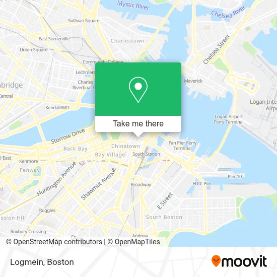
See Logmein, Boston, on the map
Public Transit to Logmein in Boston
Wondering how to get to Logmein in Boston? Moovit helps you find the best way to get to Logmein with step-by-step directions from the nearest public transit station.
Moovit provides free maps and live directions to help you navigate through your city. View schedules, routes, timetables, and find out how long does it take to get to Logmein in real time.
Looking for the nearest stop or station to Logmein? Check out this list of stops closest to your destination: Washington St @ Essex St; South Station - Summer St @ Surface Rd; Downtown Crossing - Franklin St @ Washington St; South Station Boston; Essex St @ Atlantic Ave; Chinatown Gate; Congress St @ Franklin St; Chinatown; Downtown Crossing; Chauncy St @ Summer St; Federal St @ Franklin St; Otis St @ Summer St; Park Street; Boston-South Station; Summer St @ Atlantic Ave; South Station.
Bus: 504, 92, 93, SL3, SL4, SL5, RED LINE SHUTTLE.Train: FITCHBURG, FRAMINGHAM/WORCESTER, LOWELL, NEEDHAM, COMMUTER RAIL SHUTTLE, FAIRMOUNT LINE SHUTTLE, FRANKLIN LINE SHUTTLE, KINGSTON LINE SHUTTLE, SL2.Subway: BLUE LINE, GREEN LINE D, ORANGE LINE, RED LINE, GREEN LINE B, GREEN LINE C, GREEN LINE E.
Want to see if there’s another route that gets you there at an earlier time? Moovit helps you find alternative routes or times. Get directions from and directions to Logmein easily from the Moovit App or Website.
We make riding to Logmein easy, which is why over 1.7 million users, including users in Boston, trust Moovit as the best app for public transit. You don’t need to download an individual bus app or train app, Moovit is your all-in-one transit app that helps you find the best bus time or train time available.
For information on prices of bus, subway and train, costs and ride fares to Logmein, please check the Moovit app.
Use the app to navigate to popular places including to the airport, hospital, stadium, grocery store, mall, coffee shop, school, college, and university.
Logmein Address: 1 Lincoln St street in Boston
- Wework One Lincoln Street,
- Bedford Building,
- 125 Summer St,
- State Street Corporation,
- Congresso Locksmith (Locks Mith),
- AT&T Corporate Office,
- Teco,
- State Street Financial Center,
- 99 Summer St.,
- Klaviyo,
- Truist Bank (Suntrust Bank),
- Sunstein Kann Murphy & Timbers,
- Boston Biomedical Research Inc.,
- Fox James B,
- Ronald P. Barriere,
- Tatte,
- Pearson Vue Test Center,
- Maryville Consulting Group,
- Santander (Deutsche Bank),
- DraftKings
Places Near Logmein (Boston)
- North End, Boston,
- Faneuil Hall, Boston,
- Boston Children's Hospital, Boston,
- Boston Convention & Exhibition Center, Boston,
- Isabella Stewart Gardner Museum, Boston,
- Cheers, Boston,
- Leader Bank Pavilion (Leader Bank Pavillion), Boston,
- Mgm Music Hall, Boston,
- Museum Of Science, Boston,
- Td Garden, Boston,
- Wang Theater, Boston,
- Seaport District, Boston,
- Boston Medical Center, Boston,
- Quincy Market, Boston,
- Boston Common, Boston,
- House Of Blues, Boston,
- Wilbur Theatre, Boston,
- Castle Island, Boston,
- Prudential Center, Boston,
- Massachusetts General Hospital, Boston
How to get to popular places in Boston with public transit
Get around Boston by public transit!
Traveling around Boston has never been so easy. See step by step directions as you travel to any attraction, street or major public transit station. View bus and train schedules, arrival times, service alerts and detailed routes on a map, so you know exactly how to get to anywhere in Boston.
When traveling to any destination around Boston use Moovit's Live Directions with Get Off Notifications to know exactly where and how far to walk, how long to wait for your line, and how many stops are left. Moovit will alert you when it's time to get off — no need to constantly re-check whether yours is the next stop.
Wondering how to use public transit in Boston or how to pay for public transit in Boston? Moovit public transit app can help you navigate your way with public transit easily, and at minimum cost. It includes public transit fees, ticket prices, and costs. Looking for a map of Boston public transit lines? Moovit public transit app shows all public transit maps in Boston with all Bus, Train, Subway and Ferry routes and stops on an interactive map.
Boston has 4 transit type(s), including: Bus, Train, Subway and Ferry, operated by several transit agencies, including MBTA, Southeastern Regional Transit Authority, MetroWest Regional Transit Authority, Rhode Island Public Transit Authority, WRTA, Lowell Regional Transit Authority, Merrimack Valley Transit, Montachusett Regional Transit Authority, Cape Cod Regional Transit Authority, Brockton Area Transit Authority, Martha's Vineyard Transit Authority, the WAVE - Nantucket Regional Transit Authority, GATRA, Cape Ann Transportation Authority and Massport