Directions to Loja Do Marcizio (Framingham) with public transportation
The following transit lines have routes that pass near Loja Do Marcizio
 Bus: 04N, 04S, 05, 07, 06.
- Train: FRAMINGHAM/WORCESTER, LAKE SHORE LIMITED.
How to get to Loja Do Marcizio by bus?
Click on the bus route to see step by step directions with maps, line arrival times and updated time schedules.
How to get to Loja Do Marcizio by train?
Click on the train route to see step by step directions with maps, line arrival times and updated time schedules.
Bus stops near Loja Do Marcizio in Framingham
Train stations near Loja Do Marcizio in Framingham
Bus lines to Loja Do Marcizio in Framingham
- 06, RT06,VIEW
- 14, RT14,VIEW
- 04S, RT04S,VIEW
- 02, RT02,VIEW
- 03, RT03,VIEW
- 04N, RT04N,VIEW
- GREYHOUND US0270S, Albany Bus Terminal, NY,VIEW
- 07, Rt 9 East Park & Ride,VIEW
- 09, Blandin Hub,VIEW
- 07C, Newton And Weed St,VIEW
- 01, RT01,VIEW
- 05, RT05,VIEW
- 10, RT10,VIEW
- 11, RT11,VIEW
- MBCS, Mass Bay Campus to Campus Shuttle,VIEW
- MBRS, Mass Bay Riverside Shuttle,VIEW
- MWES, MathWorks Framingham Shuttle,VIEW
- NCS, MathWorks Natick Shuttle,VIEW
- WORCESTER LINE SHUTTLE, Framingham (Shuttle),VIEW
What are the closest stations to Loja Do Marcizio?
The closest stations to Loja Do Marcizio are:
- Memorial House (Winthrop & Hollis) is 128 yards away, 2 min walk.
- Metrowest Medical Center is 218 yards away, 3 min walk.
- Framingham (Framingham Intermodal) is 858 yards away, 11 min walk.
- Banana Lot/Intermodal Center is 920 yards away, 11 min walk.
- Blandin Hub is 930 yards away, 12 min walk.
- Framingham Mbta Station is 932 yards away, 12 min walk.
- Framingham is 1135 yards away, 14 min walk.
- Framingham Amtrak is 1135 yards away, 14 min walk.
Which bus lines stop near Loja Do Marcizio?
These bus lines stop near Loja Do Marcizio: 04N, 04S, 05, 07.
Which train line stops near Loja Do Marcizio?
FRAMINGHAM/WORCESTER (#521 | Worcester)
What’s the nearest train station to Loja Do Marcizio in Framingham?
The nearest train stations to Loja Do Marcizio in Framingham are Framingham and Framingham Amtrak. The closest one is a 14 min walk away.
What’s the nearest bus station to Loja Do Marcizio in Framingham?
The nearest bus station to Loja Do Marcizio in Framingham is Memorial House (Winthrop & Hollis). It’s a 2 min walk away.
What time is the first train to Loja Do Marcizio in Framingham?
The FRAMINGHAM/WORCESTER is the first train that goes to Loja Do Marcizio in Framingham. It stops nearby at 4:54 AM.
What time is the last train to Loja Do Marcizio in Framingham?
The LAKE SHORE LIMITED is the last train that goes to Loja Do Marcizio in Framingham. It stops nearby at 8:00 PM.
What time is the first bus to Loja Do Marcizio in Framingham?
The 07C is the first bus that goes to Loja Do Marcizio in Framingham. It stops nearby at 5:00 AM.
What time is the last bus to Loja Do Marcizio in Framingham?
The 07 is the last bus that goes to Loja Do Marcizio in Framingham. It stops nearby at 11:36 PM.
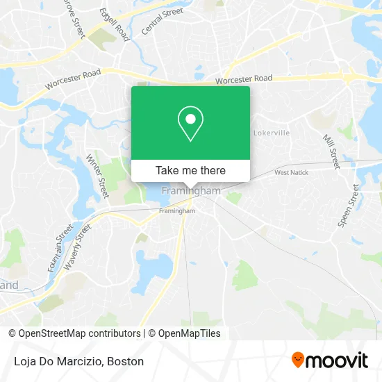
See Loja Do Marcizio, Framingham, on the map
Public Transit to Loja Do Marcizio in Framingham
Wondering how to get to Loja Do Marcizio in Framingham? Moovit helps you find the best way to get to Loja Do Marcizio with step-by-step directions from the nearest public transit station.
Moovit provides free maps and live directions to help you navigate through your city. View schedules, routes, timetables, and find out how long does it take to get to Loja Do Marcizio in real time.
Looking for the nearest stop or station to Loja Do Marcizio? Check out this list of stops closest to your destination: Memorial House (Winthrop & Hollis); Metrowest Medical Center; Framingham (Framingham Intermodal); Banana Lot/Intermodal Center; Blandin Hub; Framingham Mbta Station; Framingham; Framingham Amtrak.
Bus: 04N, 04S, 05, 07, 06, 14, 02, 03, GREYHOUND US0270S, 09, 07C.Train: FRAMINGHAM/WORCESTER, LAKE SHORE LIMITED.
Want to see if there’s another route that gets you there at an earlier time? Moovit helps you find alternative routes or times. Get directions from and directions to Loja Do Marcizio easily from the Moovit App or Website.
We make riding to Loja Do Marcizio easy, which is why over 1.7 million users, including users in Framingham, trust Moovit as the best app for public transit. You don’t need to download an individual bus app or train app, Moovit is your all-in-one transit app that helps you find the best bus time or train time available.
For information on prices of bus and train, costs and ride fares to Loja Do Marcizio, please check the Moovit app.
Use the app to navigate to popular places including to the airport, hospital, stadium, grocery store, mall, coffee shop, school, college, and university.
Loja Do Marcizio Address: 83 Concord St street in Framingham
- The Multiple Listing Service,
- Appliance We Repairs Repair Experts,
- Marcizio,
- Nilda Hair Design,
- Templo Arajã do Amanhecer,
- Vale do Amanhecer,
- Easy Fix,
- Locksmiths,
- Pool Heat Pump Repair,
- C&P Associates Inc,
- Batista Agape Church,
- Tamarin Dental Upholstery,
- Town of Framingham,
- Dave Overhead Garage Doors,
- Metrowest Firewood and Land Services,
- C R Painting Services,
- Miss Chic,
- Kingdom Tattoo,
- V and M Boutique,
- Pheonix Dental
Places Near Loja Do Marcizio (Framingham)
- House Of Blues, Boston,
- Prudential Center, Boston,
- Wang Theater, Boston,
- Boston Convention & Exhibition Center, Boston,
- Wilbur Theatre, Boston,
- Boston Children's Hospital, Boston,
- North End, Boston,
- Boston Medical Center, Boston,
- Boston Common, Boston,
- Museum Of Science, Boston,
- Td Garden, Boston,
- Mgm Music Hall, Boston,
- Massachusetts General Hospital, Boston,
- Faneuil Hall, Boston,
- Seaport District, Boston,
- Quincy Market, Boston,
- Isabella Stewart Gardner Museum, Boston,
- Cheers, Boston,
- Leader Bank Pavilion (Leader Bank Pavillion), Boston,
- Castle Island, Boston
How to get to popular places in Boston with public transit
Get around Framingham by public transit!
Traveling around Framingham has never been so easy. See step by step directions as you travel to any attraction, street or major public transit station. View bus and train schedules, arrival times, service alerts and detailed routes on a map, so you know exactly how to get to anywhere in Framingham.
When traveling to any destination around Framingham use Moovit's Live Directions with Get Off Notifications to know exactly where and how far to walk, how long to wait for your line, and how many stops are left. Moovit will alert you when it's time to get off — no need to constantly re-check whether yours is the next stop.
Wondering how to use public transit in Framingham or how to pay for public transit in Framingham? Moovit public transit app can help you navigate your way with public transit easily, and at minimum cost. It includes public transit fees, ticket prices, and costs. Looking for a map of Framingham public transit lines? Moovit public transit app shows all public transit maps in Framingham with all Bus, Train, Subway and Ferry routes and stops on an interactive map.
Boston has 4 transit type(s), including: Bus, Train, Subway and Ferry, operated by several transit agencies, including MBTA, Southeastern Regional Transit Authority, MetroWest Regional Transit Authority, Rhode Island Public Transit Authority, WRTA, Lowell Regional Transit Authority, Merrimack Valley Transit, Montachusett Regional Transit Authority, Cape Cod Regional Transit Authority, Brockton Area Transit Authority, Martha's Vineyard Transit Authority, the WAVE - Nantucket Regional Transit Authority, GATRA, Cape Ann Transportation Authority and Massport