See Loma Linda on the map
Directions to Loma Linda with public transportation
The following transit lines have routes that pass near Loma Linda
 Bus:
Bus: - Train:
How to get to Loma Linda by bus?
Click on the bus route to see step by step directions with maps, line arrival times and updated time schedules.
How to get to Loma Linda by train?
Click on the train route to see step by step directions with maps, line arrival times and updated time schedules.
Bus stations near Loma Linda
- Barton at Anderson,1 min walk,
- Barton FS Anderson,1 min walk,
- Anderson at Prospect,3 min walk,
Train stations near Loma Linda
- San Bernardino - Tippecanoe Metrolink Station,44 min walk,
Bus lines to Loma Linda
- 2,SB Cal State-San Bdno-Loma Linda,
- 19,WB Fontana-Colton-Redlands-Yucaipa,
- 14,East to Loma Linda VA Hospital,
- SBX,NB sbX Green Line,
What are the closest stations to Loma Linda?
The closest stations to Loma Linda are:
- Barton at Anderson is 42 yards away, 1 min walk.
- Barton FS Anderson is 46 yards away, 1 min walk.
- Anderson at Prospect is 180 yards away, 3 min walk.
- San Bernardino - Tippecanoe Metrolink Station is 3757 yards away, 44 min walk.
Which bus lines stop near Loma Linda?
These bus lines stop near Loma Linda: 14, 19, 2.
Which train line stops near Loma Linda?
METROLINK SAN BERNARDINO LINE
What’s the nearest bus stop to Loma Linda?
The nearest bus stops to Loma Linda are Barton at Anderson and Barton FS Anderson. The closest one is a 1 min walk away.
What time is the first train to Loma Linda?
The METROLINK SAN BERNARDINO LINE is the first train that goes to Loma Linda. It stops nearby at 4:36 AM.
What time is the last train to Loma Linda?
The METROLINK SAN BERNARDINO LINE is the last train that goes to Loma Linda. It stops nearby at 10:36 PM.
What time is the first bus to Loma Linda?
The 2 is the first bus that goes to Loma Linda. It stops nearby at 4:55 AM.
What time is the last bus to Loma Linda?
The 2 is the last bus that goes to Loma Linda. It stops nearby at 10:32 PM.
How much is the bus fare to Loma Linda?
The bus fare to Loma Linda costs about $1.75 - $2.00.
See Loma Linda on the map
Public Transportation to Loma Linda
Wondering how to get to Loma Linda, United States? Moovit helps you find the best way to get to Loma Linda with step-by-step directions from the nearest public transit station.
Moovit provides free maps and live directions to help you navigate through your city. View schedules, routes, timetables, and find out how long does it take to get to Loma Linda in real time.
Looking for the nearest stop or station to Loma Linda? Check out this list of stops closest to your destination: Barton at Anderson; Barton FS Anderson; Anderson at Prospect; San Bernardino - Tippecanoe Metrolink Station.
Bus:Train:
Want to see if there’s another route that gets you there at an earlier time? Moovit helps you find alternative routes or times. Get directions from and directions to Loma Linda easily from the Moovit App or Website.
We make riding to Loma Linda easy, which is why over 1.5 million users, including users in Loma Linda, trust Moovit as the best app for public transit. You don’t need to download an individual bus app or train app, Moovit is your all-in-one transit app that helps you find the best bus time or train time available.
For information on prices of bus and train, costs and ride fares to Loma Linda, please check the Moovit app.
Get to Loma Linda with public transit and pay for the ride in the Moovit app. In addition to all info you may need for your trip to Loma Linda, including live directions, real-time arrivals and fare prices, you can also buy public transit passes for your rides. No need for cash or paper tickets to get to Loma Linda - everything you need is accessible in the app with a click of the button.
Use the app to navigate to popular places including to the airport, hospital, stadium, grocery store, mall, coffee shop, school, college, and university.
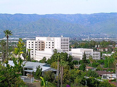
Location: Loma Linda, Los Angeles
Attractions near Loma Linda
Llumc Valet Parking Lot,Loma Linda University Children's Hospital Labor & Delivery,Loma Linda University Children's Hospital,Guldner, Gregory T MD - Nuclear Medicine (Nuclear Medicine - Stanford K Shu MD),Loma Linda University School of Dentistry,Loma Linda University Medical Center Emergency Department,Loma Linda University School of Medicine,Loma Linda University Medical Center,Loma Linda University Coleman Pavilion,LLUMC Clinical Engineering,Loma Linda University Wong Kerlee International Conference Center,Loma Linda University Campus Lawn,Center for Health Promotion,Evans Hall,Loma Linda University Centennial Complex,Loma Linda VA Hospital,VA,Deva Curl Girl Beth,Loma Linda VA Hospital ER,VA Community Living Center Bed 38How to get to popular attractions in Loma Linda with public transit
Fry's Electronics, Anaheim,City of San Bernardino, San Bernardino,Pomona Fairplex, Pomona,City of Laguna Beach, Laguna Beach,Toy Story Parking Lot, Anaheim,Anaheim Packing House, Anaheim,Monsters, Inc. Mike & Sulley to the Rescue!, Anaheim,Six Flags Magic Mountain, Santa Susana Mountains, La,Hyatt Regency Orange County, Garden Grove,Blu Jam Café, Fairfax, La,Placentia, CA, Fullerton,The Boiling Crab, Koreatown, La,Marina del Rey, Del Rey, La,85°C Bakery Cafe, Irvine,City of Anaheim, Anaheim,Diamond Jamboree Shopping Center, Irvine,The Park at Irvine Spectrum Center, Irvine,Anaheim GardenWalk, Anaheim,Mitsuwa Marketplace, Costa Mesa,Galleria at Tyler, RiversideGet around Loma Linda by public transit!
Traveling around Loma Linda has never been so easy. See step by step directions as you travel to any attraction, street or major public transit station. View bus and train schedules, arrival times, service alerts and detailed routes on a map, so you know exactly how to get to anywhere in Loma Linda.
When traveling to any destination around Loma Linda use Moovit's Live Directions with Get Off Notifications to know exactly where and how far to walk, how long to wait for your line, and how many stops are left. Moovit will alert you when it's time to get off — no need to constantly re-check whether yours is the next stop.
Wondering how to use public transit in Loma Linda or how to pay for public transit in Loma Linda? Moovit public transit app can help you navigate your way with public transit easily, and at minimum cost. It includes public transit fees, ticket prices, and costs. Looking for a map of Loma Linda public transit lines? Moovit public transit app shows all public transit maps in Loma Linda with all bus or train routes and stops on an interactive map.
Loma Linda has 2 transit type(s), including: bus or train, operated by several transit agencies, including Metro - Los Angeles, Metro - Los Angeles, Metrolink Trains, METRO, Long Beach Transit, LADOT, OCTA, Foothill Transit, Big Blue Bus, Riverside Transit Agency, LAX FlyAway, Airporter Shuttle, Playa Vista Shuttle, Amtrak and OMNITRANS