Directions to Lomasviral (Boston) with public transportation
The following transit lines have routes that pass near Lomasviral
 Bus: 10, 11, 16, 17, 18.
- Train: FAIRMOUNT, NEEDHAM, FRANKLIN/FOXBORO, PROVIDENCE/STOUGHTON, FALL RIVER/NEW BEDFORD.
- Subway: RED LINE.
How to get to Lomasviral by bus?
Click on the bus route to see step by step directions with maps, line arrival times and updated time schedules.
From Belmont, MA, Belmont
75 minFrom Hyatt Regency Cambridge - Overlooking Boston, Cambridge
63 minFrom Charlestown Navy Yard, Boston
72 minFrom Tufts University, Medford
95 minFrom VFW Parkway, Boston
58 minFrom Revere, MA, Revere
82 minFrom Inman Sq, Cambridge
59 minFrom Terrace Room, Paige Hall, Medford
96 minFrom Milton Academy, Milton
88 minFrom Terminal E- Logan International Airport, Boston
59 min
How to get to Lomasviral by train?
Click on the train route to see step by step directions with maps, line arrival times and updated time schedules.
How to get to Lomasviral by subway?
Click on the subway route to see step by step directions with maps, line arrival times and updated time schedules.
From Hyatt Regency Cambridge - Overlooking Boston, Cambridge
48 minFrom Charlestown Navy Yard, Boston
47 minFrom Tufts University, Medford
52 minFrom Inman Sq, Cambridge
39 minFrom Terrace Room, Paige Hall, Medford
53 minFrom Terminal E- Logan International Airport, Boston
41 minFrom Milton Academy, Milton
54 min
Subway station near Lomasviral in Boston
- Andrew, 1 min walk,VIEW
Bus stops near Lomasviral in Boston
Bus lines to Lomasviral in Boston
What are the closest stations to Lomasviral?
The closest stations to Lomasviral are:
- Andrew is 77 yards away, 1 min walk.
- Boston St Opp Washburn St is 126 yards away, 2 min walk.
- Dorchester Ave Opp Kemp St is 393 yards away, 5 min walk.
- Columbia Rd @ Buttonwood St is 1134 yards away, 15 min walk.
- Newmarket is 1414 yards away, 17 min walk.
- Jfk/Umass is 1432 yards away, 17 min walk.
Which bus lines stop near Lomasviral?
These bus lines stop near Lomasviral: 10, 11, 16, 17, 18, 41, 8.
Which train lines stop near Lomasviral?
These train lines stop near Lomasviral: FAIRMOUNT, NEEDHAM.
Which subway line stops near Lomasviral?
RED LINE (Ashmont/Braintree)
What’s the nearest subway station to Lomasviral in Boston?
The nearest subway station to Lomasviral in Boston is Andrew. It’s a 1 min walk away.
What’s the nearest train station to Lomasviral in Boston?
The nearest train stations to Lomasviral in Boston are Newmarket and Jfk/Umass. The closest one is a 17 min walk away.
What’s the nearest bus station to Lomasviral in Boston?
The nearest bus station to Lomasviral in Boston is Boston St Opp Washburn St. It’s a 2 min walk away.
What time is the first subway to Lomasviral in Boston?
The RED LINE is the first subway that goes to Lomasviral in Boston. It stops nearby at 5:21 AM.
What time is the last subway to Lomasviral in Boston?
The RED LINE is the last subway that goes to Lomasviral in Boston. It stops nearby at 1:57 AM.
What time is the first train to Lomasviral in Boston?
The FAIRMOUNT is the first train that goes to Lomasviral in Boston. It stops nearby at 4:47 AM.
What time is the last train to Lomasviral in Boston?
The FAIRMOUNT is the last train that goes to Lomasviral in Boston. It stops nearby at 11:57 PM.
What time is the first bus to Lomasviral in Boston?
The 16 is the first bus that goes to Lomasviral in Boston. It stops nearby at 4:34 AM.
What time is the last bus to Lomasviral in Boston?
The 16 is the last bus that goes to Lomasviral in Boston. It stops nearby at 1:54 AM.
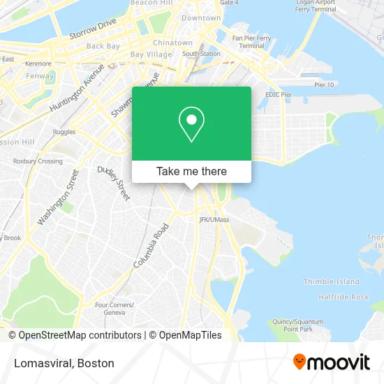
See Lomasviral, Boston, on the map
Public Transit to Lomasviral in Boston
Wondering how to get to Lomasviral in Boston? Moovit helps you find the best way to get to Lomasviral with step-by-step directions from the nearest public transit station.
Moovit provides free maps and live directions to help you navigate through your city. View schedules, routes, timetables, and find out how long does it take to get to Lomasviral in real time.
Looking for the nearest stop or station to Lomasviral? Check out this list of stops closest to your destination: Andrew; Boston St Opp Washburn St; Dorchester Ave Opp Kemp St; Columbia Rd @ Buttonwood St; Newmarket; Jfk/Umass.
Bus: 10, 11, 16, 17, 18, 41, 8.Train: FAIRMOUNT, NEEDHAM, FRANKLIN/FOXBORO, PROVIDENCE/STOUGHTON, FALL RIVER/NEW BEDFORD, GREENBUSH, KINGSTON.Subway: RED LINE.
Want to see if there’s another route that gets you there at an earlier time? Moovit helps you find alternative routes or times. Get directions from and directions to Lomasviral easily from the Moovit App or Website.
We make riding to Lomasviral easy, which is why over 1.7 million users, including users in Boston, trust Moovit as the best app for public transit. You don’t need to download an individual bus app or train app, Moovit is your all-in-one transit app that helps you find the best bus time or train time available.
For information on prices of bus, subway and train, costs and ride fares to Lomasviral, please check the Moovit app.
Use the app to navigate to popular places including to the airport, hospital, stadium, grocery store, mall, coffee shop, school, college, and university.
Lomasviral Address: 10 Bellflower St street in Boston
- I-93 Exit 15,
- Dawn's Baked Goods,
- Fleet Corps,
- ScrubaDub,
- All Right Locksmith,
- Boston Car Wash,
- Steven and Francines Locksmiths,
- Home2 Suites-Boston South Bay,
- Rockitcoin,
- M&M Moving and Storage Company,
- Home2 Suites-Boston South Bay (Home2 Stes by Hilton Boston S Bay),
- Courtyard South Boston (COURTYARD by Marriott),
- Courtyard Boston South Boston,
- Msgr O'Callaghan Way,
- 224 Boston Street Restaurant,
- Dorchester Ave Locksmith Inc,
- Halal Guys,
- Holiday Inn Express Boston,
- PNC Bank,
- Dave's Hot Chicken
Places Near Lomasviral (Boston)
- Wang Theater, Boston,
- Isabella Stewart Gardner Museum, Boston,
- Td Garden, Boston,
- Faneuil Hall, Boston,
- Seaport District, Boston,
- Boston Medical Center, Boston,
- North End, Boston,
- Wilbur Theatre, Boston,
- Mgm Music Hall, Boston,
- Castle Island, Boston,
- Quincy Market, Boston,
- Boston Children's Hospital, Boston,
- House Of Blues, Boston,
- Prudential Center, Boston,
- Boston Common, Boston,
- Boston Convention & Exhibition Center, Boston,
- Leader Bank Pavilion (Leader Bank Pavillion), Boston,
- Massachusetts General Hospital, Boston,
- Cheers, Boston,
- Museum Of Science, Boston
How to get to popular places in Boston with public transit
Get around Boston by public transit!
Traveling around Boston has never been so easy. See step by step directions as you travel to any attraction, street or major public transit station. View bus and train schedules, arrival times, service alerts and detailed routes on a map, so you know exactly how to get to anywhere in Boston.
When traveling to any destination around Boston use Moovit's Live Directions with Get Off Notifications to know exactly where and how far to walk, how long to wait for your line, and how many stops are left. Moovit will alert you when it's time to get off — no need to constantly re-check whether yours is the next stop.
Wondering how to use public transit in Boston or how to pay for public transit in Boston? Moovit public transit app can help you navigate your way with public transit easily, and at minimum cost. It includes public transit fees, ticket prices, and costs. Looking for a map of Boston public transit lines? Moovit public transit app shows all public transit maps in Boston with all Bus, Train, Subway and Ferry routes and stops on an interactive map.
Boston has 4 transit type(s), including: Bus, Train, Subway and Ferry, operated by several transit agencies, including MBTA, Southeastern Regional Transit Authority, MetroWest Regional Transit Authority, Rhode Island Public Transit Authority, WRTA, Lowell Regional Transit Authority, Merrimack Valley Transit, Montachusett Regional Transit Authority, Cape Cod Regional Transit Authority, Brockton Area Transit Authority, Martha's Vineyard Transit Authority, the WAVE - Nantucket Regional Transit Authority, GATRA, Cape Ann Transportation Authority and Massport